Author Archives: yachtcamomile
Convoy to Tawau
I’ve written this blog for the cruisers that are coming along after us. It has waypoints of the anchorages we used, which should all be checked before use. I hope you find it useful.
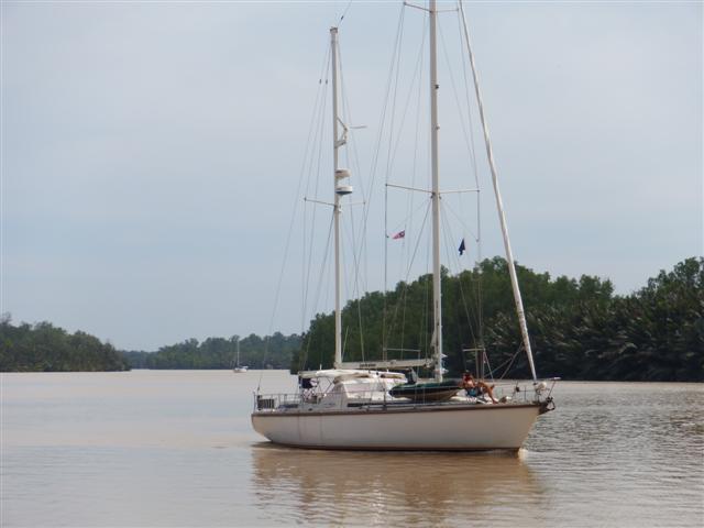
Our route through to Dewhurst bay
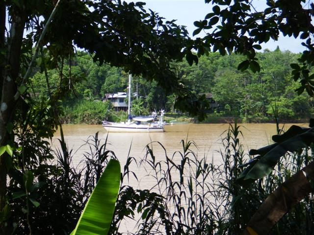
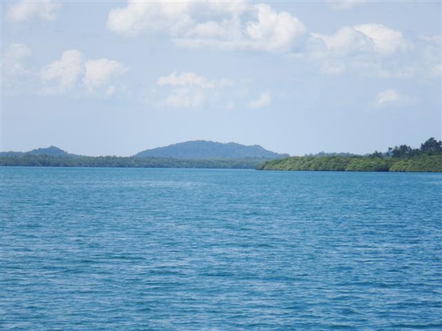
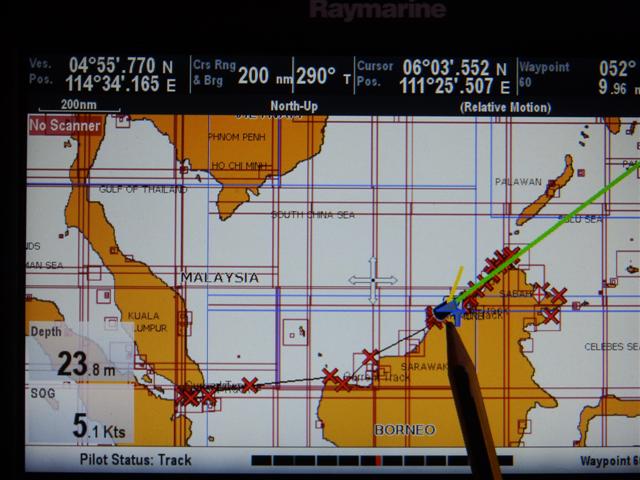
After our wonderful time up the Kinabatagan river we made our way back down the river to the junction at waypoint
05º41.95N
118º23.07E
(just to the left of where Camomile is in this screen shot of the chartplotter)
At this point you have two choices
- go back the way you came and continue back down the Malaysian west Sabah coast and onto Sarawak and the Singapore area
- or go back the way you came but instead of heading to Singapore head north to the Philippines after checking out in Kudat
If you’re not going to Indonesia then I would recommend one of the above
- or turn right and continue on the journey down the east Sabah coast, which is what we did.
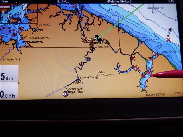
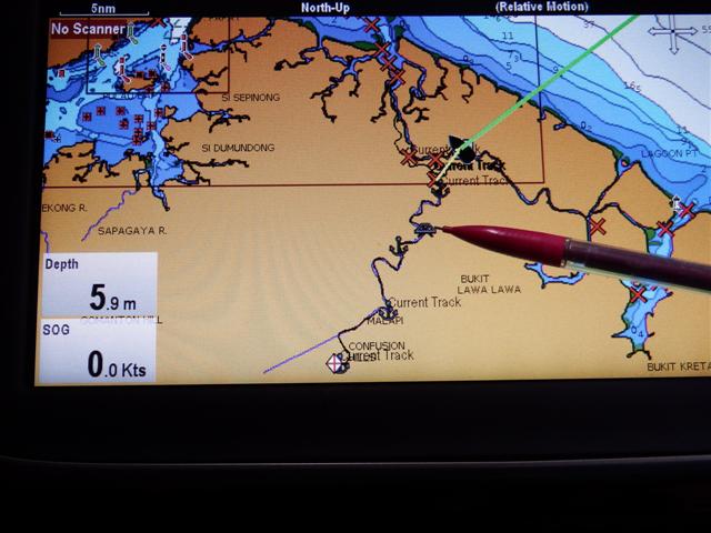
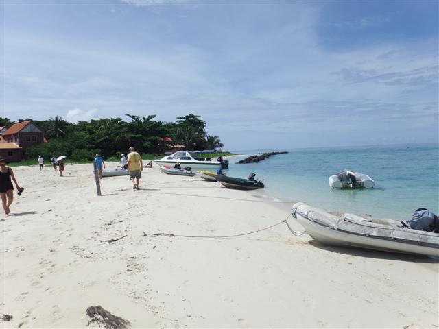
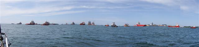
Within a few days the rally was assembled in Dewhurst bay (I’m pointing to it with the pencil) for the start of the convoy that we were being encouraged to join for our safety. The pirate situation in the Sula sea was perceived to be a big enough threat to concern the Malaysian navy, having already been told a curfew was in place from 6pm to 6am.

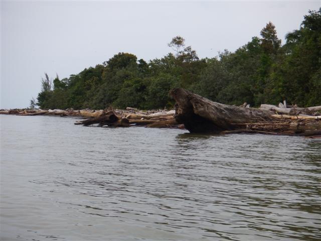
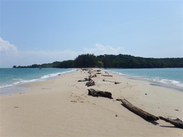
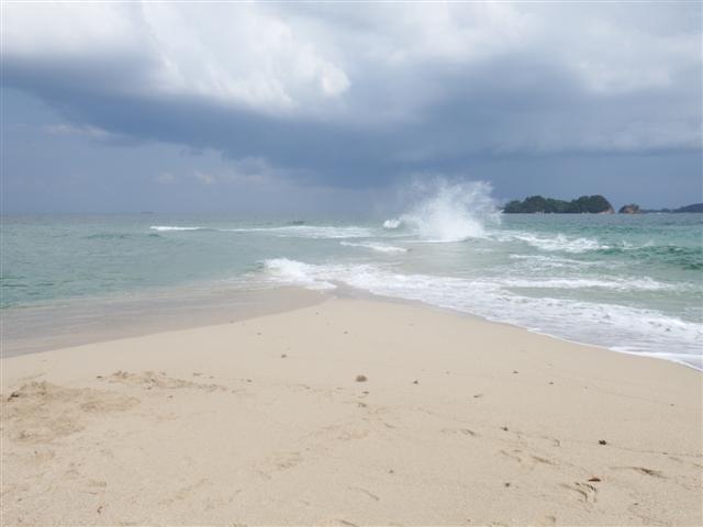
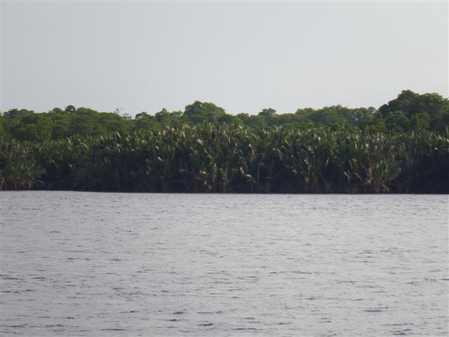
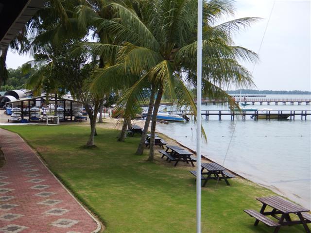
Driftwood point beach

Driftwood
On the evening of 31st August the boats all moved out to the outer anchorage ready for an early start.
05º38.12N
118º36.5E
On the chart it’s called driftwood point and this certainly described the beach. The dinghy was lowered so we could take a closer look. The beach was indeed covered in the biggest logs I’ve ever seen on a beach before. Luckily they were on the beach and not in the water, some of them would have caused some serious damage to rudders, etc.
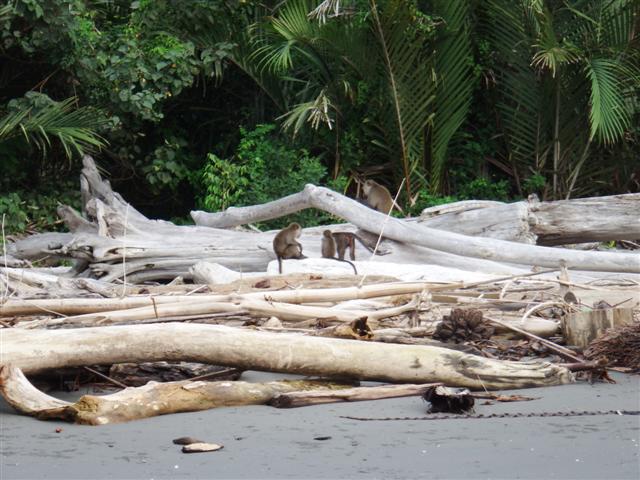
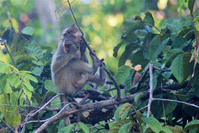
Monkeys playing
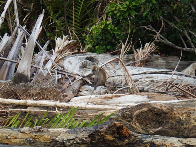
Monkey looking for food
There were monkeys playing among them searching for titbits of food, we sat and watched them from the waters edge for a while.
Some big pieces
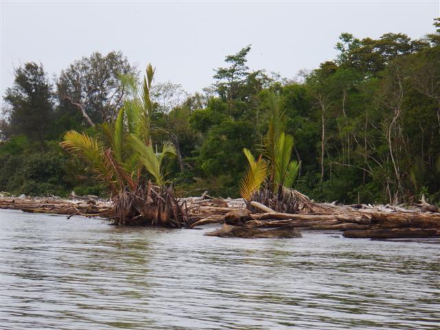
Trees taking root
Some of the ‘driftwood’ were taking root and beginning to form new trees on the low tide line. It was the most extraordinary sight.

Early morning sunrise
The next morning, 1st August just before 6am the sky turned the most stunning colours before the sun came up. Everyone had agreed to leave at 6am so it was anchors up and we all left together.

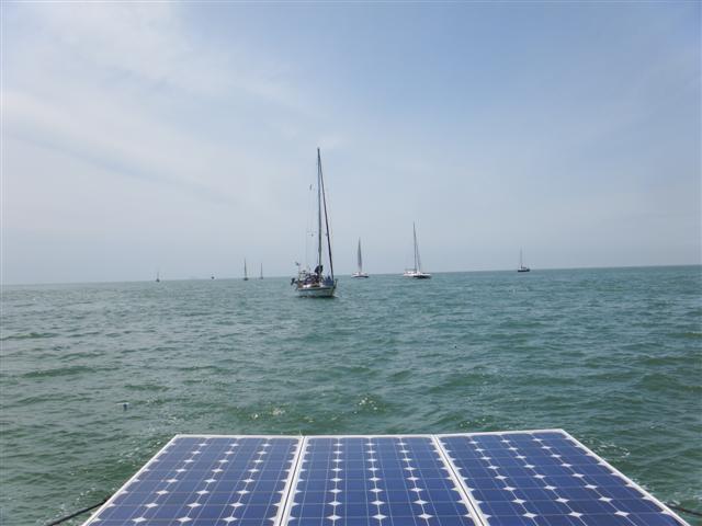
Half of our convoy showing their AIS signals
There were now just 15 boats travelling together with more than half of them transmitting their position on AIS. The screen on the chartplotter looked quite amusing as we all travelled together. No sign of our escort yet.
There wasn’t any wind so we motored the 24 miles to Evans bay until a few miles outside when the wind piped up but too late to be of any use and it was accompanied by rain. The rest of the day was spent reading. We had all been invited to sundowners on Labarque but the weather put a stop to that so I dusted down the quiz book and we had a Camomile Quiz on the radio instead.
Evans bay waypoint
05º24.2N
118º56.1E

Early morning start
2nd August, another 6am start but there was enough wind to sail so up went the sails and we sailed most of the 36 miles to Dent Haven, on the most eastern headland on the Malaysia mainland.

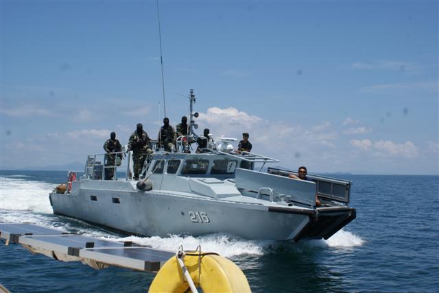
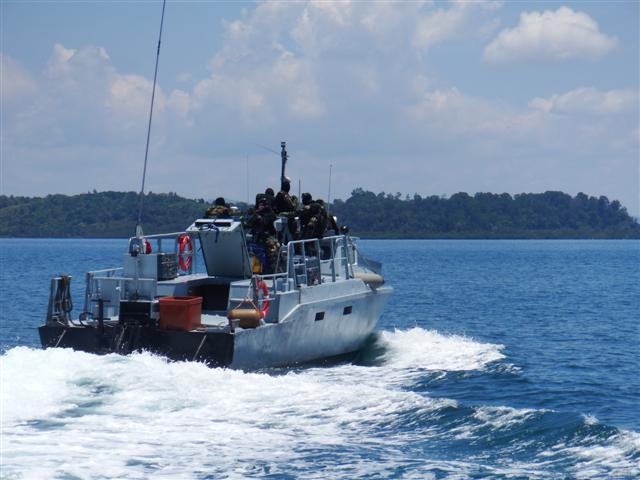
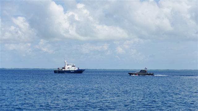
Navy gunship
Today our navy escort made an appearance. We had seen a navy ship on the AIS but as we all came into anchor a Police boat and a small gun ship arrived. Yes that is a machine gun on its bow! It was a nice evening and the invitation to Labarque was renewed.
Anchored at waypoint
05º14.9N
119º15.5E

Another early morning start
3rd August after, yes you’ve guessed correctly, another 6am start we had a really good sail to the Tungku lighthouse 32 miles away, many of us didn’t want to stop but we’d all agreed to stick together and we wouldn’t have made Lahad Datu in daylight. The American catamaran Ocelot invited everyone for sundowners that evening.
Waypoint for anchorage west of Tungku lighthouse
04º59.3N
118º50.3E
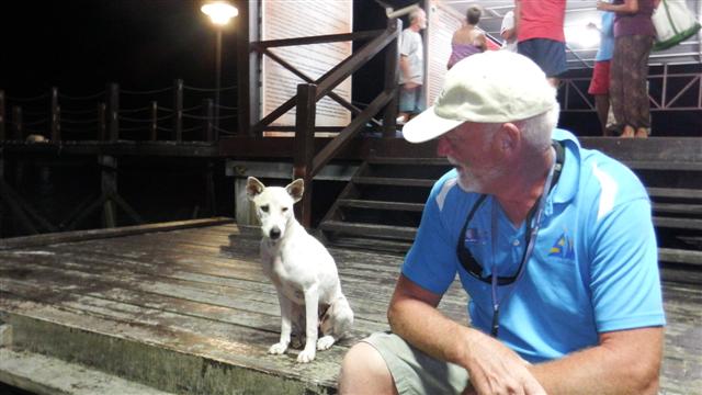
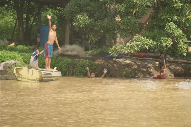
Friend or foe?
4th August started off a sad day for me because it had been a year since my Mum had passed away but I wasn’t allowed to be sad for long because on our passage to Lahad Datu the security was really stepped up as we approached the area where there had been a pirate attack earlier in the year. As well as our now normal police escort and the gunboat, first we were over flown by a police helicopter, then these guys pulled alongside us. Were they the pirates?
Glad they are on our side
Fortunately they were on our side as they started waving and taking photos of US. I felt they deserved a medal simply for wearing that amount of clothes they must have been baking! After motoring alongside for about 5 minutes they moved on to photograph the next boat – bizarre!
So we made it to Lahad Datu where we stayed for 2 nights at
05º01.1N
118º20.0E
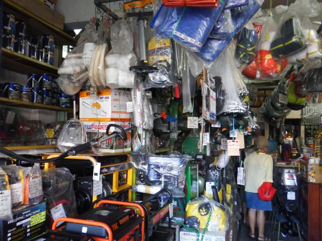
Hardware shop
What’s the first shop you would think we’d look for, supermarket maybe? No we start with hardware stores! This one was fairly well packed with all sorts of things; it even had some chandlery bits towards the back.
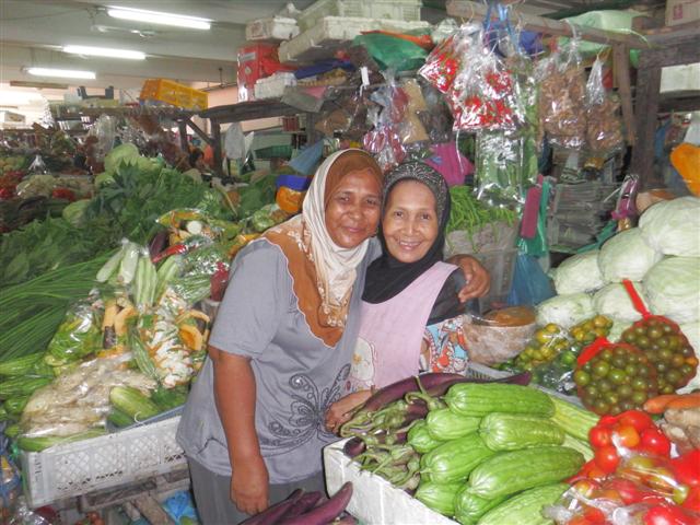
Lovely Malaysian ladies
I left Bill to have a rummage around while I headed off to look for the market. The markets here are always well stocked with lovely fresh fruit and veggies. These two ladies had a fantastic stall where I bought lots of lovely produce. They loved having their photo taken. The Malaysians are such friendly people.
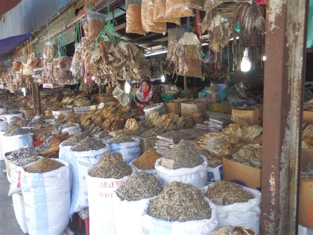
Dried fish stall
I continued through the market and knew by the smell I was getting close to the dried fish stall. I managed to hold my breathe long enough to take this photo before I had to move away. The whole stall consists of dried fish of varying sizes, it’s very popular and looks very fresh in a dried sort of way but it absolutely stinks.

This lady was selling medical supplies
It was possible to buy anything from this lady, antibiotics, birth control, paracetamol, viagra, anything. Whether it was real is another matter as is the fact that a lot of them should be prescription drugs but I assume doctors are too expensive to visit. A bit worrying really.
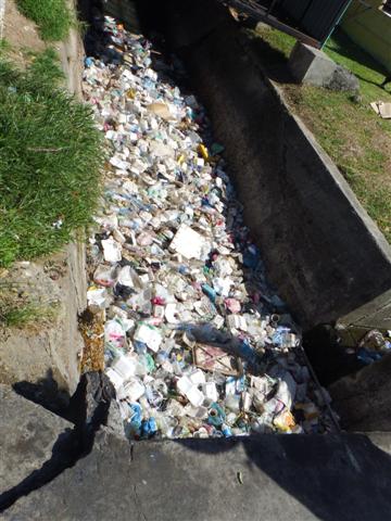
Rubbish is a problem
Rubbish is a real problem in these areas. Underneath this pile of mostly plastic and polystyrene is a river that flows into the sea, fortunately there was a grill preventing the rubbish from going any further but it’s a huge problem here. Many fish and sea creatures such as turtles are badly affected by the rubbish floating in the sea. To be fair a truck had just arrived to clear away the debris but something has to done about the rubbish problem in this part of the world, and soon.

Rally boats at anchor
We walked back to the harbour where the fleet were anchored. Our police escort were tied alongside the local police wharf and our dinghies were tied alongside them. Hopefully there won’t be an emergency!
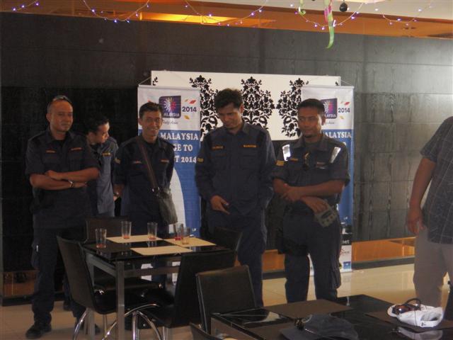
Some of our friendly escorts
On our second day in Lahad Datu the rally put on a lunch in a local hotel so we could meet and greet our protectors, they were a really lovely bunch of lads. After their talk they spread out and came and sat with us for lunch. Some of them only had basic English but managed really well chatting to us and answering our questions. Most of them were still carrying a weapon. In the afternoon I found a hairdresser for a haircut. Something got lost in translation because instead of ‘a inch or two off’ I got an inch or two left! Oh well it’ll grow and it’s cooler.
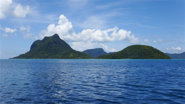
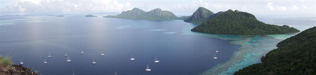
Our first sight of Pulau Bohey Dulang
Wednesday 6th August we motored the 33 miles to the Tun Sakaran marine park and Pulau Bohey Dulang. The first sight of these islands took our breath away. The sheer cliffs and lush tropical jungle make a striking contrast to the fairly flat, palm tree covered islands around it. Being part of the rim of an ancient volcanic crater, now inundated, it’s encircled by coral reefs. Normally yachts aren’t allowed into the lagoon because it’s a marine research centre but the rally had obtained permission for us to enter. One by one we entered the reef at waypoint
04º35.33N
118º42.99E
Our escort at the entrance
Our police escort was the last in and anchored across the entrance as a ‘plug’, the navy tied their boats (there were now two of them) to the wharf. The rally had been asked to anchor close together but unfortunately the organisers hadn’t realised that the area they wanted us to anchor in was 20m+. Bill’s normal policy is to find somewhere 10m or less but it went from 20m to reef so we didn’t have any option but to anchor in 20m. We were consoled by the fact that several of the yachts carried divers with tanks and compressors so if the anchor got stuck we could ask for their help. We anchored at
04º35.9N
118º46.7E in 20.3m of water, the deepest we’ve ever anchored in.

Beautiful anchorage beyond the reef

The cages have clams in them
Our surroundings were superb, the water was an amazing colour; so blue. We took the dinghy to the wharf and were given a guided tour of the marine research centre where they cultivate clams before putting them back in the water in a controlled environment for their protection. Unfortunately the locals eat them and their numbers are diminishing.
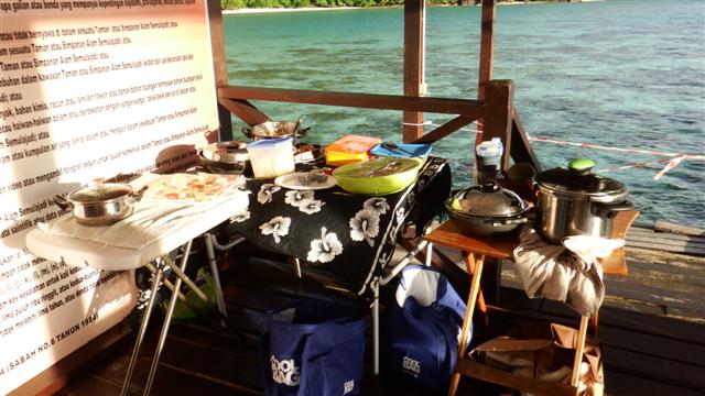
Pot luck supper
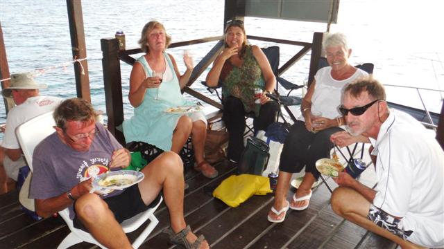
Cruisers enjoying the delicious food.
The wharf made an ideal setting for a pot luck supper so I got on the radio and managed to organise several tables, some chairs and a ‘pot’ from everyone for supper. We all took our own plates, k,f & s, and alcohol. We invited the navy boys to join us because they didn’t appear to have much food on board, cans of coke were also given to them and they seemed really happy with the invitation. It was that evening that we found out that we had become ‘tethered goats’. Earlier in the year there had been a pirate attack on the island of Mabul and one of the police or navy had been shot and killed and another had been taken ransom. If the pirates launched an attack on us the navy planned to capture one of them so they could exchange him for their colleague because the government won’t pay the ransom. Not sure how we felt about that situation but fortunately the pirates stayed away.
‘Can I come home with you?’
This little chap quietly waited for titbits all evening and did quite well, he was very thin and obviously a stray. I would have loved to have taken him on board but Bill, sensibly, said No. I called him Snowy.
Looking down on the bay
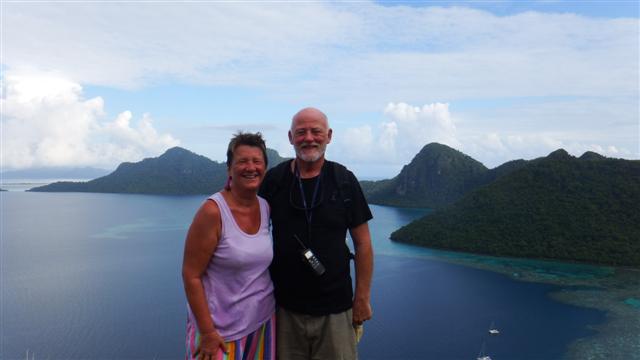
Bill and Sue looking hot?!
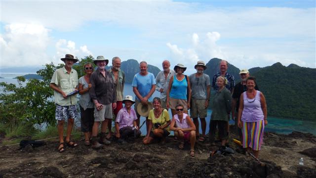
The next day the research centre made one of their staff available to take us on a trek up the hill to an amazing viewpoint. The view was astounding. If you think our t-shirts look wet you’re right and it’s perspiration. It only took an hour to walk up there but it was very steep and there were lots of steps and it was HOT. Try putting a stepper machine in a sauna and using it for an hour and you’ll get an idea of the conditions. All agreed the view was worth it.
Hot and sweaty cruisers
Camomile in the bay
Little Camomile waiting for us.

Our young guide
Our little guide, who did the walk without any effort, sat on the cliff logged onto facebook as there wasn’t a signal in the bay making many of us feel our age. Note he’s beyond the line that says ‘Don’t pass’!

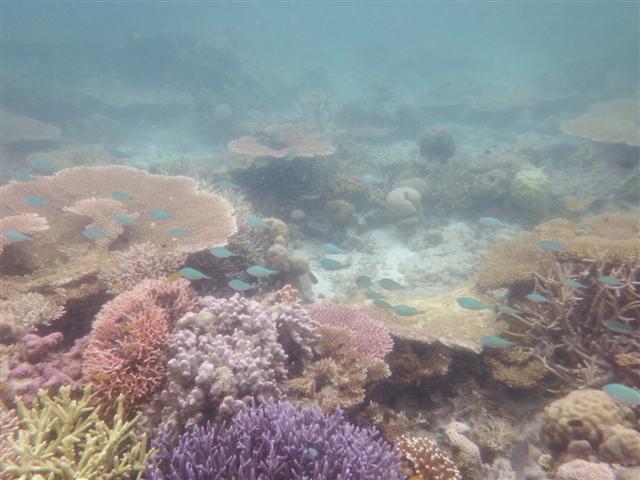
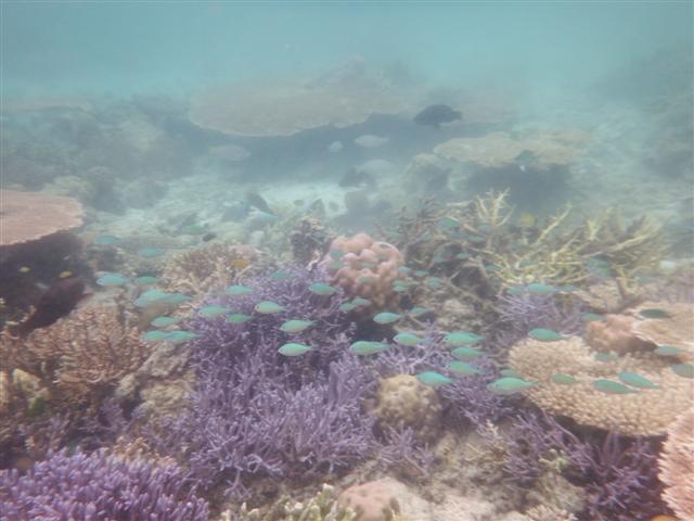
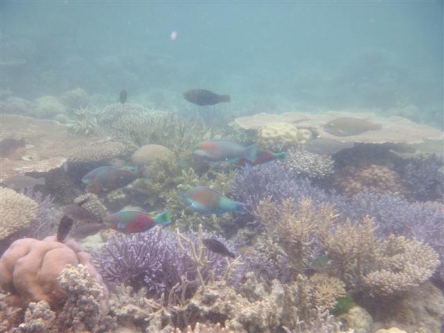
Beautiful green coral
In the afternoon we went snorkelling. The water was so clear, there were lots of different coloured coral, fish and lots of rays lying on the sand. We weren’t allowed to go outside the reef but you didn’t need to there was so much to see inside.

and pink coral
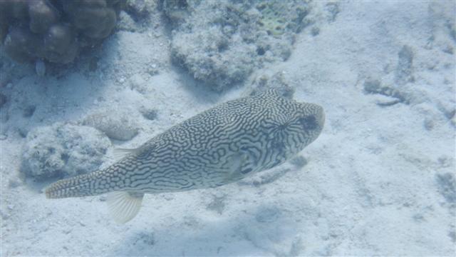
Puffer fish about the size of my foot
Jacqui kits me up
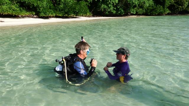
Our friends Jacqui and Dave on Jackster have their own diving kit on board and offered to give me a diving lesson later that day. Dave didn’t give me any chance to think about it because he knew I would have found an excuse but I didn’t and off we went to the beach.

Diving with Dave
The water was a bit cloudy close in but I managed to get down a few metres and Dave helped me to regulate my buoyancy. It was fun but I don’t think I’ll be signing up for my Padi just yet.
After 3 days it was time to leave and after our usual 6am start we headed towards Bum Bum island and into the Bum Bum channel. As you can imagine there were lots of jokes being cracked on the radio about the passage, I’ll say no more!
The village of Semporna
Waypoint at the entrance
04º31.41N
118º37.74E
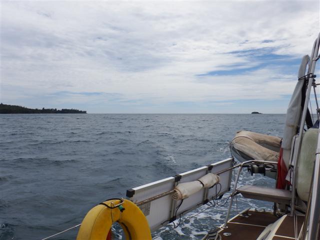
We passed Semporna, which had been on our original itinerary, but after the attack on Mabul earlier in the year the navy didn’t want us to stop there. Sadly the local people abuse the sea terribly and there was so much rubbish floating in the water. Several of the boats had to stop with blocked inlets or rubbish around their prop. Most of the islanders live in houses on stilts over the water and just throw their rubbish over the side.
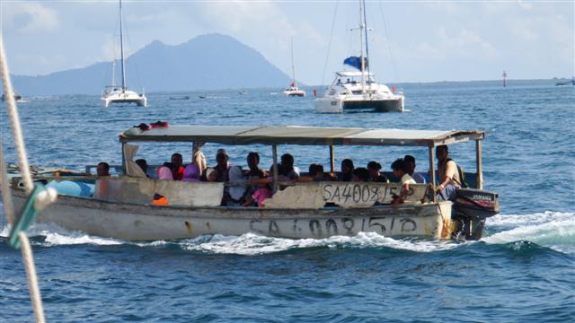
A local boat
As the rally passed through it generated a lot of interest with local boats coming out to see us and wave. Everyone seemed very friendly it was a shame we couldn’t stop.
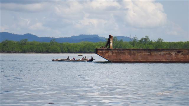
Hitching a ride
Once out the other side we continued on to the Kumpong river. There was lots of shipping although mainly tug and tows. Some locals had hitched a ride on this barge and this one was so overloaded it was difficult to see the barge underneath. It looked very unbalanced, no wonder there are so many logs floating around in this area.
An overloaded barge
The entrance to the river was very shallow and the rally had arrived too early. Some of the boats anchored outside for a while. Camomile touched the soft mud bottom but ploughed on, literally, with the rising tide and eventually found enough water to continue inside.
The shallowest part was at
04º19.46N
118º22.30E
Some of the boats came in about a mile to our port really close in to the Kiraz point you could try that but proceed with caution.
Another water residence
There was a stilt village on the inside and the children waved as we passed by and made our way up another muddy brown estuary but luckily not too far.
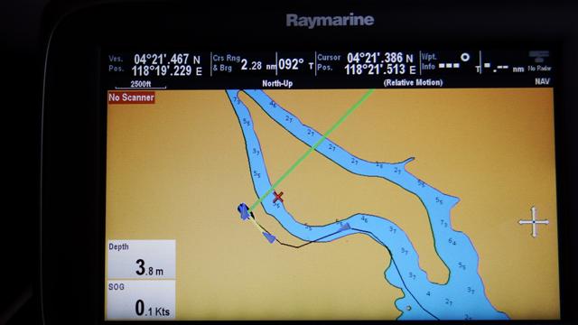
Chartplotter way out
As you can see the chartplotter was out again so we just used the rule of sticking to the outside of the bends. The black line is our track.

A bit too close
The anchorage was alongside a nice resort but the river was quite narrow and when the tide turned we could almost touch the trees. We anchored at
04º21.4N
118º19.2E
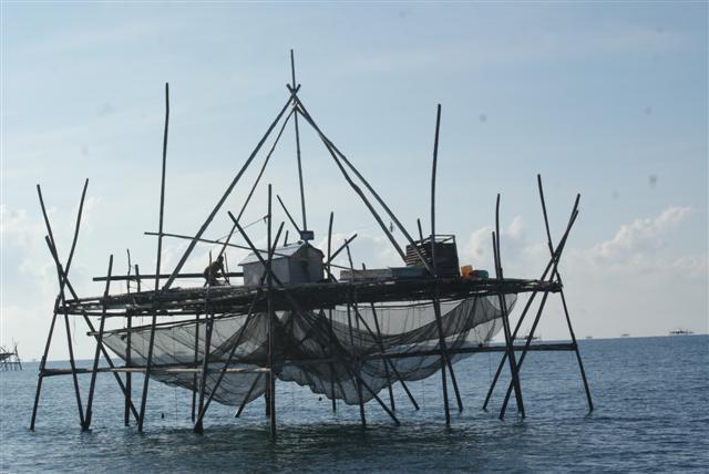
Fishing structure with fisherman rigging his nets
On the final leg to Tawau we discovered some structures that wouldn’t have looked out of place on a War of the Worlds film set. They are fishing traps, unlit of course, but quite visible being about 10 feet above the water level. What was more worrying was that there were some derelict ones with just a few stumps sticking out of the water. What was underneath the water in between them?
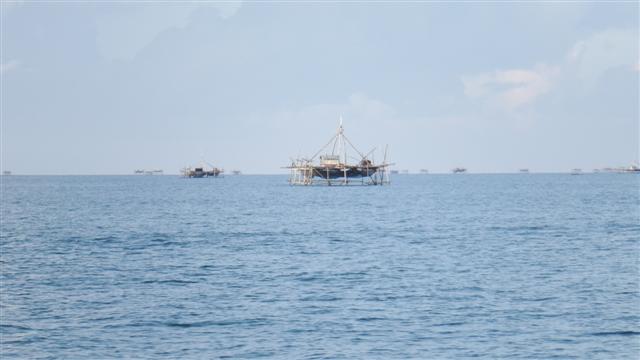
Many structures as far as you can see
There were hundreds of structures spread over many miles so to go around them would have been a huge detour. I kept watch on the bow as we motored in between them, carefully, hoping we didn’t get lucky!

Tawau
Eventually we got clear of them and continued on to Tawau, our final stopover in Malaysia, where we anchored at
04º15.0N
117º52.4E.

Final party
The rally organised a lovely farewell party for the cruisers, everyone was relieved to have got there in one piece and the only thing that marred the evening were some ‘rascals’ who stole furling lines from some of the boats at anchor while we were all ashore enjoying ourselves.
Camomile’s was cut just below the drum but not taken (Bill had enough spare line to reload it though). It was a shame for the 3 or 4 boats affected and the organisers were exceedingly embarrassed that it had happened right in front of the yacht club with several of the police/navy hierarchy present. Patrol boats were sent out but the culprits were long gone.
During the final leg of the passage our trip counter had clicked over 40,000 miles since leaving the UK and so far this is the only time anything like that has happened despite some of the remote locations Camomile has visited. We’ve had such a diverse journey meeting so many wonderful people of all different faiths and cultures who have all wanted to warmly greet us. Not once have we felt threatened, a truly remarkable journey and it continues.
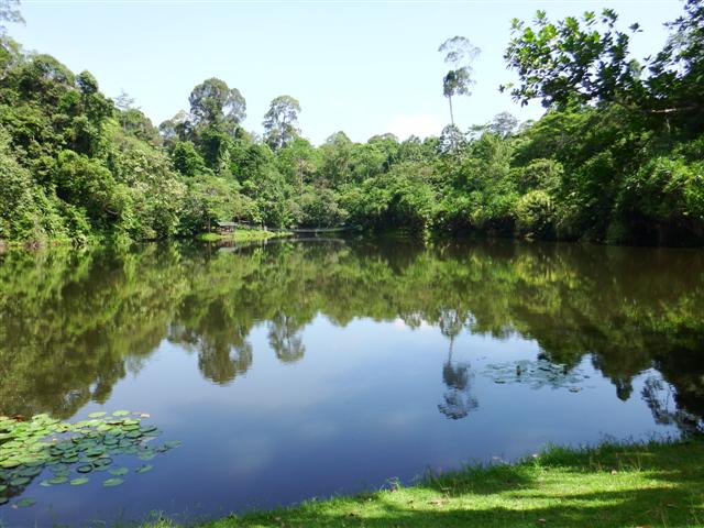
The Kinabatangan River

Chart showing entrance waypoints
We spent a week at Sandakan before moving on to the Kinabatangan river. The night before we left a huge storm swept across the anchorage causing some of the boats to drag again. There was so much rubbish on the sea bed the anchors couldn’t dig in properly. The pink area on this chart is rain, when it rains here it rains!! This chart also shows the waypoints and our route plotted across the sandbanks to the entrance to the Kinabatangan river. The entrance has a sandbar and lots of sandbanks, it looks like our route went over the shallows but we didn’t have less than a metre under our keel the whole journey on the high tide.
Jackster with Samsara II in the distance
Our friends on Jackster followed us in and Samsara II were a little way behind them. Fortunately the convoy had broken up a bit, some of the catamarans had gone in a day or two earlier and some of the mono hulls were still in Sandakan waiting another day or two for a higher high tide.
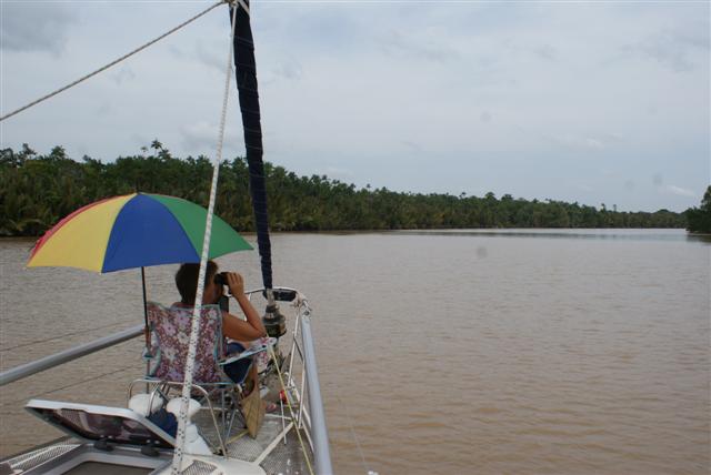
Wildlife spotting on the bow
I took up my position on the bow with my deckchair, sunshade and binoculars looking out for wildlife.
Chocolate brown river
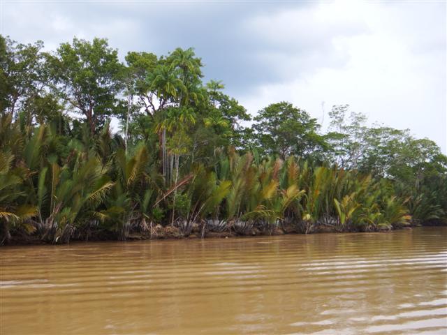
Ninah palms on the river bank
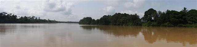
The Kinabatangan river is Sabah’s longest at 560km of chocolate brown water, it coils into the Borneo interior. There’s a narrow strip of rain forest trees that have lots of wildlife in it that flee ever-encroaching palm-oil plantations. The scenery was beautiful not in a ‘chocolate box cottage’ kind of way but in a ‘Borneo rainforest’ kind of way.
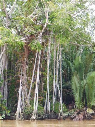
Riverside scenery
Our plan was to slowly glide along and just stop whenever we saw something interesting. All along the river are different types of trees holding 100s of monkeys. We were able to get in quite close to the rivers edge; it was fairly deep.

Nudging the bow in close
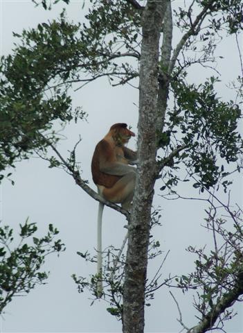
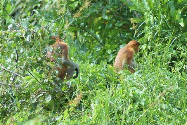
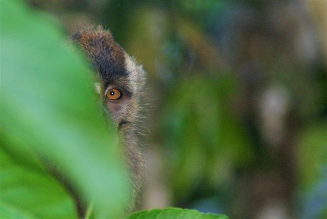
Proboscis monkey
There were Proboscis monkeys everywhere; the males have large pendulus noses. They leap from tree to tree, bush to bush. We have lots of photos of them but here are just a few.

 The three boats anchored together that evening and we all enjoyed a fantastic display of fireflies once it got dark. Our waypoint was
05º42.08N
118º21.63E
Waking up in the morning in the middle of a rain forest was magical. The silence was very noisy.
Fishing village
We got under way and continued our slow journey stopping whenever we caught sight of something in the trees.

Homestead
Local woman doing the washing
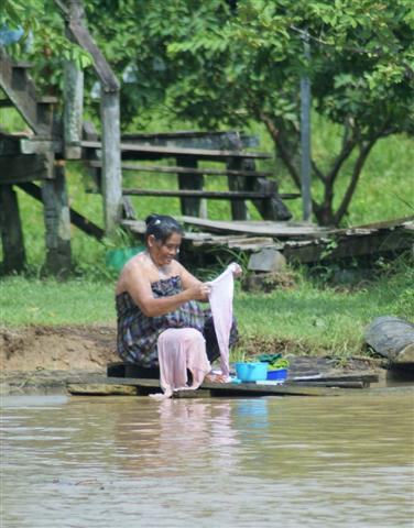
We went past some homesteads. The little shed on the waters edge is a ‘long drop’ toilet. Then a bit further along the riverbank the ladies were washing their hair and their clothes, as they’ve probably done for centuries, and the children were swimming in the water. The river flowed fairly fast so I suppose everything gets washed out to sea.
Local boys swimming

Local boys fishing
These young boys were fishing, not sure I would like to eat anything caught in that water.

Slooping house
Yes this house is sloping towards the water; I wasn’t holding the camera crooked.
Anchored next to resort
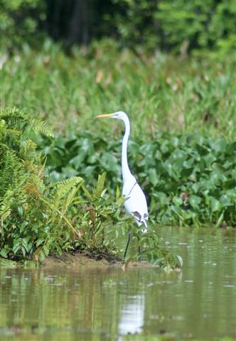
Egrets balancing on floating logs
We turned right into the main river and anchored off of a resort for the rest of the day. There were lots of lumps of wood floating down the river. The egrets like to stand on them and float down with the tide and watch for fish but they were a real nuisance getting caught around the anchor chain.

Debris caught around the anchor chain
There was more heavy rain in the afternoon, well we are in a rainforest. We only travelled about 6 miles that day, if it hadn’t rained we might have gone on but we had plenty of time. Our waypoint was
05º41.10N
118º22.98E
Entrance to Oxbow lake
The next morning we made our way to the entrance of an oxbow lake, which was only 3 miles away. An oxbow lake is a U-shaped body of water that forms when a wide meander from the main stem of a river is cut off, creating a freestanding body of water. The first part was long and narrow then it opened up into the lake and wow!

The oxbow lake

Egret in the lake
The photos don’t do it justice but I’ve taken some panoramic shots to try and recreate our view.

Egret in flight

Kingfisher with orange breast
The bird life was fantastic. Lots of hornbills, egrets and this beautiful kingfisher with an orange breast and red beak.
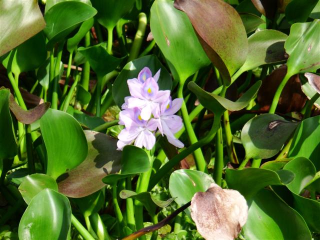
Blue water Hyacinth
The blue water hyacinths that covered more than half the lake were exquisite.

Dave and Jacqui on Jackster
Jackster and Samsara were there too.
Steve and Julie on Samsara II
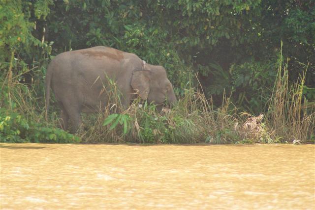
Pygmy elephant
After an hour or so we motored back to the boats, I took up my position on the bow again and we continued up the river. We were so lucky being the lead boat that day because just around the next bend I saw a pygmy elephant drinking from the river.

“Cruisers coming, I’m off”
It was on it’s own and we glided slowly towards it but it saw us coming and turned back into jungle. The others arrived and we could hear it stamping around behind the bush but it didn’t come back out again.
Pencil marks the spot
The pencil marks the spot where we saw the elephant. The red and white flag at the bottom of the chart is as far as we could go because it’s marking power lines that we couldn’t get under.
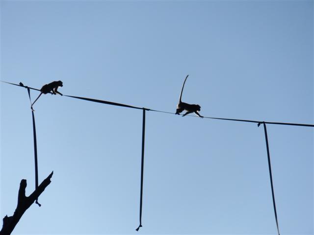
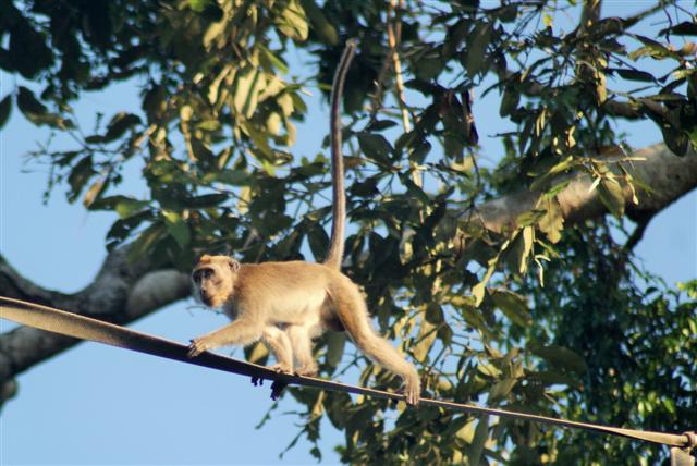
Macques on the webbing line
Our third night at anchor was spent only about an hour before the power lines next to a tributary. We took a closer look in the dinghy. There was webbing stretched high up across the tributary. Just as we were wondering what it was for a couple of monkeys walked along it. When they stopped they wound their tails expertly around the webbing hanging down for balance. We got some great photos of them.
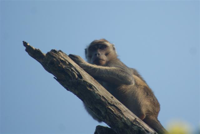
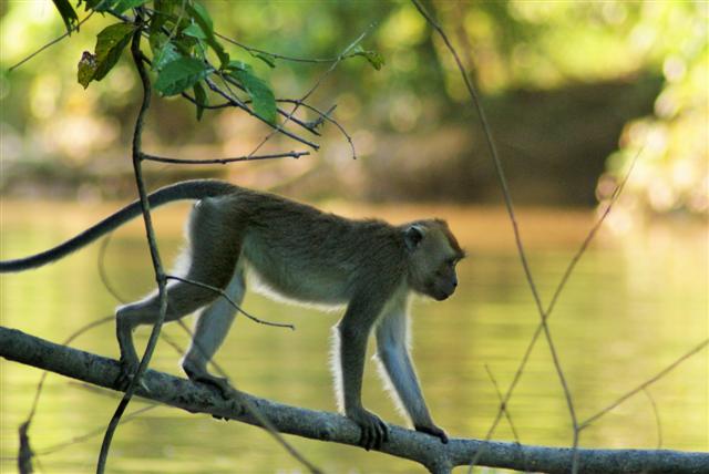
Macaque monkey
Further in there were lots of macaque monkeys playing in the undergrowth.
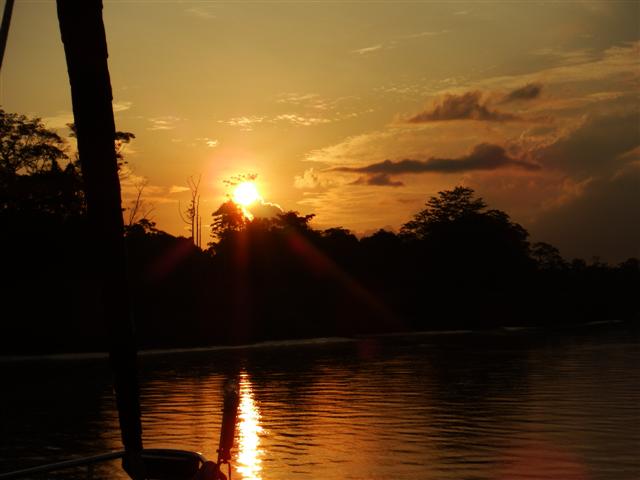
Stunning sunset
A stunning sunset awaited us back at the boat.
Our waypoint was
05º33.35N
118º20.17E
The next day we motored the last hour into Sukau the village next to the power lines.
The waypoint was
05º30.48N
118º17.54E our chartplotter showed this on land but the chart had been roughly correct up to the last little bit.
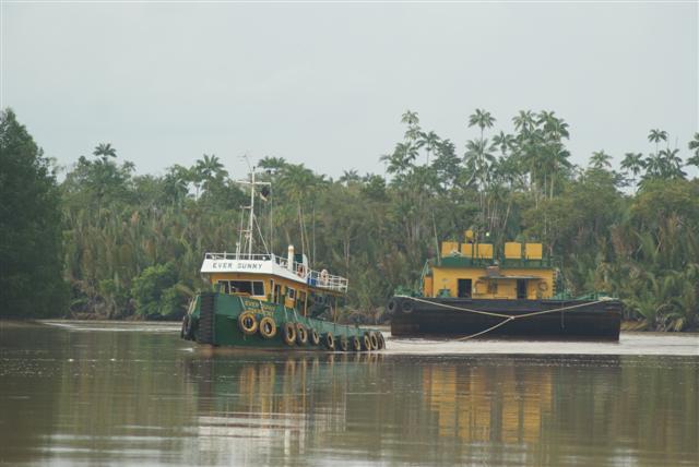
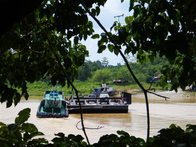
Tug and tow
Our old friend the ‘tug and tow’ was there to greet us. We were only 20 miles inland as the crow flies but we’d travelled 41 miles from the river entrance. I don’t think Camomile has been that far away from the sea since crossing the Panama canal.
Camomile pretending to be the African Queen

Local mosque
I went ashore to explore Sukau. There was the usual mosque and several rows of prettily painted houses with the usual washing hanging out.
Pretty houses
Barge acting as ferry
The roads were only dirt tracks but to cross the river a barge was used pushed along by a large tug.
I walked for a couple of miles on a circuit from the village to a couple of resorts and back. Sadly I found as soon as I was away from the river the trees changed to palm oil plantations, miles and miles of them. It’s so wrong because the wildlife can’t live in them and in particular the wild Orang-utans need proper trees to live in.

Another pygmy elephant
We spent 2 nights in Sukau before making our way back down the river. On the second evening we took the dinghy under the power lines to see what we could find. We found a whole herd of pygmy elephants and we managed to get really close. So lucky
I took 100s of photos and it was difficult choosing which ones to post on my blog, I hope you like my choice. A photo can show you what we saw but you can’t feel the temperature or the humidity, you can’t smell the jungle and you can’t hear the sounds of which there was a cacophony.
I’m looking at you, looking at me, looking at you
Sandakan
The yachts arrived in convoy
On the 15th July we left Turtle Island (Siligan island), without seeing the turtles, to go to Sandakan and onto the Kinabatangan river, hopefully we’d see some wildlife there. We were now in convoy because we are in the Sula sea which is one of the areas in the world that has pirates. Sazli, the rally organiser accompanied us on Out of the Blue II with some local dignitaries and asked if we could all arrive at the same time with our sails up to impress the local people – so much for keeping a low profile.
The town of Sandakan

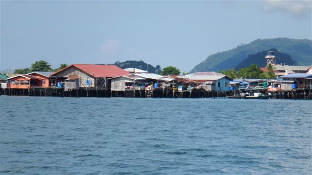
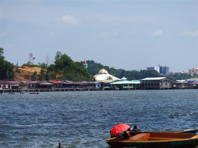
The water village
Sandakan sits on the entrance to a large bay. The mosque towered over the surrounding buildings. There was also a big water village where all the houses are built on stilts, I say houses but they are little more than garden sheds. One decent cyclone or tsunami would wipe the whole village out, and frequently does.

Monitor lizard prowling the shoreline
We went ashore to the local yacht club and spotted this little chap doing his rounds of the ‘beach’ looking for food or animals smaller than him, he was about a metre long.

Flats in the town
The next day we had a whole bunch of jobs to do and headed into the town. As usual everyone was happy and friendly and greeted us warmly but this is one of the rows of flats in town where they live, it looked fairly grim but the people don’t seem to complain. I suppose they don’t know any different.
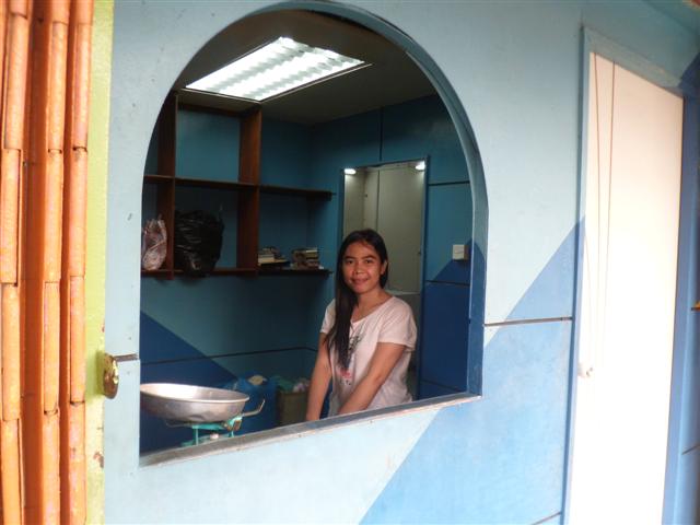
The little laundry girl
This sweet young girl runs the local laundry, it felt strange asking her to do our washing but she seemed pleased to do it. I’m sure when the rally arrived in town all the prices went up but it was still reasonable at MR31 (about £5.50) for a huge bagful.
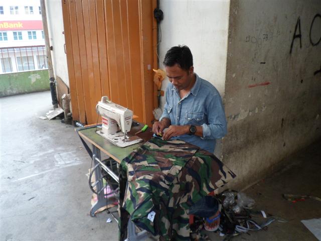
One of many workers sewing
This man was working out on the balcony, the light was bad inside, making clothing that would probably end up in a western shop somewhere

The big mall
In sharp contrast next door was a huge mall complete with air conditioning. As Hari Raya was coming up every where was decorated similar to our Christmas, the children seemed excited. We couldn’t find out the significance of this house with Hari Raya but everyone was taking photos of it.
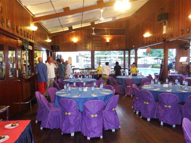
Set for the rally dinner
The following evening was the rally dinner in the Sandakan yacht club, which is opposite to where the boats are. The bar looked very grand with all the extra tables to fit us all in.
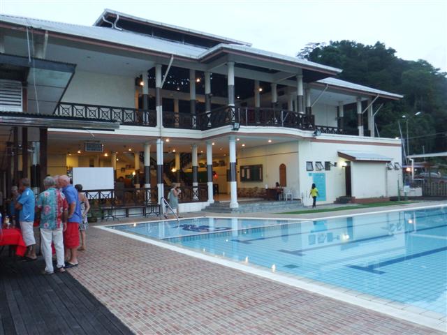
The pool at the yacht club
The yacht club has a colonial look about it like most of these places it was like an oasis. The pool looked lovely but sadly we don’t seem to have the time to use these pools, too busy trying to write and post blogs!
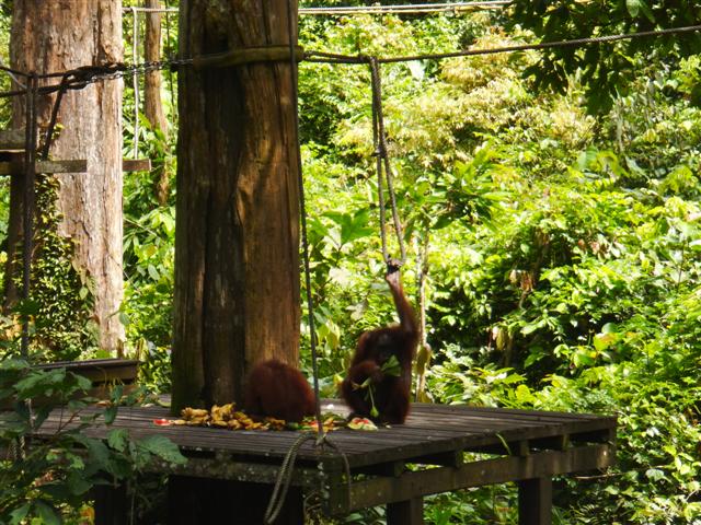
Orang-utans feeding
The next morning after our briefing on the next stage of our journey, most of the rally got on a coach provided by the local council to go and visit the Sepilok Orang-Utan rehabilitation centre. Established in 1964 it rehabilitates orphaned or injured orang-utans to return to forest life. We arrived at feeding time and were lucky to see several young orang-utans swing out of the trees onto the feeding platform.

Orang-utan swinging through the trees
Otang-utans are beautiful creatures and their name means ‘man of the wild’, they are the only species of great ape found outside of Africa. The males can weigh up to 144kg although there weren’t any big males at Sepilok. Sadly their natural habitat is slowly but surely disappearing, it was once said that an orang-utan could swing from tree to tree from one side of Borneo to the other without touching the ground but not any more. With hunting and habitat destruction it’s estimated fewer than 15,000 specimens now exist in the wild, very sad.
Beautiful gardens
I could watch them all day but we moved onto the Rainforest discovery centre that has a series of towers connected by walkways giving us a birds eye view overlooking the rainforest. We saw lots of macaque monkeys, hornbills and a slow loris, going slowly, but all too far away to get photos of them. Back at the entrance they had the beautiful plant discovery garden, it was wonderful to look around a garden for a change instead of hardware stores and boat shops.
The lake by the gardens

Entrance to Agnes Keith museum
During our stay, in between shopping, buying fuel, finding gas fixing the watermaker and all the other 101 jobs, we found time to walk up the 100 or so steps to Agnes Keith’s house on the hill above the town. Agnes was an American who came to Sandakan in the 1930s with her husband, the then conservator of the local forests. The house has been turned into a museum with some wonderful photos of how Sandakan used to look.
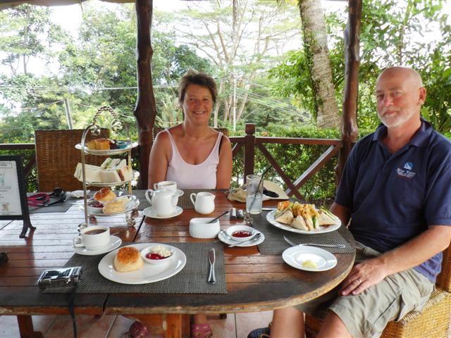
Tea in the garden
In the grounds was an English Tea house serving afternoon tea – it would have been rude not to stop!
The Turtle islands

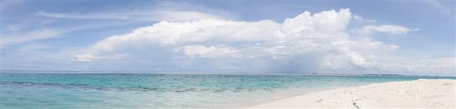
The beach on Siligan island
Thursday 10th July we left Pulau Lankayan and headed south to the Turtle islands marine park. After arriving in the afternoon a squall blew up preventing us from going ashore but the following morning we headed for the beach. The white sand squeaked under our feet as we walked around the waters edge.

There were turtle tracks going up into the sand dunes all around the island where the female turtles haul their huge bodies ashore to lay their eggs. Once the eggs are laid she crawls back down the beach into the ocean leaving her eggs to fend for themselves.

The hatchery
It was forbidden to walk among the nesting sites although there aren’t any eggs there because the morning after they’ve been laid the staff from the conservation centre dig them up and remove them to the hatchery where they have a better chance of survival.

A monitor lizard prowling around the island
Turtle eggs are delicacies to monitor lizards, like this big chap we saw walking around the island, and to the Chinese who buy them on the black market.
Beautiful clams under the water
We spent a few days relaxing there as the rest of the boats arrived. We found a bit of nice coral but it wasn’t a patch on Pulau Lankayan.

Clown fish (Nemo) hiding in the sea anemones
We tried anchoring off of one of the other islands for a change of scenery but the area has very deep water and the anchoring was challenging so we went back to the main island and spent a few days doing boat jobs and writing.
The boats at anchor
Dinghies arriving on the beach for the meeting
Monday 14th Sazli the rally organiser arrived and we were all invited to a meeting on shore. We spent an interesting afternoon learning all about the turtles and the conservation carried out at the resort on the island. It was also arranged that one of the resort boats would come and get us all after dark to watch a turtle laying her eggs and to release some baby turtles.
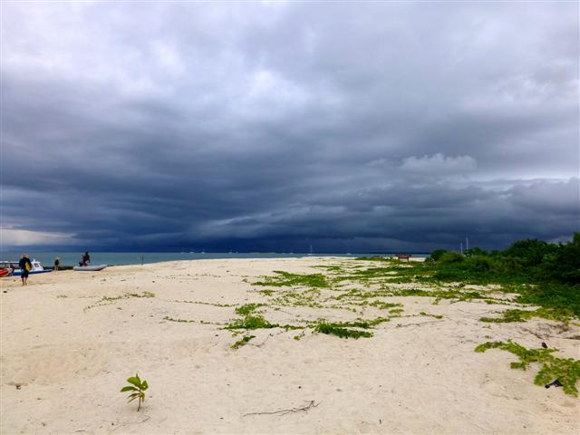
Storm brewing.
As usual the weather didn’t behave, can you see the storm clouds gathering?
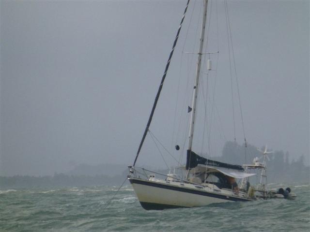
Poor Camomile
We managed to get back to the boat before the storm broke and raised the dinghy. Very soon the rain started, how it rained and rained and rained. At the same time the wind picked up to 30 then 40kts. The first boat to start dragging was Sailabout but there was nothing we could do but look on as they fought to get the anchor on board and re-anchor. The boats were all bucking like broncos and the rain continued to lash down. We were watching Calypso behind us and Labarge in front of us and they stayed the same distance from us. We thought that Out of the Blue II were motoring forward. I called Lyn on the radio to ask if they were motoring forward but she replied they were still anchored that meant only one thing – Calypso, Labarque and we were all dragging our anchors towards the island.

Camomile disappearing behind the waves
Bill had already managed to get the snubber off earlier so I crawled to the bow to guide Bill with hand signals as we raised our anchor. After about 10minutes of screaming into the wind and gesticulating frantically the anchor lifted clear of the water but not without a massive thump on the bow as it swung clear of the water. We motored to the other side of the bay, where there was a bit more shelter from the strong current that was pulling us towards the island, and re-anchored. Needless to say the trip ashore was cancelled and I didn’t get to see the turtles laying their eggs or release the baby turtles.
Chris on Out of the Blue II managed to take these photos of Camomile as she was bucking in the storm.
Underwater at Lankayan Island
This story is old news now but I’d written it and it continues the story so I decided to post it.
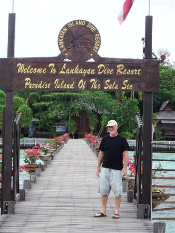
The entrance to the resort
We spent the next couple of days making our way south stopping at average anchorages. The wind had been quite strong making everywhere quite rolly. We were with the rally group of a dozen or so boats. One of the original stops had been the island of Lankayan but we had been told by one of the cruisers that it was expensive because they were charging for anchoring, snorkelling and even to walk on the beach and to give it a wide berth. Wednesday 9th July we decided to head south with our friends on Jackster, an Amel, who soon disappeared over the horizon. The original plan had been to sail as far as the Turtle islands but the wind had been very fickle and we realised we couldn’t catch Jackster up and wouldn’t make Turtle island before nightfall. As we were passing Lankayan I contacted them to see if one of their buoys was available, luckily all three were. It was very hard to spot because it didn’t have a buoy attached to it just the line lying in the water. Luckily the resort sent one of their little boats out to show us where it was.
The lodges on the beachfront
For those coming behind us the waypoint for the buoy is
06º30.1N
117º54.7E
it’s the nearest one to the resort the other two are just behind it. The resort listens to VHF16. It was only 3pm so we decided to go ashore and see how much they were going to charge us. It turned out they didn’t charge for their buoys or even to anchor they just charge MYR25 (£5) per person per day conservation charge. For that you can tie up to their jetty, snorkel their beautiful coral round in front of the resort, walk on the beach, and do what you like.

Looking out to the restaurant built over the water
So we were glad we stopped, it was a beautiful spot. The island was very small and could easily be walked in less than an hour. Interestingly all around the seaward side were manned machine gun posts. There has been a lot of trouble recently with the Filipinos coming over and bothering the tourists. We don’t think any one has been harmed but they didn’t seem to want to take any chances.

Looking from the restaurant back to the island
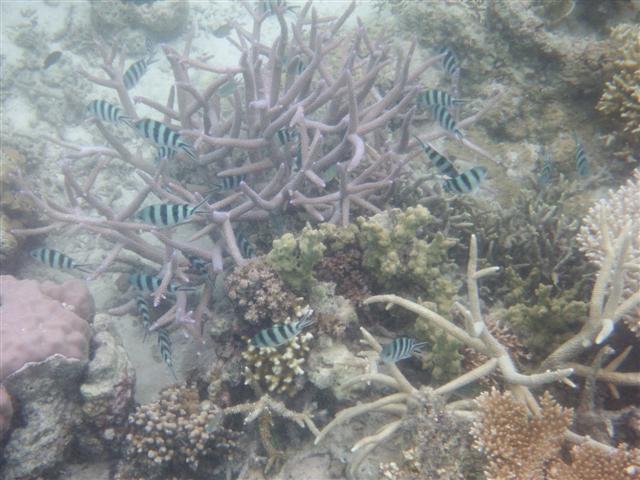
Beautiful coral
The next day we decided to get in the water. We had two snorkels that day. We took the dinghy to the jetty and just swam off of it and the second one was further out which needed the dinghy.

Blue stag coral
We found an amazing amount of the most superb coral, some of the best we’ve seen since Fiji, and in wonderful colours. The water clarity wasn’t as good as Fiji but the coral was beautiful. Further out was even better away from the tourist area.

Plate coral
Each one of these plate corals is the size of a dining table.
We saw several of these blue starfish
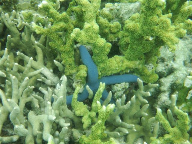
Blue starfish

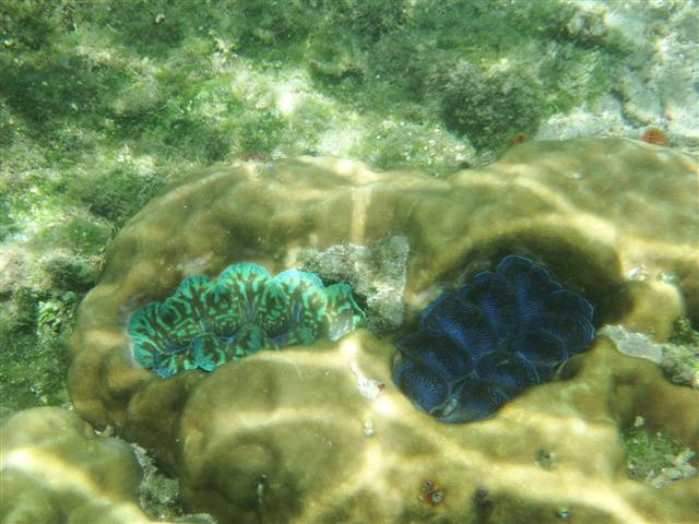
Blue clams embedded in the rock
And the most remarkable clams of vibrant blues

Angel fish
Little blue fish
So many fish of all sorts. Angel fish, parrot fish, sergeant majors,
Parrot fish
Little white fish under the jetty

A big Billum fish
And a big Billum fish.
So it just goes to show you should always see these places for yourself and don’t be put off by other people’s comments.
Joining the Rally in Kudat
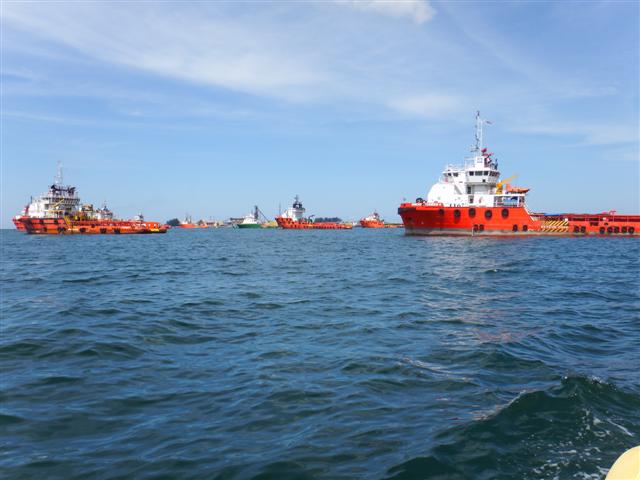
Leaving the Rig support vessels behind
At the beginning of the journey to Kudat a gentle breeze in filled our sails and gave us 2.2kts of speed, hmmmm this was going to take a while. We realised that the island was shielding us from the wind and, despite hoisting the cruising chute, we’d have to motor. We soon left the rig support vessels behind us in the distance. If you look in the foreground of this photo you can see the tips of part of a tree sticking up in the water. That’s the sort of thing we have to look for on this coast, the tropical equivalent to icebergs.
Mount Kinabalu shrouded in cloud
We had decided to do one more night sail mainly to catch up with the rally but also, with the swell that was running, any anchorage on this side of the peninsular would have been untenable. By 15.00, when the sea breezes set in, the mainsail and the cruising chute were back up and the engine was off; we were sailing again. By 18.00 the wind had got stronger and the cruising chute was replaced by the genny and the sea was getting rougher. By 23.00 the wind died completely and the engine was back on. I went to bed at 2am, although sleep was impossible in the swell that was hitting Camomile from the west. Bill came up on watch just in time for the squalls to start; poor Bill got soaked. The wind was up and down during the night, as the squalls crossed our path. At 6am I came back on watch and we were sailing although it was like a washing machine down below and I hadn’t slept much. Bill went down to try to sleep but by 10.00 he was back on deck as we started having 30/35kt squalls. This is Mount Kinabalu, I had hoped to see it in all its glory but it was shrouded in cloud for our journey. Unfortunately we had the tide against us giving us wind against tide and we were only achieving a boat speed of 4kts.
Approaching the northern tip of Borneo
At 2pm we rounded the tip of Borneo, this is the most northerly part of mainland Malaysia.
Much calmer on the eastern side
Thankfully the swell disappeared as we started heading south on the other side of the peninsular. I was hoping we would arrive in time for the trip the rally were running to a Longhouse further inland that was leaving at 4pm, the GPS was giving us an arrival time of 16.01! As we approached I called our friends on the boat Jackster and asked them if the coach would wait for me, although Bill wouldn’t be able to leave Camomile if we had only just anchored. As we arrived at the anchorage and dropped the anchor it was indeed 16.01, how clever is that? Dave very kindly came out to get me in their dinghy and I was whisked away leaving poor Bill to sort the boat out. Luckily he didn’t mind.
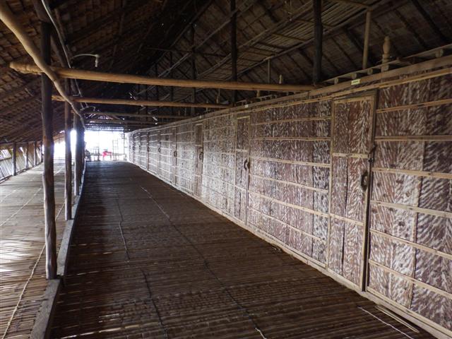
A traditional Long house
After a drive of about ¾ of an hour we arrived at the traditional Longhouse, which is one of the distinctive features of Dayak life. The longhouse was raised above the damp jungle floor on stilts and built alongside the beach. In fact this was the stretch of coastline we had battled along earlier in the day. Some longhouses have whole villages living in them but this one was available for guests. It consisted of a long covered veranda along which were rows of doors giving access to the basic rooms.
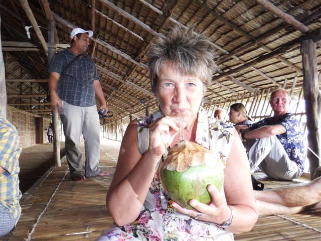
Drinking from a fresh coconut
We were invited to sit down inside the veranda and offered fresh coconuts with the top sliced off allowing us to drink the delicious liquid inside them.
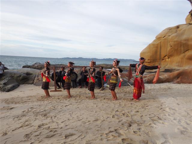
Village girls in local costume
The rally was invited onto the beach to watch local girls performing some traditional dancing. Their costumes were beautifully made. The guy on the end seemed to be doing his own thing.
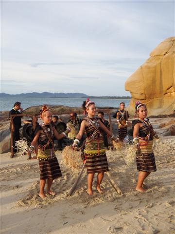
Clever dance using bamboo poles
The rocks behind the beach made a wonderful backdrop. After the sun had gone down we were invited into the living quarters of the longhouse for a meal. As we are in the time of Ramadan at the moment many of the locals fast from sunrise to sunset. A delicious buffet meal was served but with very little light it was difficult to see what we were eating; perhaps that was the idea! It all tasted very good and it was nice to have finally caught up with the rally.
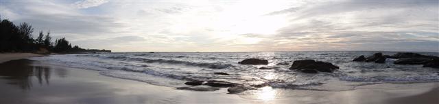
Beautiful sunset
Kudat was a funny little town. It had quite a few Chinese hardware stores, a couple of small supermarkets and a handful of eateries. After 2 days of wandering around we decided we wanted to get out into the surrounding islands rather than sit in anchorage surrounded in murky water.
Scenery surrounding island of Banggi
So Saturday 5th July we left early and headed north to Banggi island. It was beautiful. We tucked ourselves into an enclosed anchorage with little islands to the south covered in jungle. We took the dinghy on a little tour of the anchorage but there were mangroves growing down to the waterline and we couldn’t find anywhere to land. For those following along behind us the waypoint for the anchorage is 07º10.15 North 117º09.5 East.
Happy Birthday Bill
This was the furthest north that we were going this year so the next day we headed south again. Bill wasn’t happy being on our own as we were now in the Sula sea, one of the areas in the world that claims to have pirates. The rally have arranged for us to have a naval escort when we get further south into the more notorious area. We headed to Silk island where many of the rally boats had arrived having just left Kudat. As it was Bill’s birthday we invited our friends Dave and Jacqui from Jackster to come and join us for a meal. We had a wonderful evening together.
The duty free island of Labuan
Driftwood on the beach
Labuan is only 20 miles from BSB in Brunei and, as it was a Sunday and we wouldn’t be able to check in until the next day, we decided to have a lunch stop at Keraman island. It’s a small island just south of the main island and had an interesting sand spit protruding out into the sea that gave us a nice protected anchorage. The tide was out exposing the beach along the sand spit so we jumped into the dinghy and headed over to it. It had a steep incline to the beach landing and it was easier to jump in the water and wade in, luckily we had gone in swimming costumes. The beach was littered with the most amazing driftwood that had been washed up on the high tide.

Bill brought the dinghy up the beach while Camomile watched
The dinghy was misbehaving so Bill managed to drag it on to the beach so we could walk the length of the sand spit.

There was surf on both sides of the sand spit
Bill and I on the beach
Storm clouds building
At the far end where the two sides of the beach met the sea the waves were crashing into each other and sending up great walls of spray but look behind the waves and note the black clouds forming in the background. We managed to launch the dinghy and headed back to Camomile and lift the anchor quickly. We motored as fast as we could but the squall caught us and we were lashed by the driving rain followed by 40kt gusts of wind as the storm picked Camomile up and propelled her through the choppy sea towards Victoria harbour on Labuan. The visibility was down to a mile or two but with the radar on we carefully inched our way to the marina in the north of the bay.

Lots of contacts on the chartplotter
The AIS contacts on the chartplotter showed many ships anchored in front of us but we couldn’t see them.
There were many ships anchored in the harbour.
Gradually as the storm cleared the ships started appearing out of the gloom. It appeared they were all support vessels of different kinds for the many oil rigs in the area
Victoria harbour marina
By the time we got to the marina the blue skies were back and you wouldn’t believe we’d had a storm.
The next day we had to go through the usual hoops to check in, it took 2 b*****y hours because we had the wrong stamps in our passports. Long story, won’t bore you with it but eventually they cleared us so we could go shopping.
Mission accomplished
As I’ve said before Labuan is an island; it’s a duty free island, what does that mean ….. cheap booze! Particularly if you go to the Chinese shops because unlike the Malaysians they love to barter. By the end of the day we had been back to the boat twice with 14 litres of spirits and 66 litres of wine. This is my supply of white wine for the next 5 months, the red trolley bag is full of red wine in boxes, they didn’t have a very big supply but managed to find some Banrock Station Shiraz and some French Merlot, we bought all they had. We spent the rest of the day finding places to put it all including lifting the floorboards, Camomile will have to have her waterline lifted again!
Sailing north leaving the ships behind us
The next day, with mission accomplished, we left the marina for an overnight trip around the tip of Borneo to Kudat. The rally were there so we would finally catch up.
The Kingdom of Brunei
Finally got internet coverage so I can continue the tale of our adventure.
The east Malaysian coast
After stopping at the island of Pulau Satang Besar we continued on our journey North East. There wasn’t time to visit Kucking and so we motored about 50 hours until we reached Miri (I’m pointing the pencil at it) on the Sarawak coast. We arrived at the marina entrance on 23rd June about an hour before low water and we knew the entrance was shallow. We had a tense half an hour as we slowly edged towards the entrance in a 1-metre swell watching the depth dropping. Fortunately it didn’t go below 1 metre below our keel. Bill had calibrated the depth transducer before we had entered as it had been set wrong. First things first – air conditioning on. The plan had been to check in and do some shopping but the next morning I discovered the marina was right outside the town and a taxi was needed to get there. I managed to get a few bits of shopping in a local shop. After which a plan B was developed and we decided to move on to Brunei. Originally we didn’t think we would have time to visit but after talking to friends who said fuel was the equivalent of 15p a litre the decision was made.
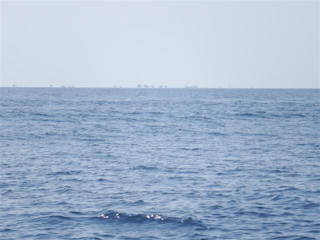
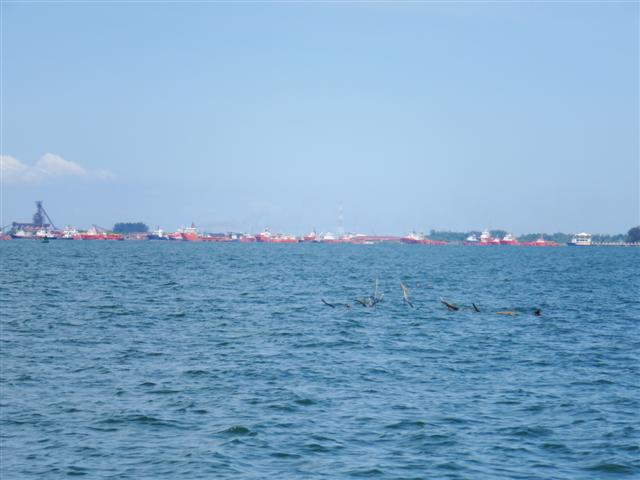
Oil rigs in the distance
We didn’t want to do any more night sailing because this coastline is littered with oilrigs and their entourage of supply ships so a day sail to Kuala Belait was planned. We passed many oilrigs on the way mostly a fair way out to sea but some were closer in.
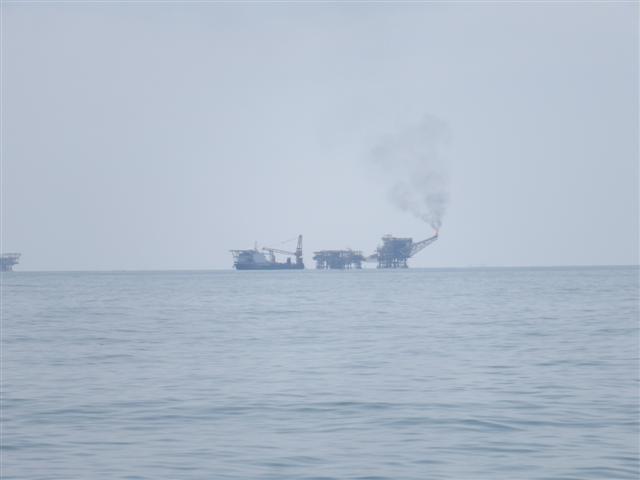
Some were a little closer

Oil rig construction
We entered Kuala Belait at 4pm and motored up the river for about a mile and a half before dropping the anchor. In front of us was a bizarre sight as this was the base where the rigs were built and there were a row of them along the riverfront. They were a hive of activity until 5pm when it was down tools and home time. It left an eerie silence except for the cicadas chirping in the untouched jungle opposite.
opposite untouched jungle.

Beautiful sunset in our wake
We left at 5am the next morning for the 63 mile journey to Bandar Seri Begawan, Brunei otherwise known as BSB. There wasn’t any wind so we motored all the way arriving at the entrance channel just after 6pm leaving a beautiful sunset in our wake.
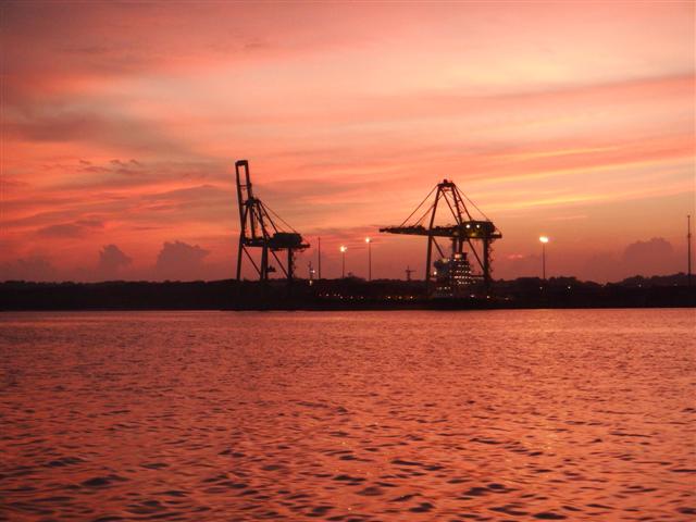
Pink glow over the container port
The container port looked striking in its pink glow as we approached the anchorage. Fortunately there was enough light coming from the land to guide us in.
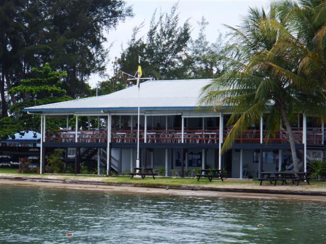
BSB yacht club
The following morning we took the dinghy into the yacht club. It had a wonderful colonial feel about it.
Camomile sat and waited for us.

Camomile waiting for us.
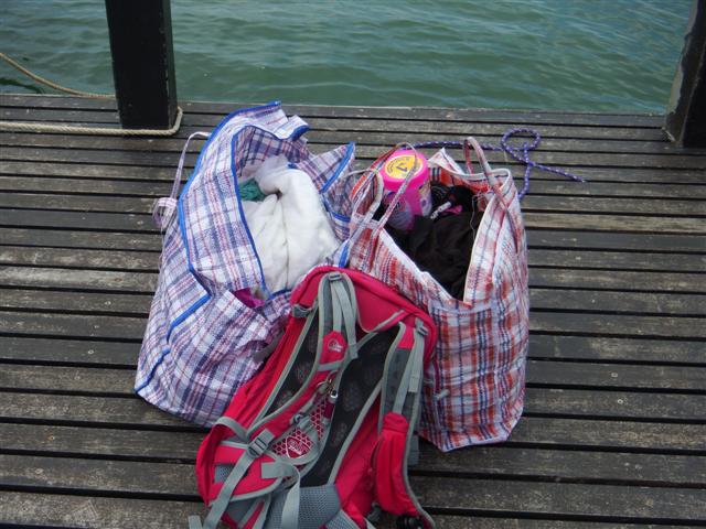
Lots of washing to do
I’d heard there was a FREE washing machine, yippee, cruiser price. The lockers were emptied and all the washing was taken ashore; don’t know where the next washing machine will be.
Lovely outlook
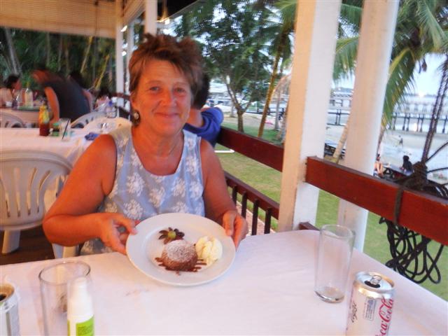
Delicious chocolate fondant pudding with ice cream… yummmm
While the washing was churning away we sat and used the free internet service to download emails and facebook then enjoyed a delicious meal.

Lovely swimming pool
They even had a swimming pool but we didn’t get a chance to try that out. We contacted Allan Riches of Sailmail who, its reported, can arrange a fuel run. His van was booked that day but it was arranged for Zahir to pick us up the next morning with our jerry cans and take us first to a supermarket then on to a fuel station. We retired to Camomile for the evening. Sharia law has limited the bar to soft drinks and beer so we opened a bottle of wine on board instead.

Striking buildings
Zahir was a funny little man in his early 30s and insisted on calling us Mammy and Daddy even though we had given him our names, quite weird. It took almost an hour to drive into the city during which time Zahir ‘grilled’ us about out life. We in turn found out a lot about Brunei from him. Contrary to popular belief the people don’t lead a suppressed life, far from it, Zahir was extolling the virtues of the Sultan and how he looks after everyone handing out money to the children at the end of Ramadan and inviting the whole country to his palace for Hari Raya (the big feast at the end of Ramadan, their equivalent to Christmas). Also they have no income tax, no capital gains tax, no VAT, free schools, free health care, all in all they have a pretty good life. The supermarket was bizarre because it was full of English products, some of which were from Waitrose, right down to the price printed in pounds on the products, although they were being sold for the equivalent of twice the price. I managed to get some things that I haven’t seen since Australia like yoghurt mixes for my yoghurt maker, cranberry juice and really nice museli. I filled the supermarket trolley and it was loaded into the back of the van before we moved on to the fuel station. Bill was really pleased because it was B$0.31 a litre which is the equivalent to 15p a litre….. 15P A LITRE! That’s the cheapest we’ve found since Gibraltar, luckily Bill had borrowed some jerry cans from the yacht club.

Chinese temple
As we drove back to the yacht club Zahir took a different route so we had the chance to see a bit of the town. There were some very modern buildings on the way as well as some traditional ones like this Chinese temple.

The water village on the opposite bank of the river
BSB is home to the biggest water village in the world. Founded at least a thousand years ago it has its own schools, mosques, police stations and fire brigade and is home to an estimated 20,000 people.

School on water
A mosque on water
One of the car parks for the water village
On the opposite bank there were large car parks with luxury cars parked in them, many of which belong to the water village residents.
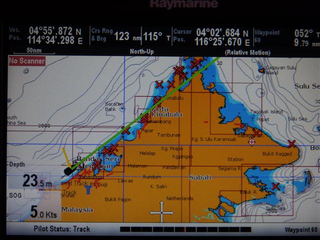
The Sabah coastline
We stayed at the anchorage for a second night so we could enjoy another meal in the Yacht club but the following morning we had to leave. If time had allowed it would have been great to stay another couple of days and explore further but we needed to keep heading north to catch up with the rally. This chart shows us just outside BSB and the rally were at Kota Kinabalu and travelling north to the tip of Borneo so we weren’t far away but we wanted to stop at the duty free island of Labuan first for a little alcohol!
We’re on our way to Malaysian Borneo
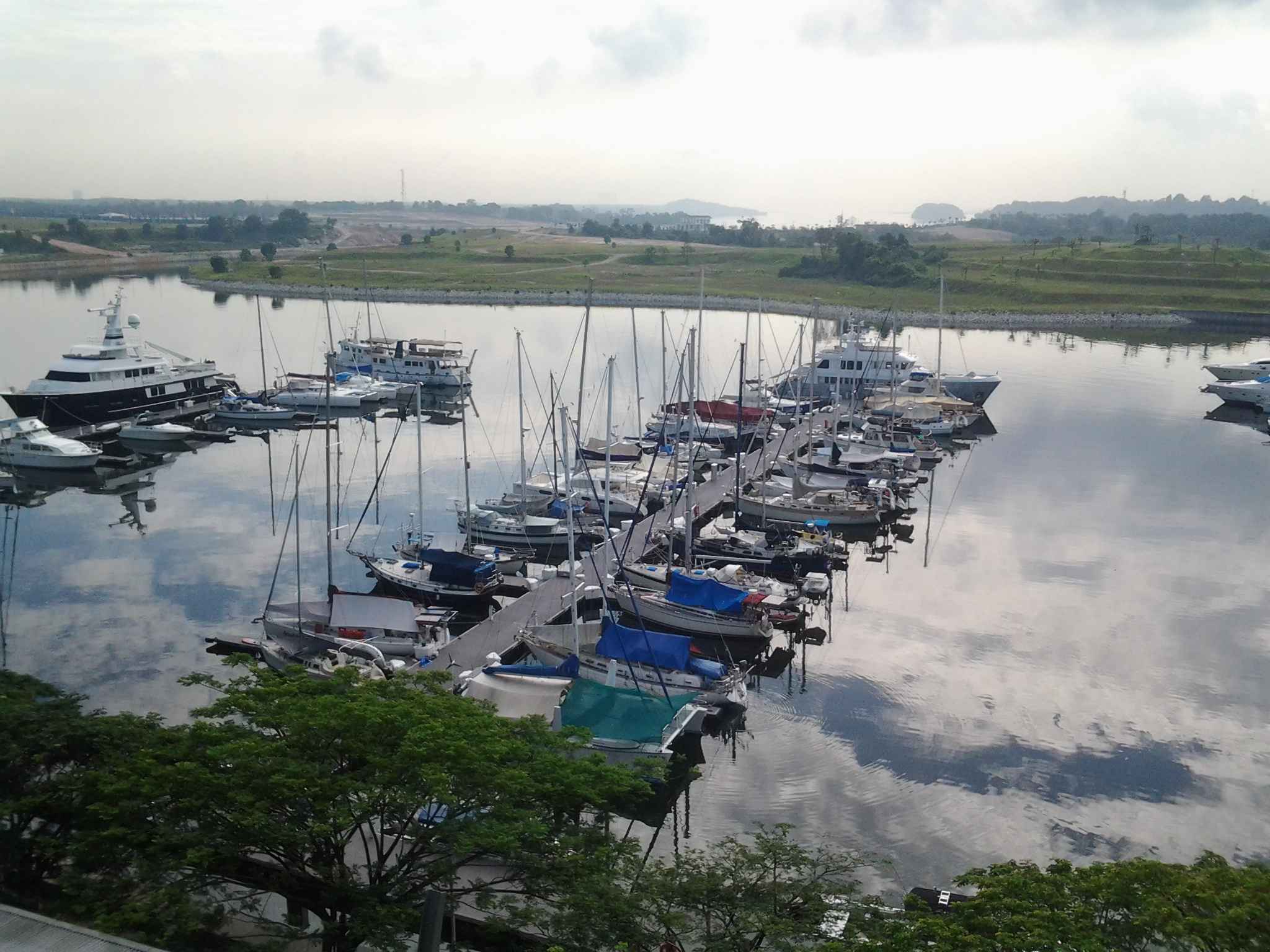
Puteri marina from the Traders hotel
Monday morning 16th June we were up early because there were lots of last minute things to do. Turned the instruments on – no depth! Can’t go without a depth sounder; no speed either. Bill had to get the transducer interface box out from behind the panel again to investigate. It turned out to be a locking collar on the cable had come lose because Yap hadn’t tightened it properly – naughty Yap. Bill got it sorted and we continued with our jobs. Bill wanted to do an oil change as we anticipate lots of motoring on the next part of our adventure. That involves moving the stairs and lots of swearing at inanimate objects to curse them into submission! I beat a hasty retreat to the gym with Jackie for one last time. At 11am they came to collect us in the marina golf buggy to take us all of 300metres to immigration to check out. I don’t think they realise that we are able to walk but it helps them to justify the charge of £10 for doing the check out paperwork that consists of writing out the port clearance and stamping the passports.
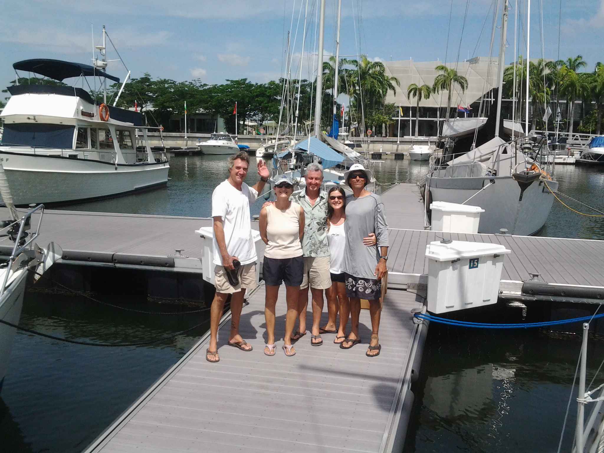
Goodbye Bill, Zdenka, Jack, Jackie and Jake
At 2pm we said a final sad goodbye to Hokele’a, Soltice and Kite then left Puteri harbour, it was almost exactly 5 weeks to when we had arrived and 8 weeks all but 2 days since the lightening strike. It was like travelling with a new baby with all the new noises Camomile was making. The VHF was beeping every 4 hours because Bill hasn’t set up the NMEA connection with the GPS yet and the AIS kept peeping because there were so many ‘dangerous targets’ around. We felt quite nervous. We were also going really slowly and Bill decided the prop must be covered in barnacles; he couldn’t get any speed out of the engine.
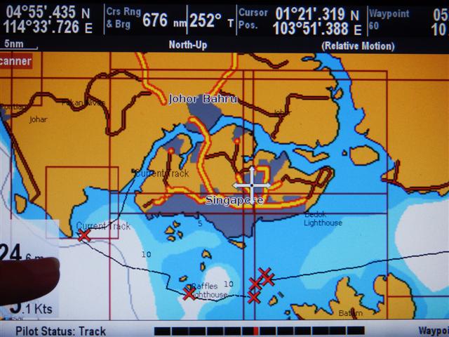
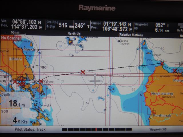
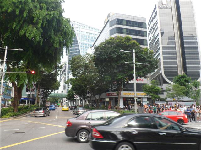
The island of Singapore
This is a screen shot of the chartplotter. The black line is the course we took. The first ‘current track’ is Puteri harbour and the first red cross is the waypoint for our first anchorage. We had decided we wouldn’t go far on the first day and just anchored at the bottom of the Johor straits, which took us 4 hours. It was strange to be out of the marina after such a long time. We were also now without the air conditioning and it was hot hot hot.

Jets flying over us
The next morning we left early and by 9am we were sailing. We were over flown about a dozen times by the Singapore air force, I think they had come out to see us off. There had been regular flyovers when we were in Puteri but usually only 2 or 3 at a time. Today they had all 6 out. 5 were in formation and we think the sixth was probably training them, any way they looked pretty spectacular.

Going round again
We sailed down to Raffles lighthouse, putting in a tack along the way as the track shows (we do sail properly sometimes!) so we didn’t hit the little island. We were so lucky with the shipping because just past Raffles lighthouse we crossed the Singapore shipping lanes, which are normally incredibly busy, sailing, practically unheard of. The next set of 4 red crosses is where we stopped for an hour among some islands so Bill could go over the side to scrape the barnacles off the prop. It really needed it and he said the hull was quite bad too but for now just scraping the prop made such a difference.
The gap
This next screen shot is a smaller scale and from side to side the distance is about 500 miles, don’t take any notice of the numbers along the top, they were Camomile’s current position at the time I took the photos. So the red cross that’s sitting on top of the word ‘Singapore’ was how far we got at the end of our second day out. We had made the decision not to stop for the night because there had been some sea robberies among the islands on the bottom left of the picture, which is northern Indonesia. So we kept going. We spent the next 60 hours, 3 nights and 2 days, going backwards. Not literally, of course, just travelling eastwards towards the sunrise. The first night there was a bit of lightning which lit up the sea in front of us but hopefully we’ve left that behind now. Bill used his time to finish some of the jobs like interfacing the NMEA to the VHF and SSB radios and working out how to turn the alarms off. The new system is very user friendly and we are both learning how things work and teaching each other. After the red cross in the middle, which was marking a tiny island, the wind was much more constant and we put up the cruising chute. Camomile was sailing really well and we had much better winds than we were expecting.

Dolphins
We were visited by a wonderful pod of dolphins half way across. As usual when you get the camera out they become shy but I managed to get a few photos of bits of fins and tails.
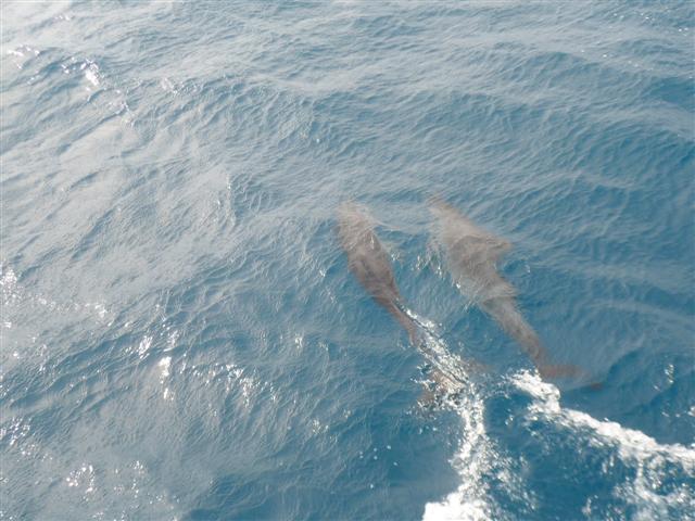
Dolphins again
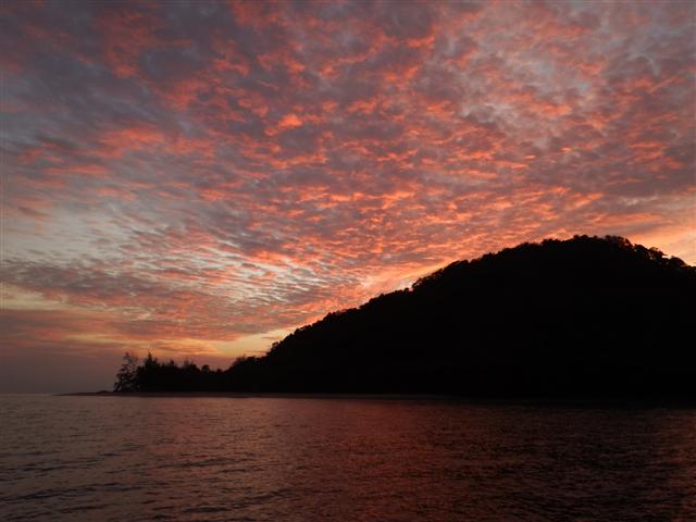
Beautiful sunset
When we reached the first red cross on the right hand side at the tip of the point on Friday morning the wind died. We spent the day motoring to the island at the last red cross on the right hand side. It was Friday evening, the crossing had taken us 4 days and we arrived just in time for sundowners while we watched the most beautiful sunset over the island.
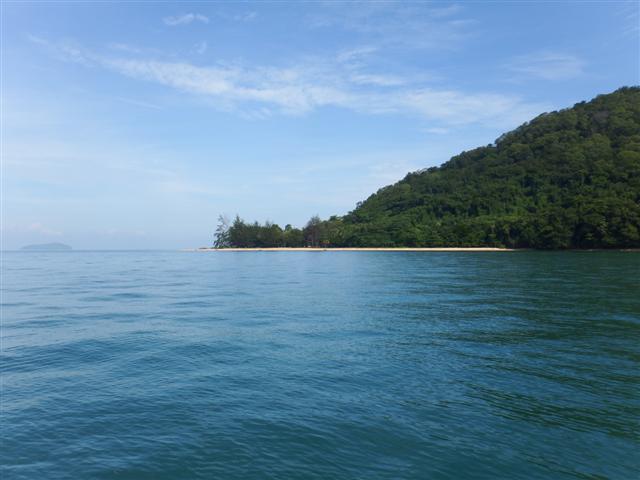
Just as beautiful in the day
Our position is
01º46.8 N
110º10.15 E
Pulau Satang Besar.
It looked equally attractive in the day and as the water was so inviting Bill put his wet suit on and spent about an hour in the water under the boat scraping off the barnacles. Lucky he had his wet suit on because there were quite a lot of jellyfish in there. My much-desired swim was not to be.

Camomile back in the islands again, where she likes to be.
Camomile on the Mend week 5
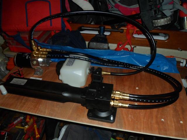
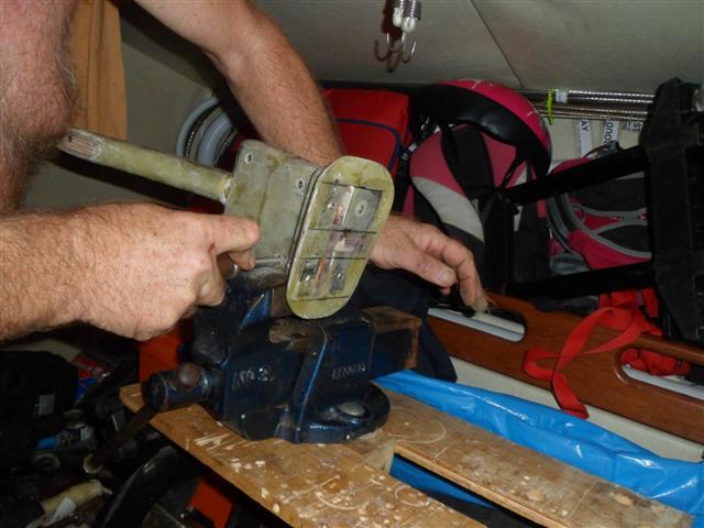
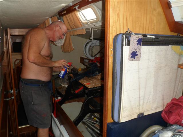
The autopilot hydraulic ram
So the auto pilot hydraulic ram turned up on Monday. Bill spent the morning finishing off some wiring for the crossover DC switch in the radar arch to get his horns working (I’m not going to begin to explain that). After lunch Ally turned up with the hydraulic ram, which she had extracted from the Singapore customs. When we opened the box we kind of understood why they had held it. The ram was skilfully attached to a backing plate to prevent it from moving in transit, it had come from the UK, but on an x-ray the profile probably looked like a gun. Secondly it had a little container of hydraulic fluid attached to it and the customs officials, bless them, had drained it. Why? Who knows but it meant we needed more before we could test it.
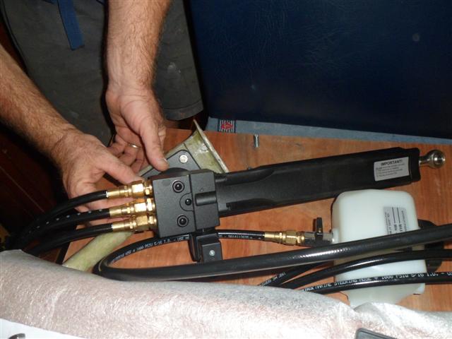
Trying the mounting unit for size
This is how the unit fits onto the mystery object.
It needed some fine-tuning!
Fine tuning

The base of the ram in place
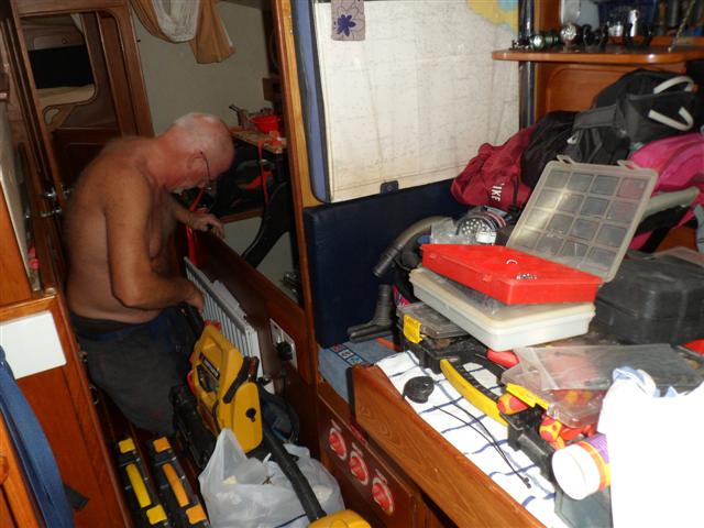
The hydraulic ram hull mounting reinforcement, Bill’s official name for the mystery object, was fibre glassed in place by the end of the day Monday. Bill spent the next 2 days mounting the ram and wiring it up. The main mounting is under the port locker next to the bed with the ram going through a hole in the bulkhead ready for attaching to the rudder quadrant.
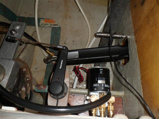
The ram ready for attachment to the quadrant
It couldn’t be tested without the hydraulic fluid and I spent 2 afternoons, on the bus, going to the next two towns carrying my little empty bottle trying to buy hydraulic fluid with an ISO of 10 – without speaking the language! Who says I have nothing to do all day? Unfortunately I failed. I managed to get cable ties, easy, and electrical terminal blocks, little harder, but not hydraulic fluid. I could have bought a 15 litre bucket of it but we only need 2 or 3 litres and they wouldn’t sell me a little bit. So I came home disappointed. We had a further disappointment when we heard the TV coming from the UK had been held up until Monday but at least that gave us a focus to work towards – leave on Monday.
Meanwhile Bill had sent another email to Aquila asking again about the VHF and the SSB. To give Aquila their due they always respond well to emails. Ally assured us the new VHF was on it’s way from Australia and would be here before the weekend, and they had bought a new Icom SSB from their supplier and installed it in their office to test ours, (apparently their supplier maintained it didn’t have a warranty because they don’t break) and they had our SSB head working! She also had hydraulic fluid. As our parts for the fridge had also arrived with the refrigeration company in Singapore we decided another trip to Singapore was in order.
Busy streets of Singapore
Thursday morning we got on the bus and made our way across the border, stopping to get a stamp in our passport either side. We went to the fridge company first to pick that up and got all the parts in our backpacks. After lunch we made our way to Aquila’s office. They are based in an unusual building in that it’s a vertical industrial estate. Singapore is very short of space so they have built many light industrial units vertically, it’s a brilliant idea. Apparently there was a service area around the back with a multi story ramp that delivery vehicles can drive up and there’s a large service lift on the inside. Aquila has a showroom/storage area on the 7th floor with a large office at the back of their unit. Very practical. Any way we arrived and had a demonstration on the SSB and sure enough it was working – brilliant. We made our way home – stopping to get two more passport stamps – and refitted the SSB head to try it. Turned it on …. same problem, GGGRRRR. Another email.
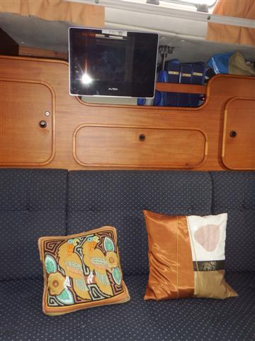
The new TV with two of my cushion collection
Friday 13th was it going to be our lucky day? Aquila were due to come over in the afternoon and commission the new instruments. The first good news of the day was that Ally had our VHF radio from Australia. The second good thing was the little TV turned up from the UK early, hooray nothing to stop us going now except a couple of radios! Then we heard Aquila were delayed and wouldn’t be over until late afternoon. 2 steps forward 1 step back all the time.
Bill made an attachment to go on the back of the TV so it could sit were the old one had been.
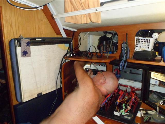
Bill had arranged for Aquila to bring over the new SSB system they had bought to check our system, which meant my sewing machine cupboard had to emptied – again.
We waited all day for Aquila to arrive and just as we were giving up hope of them coming, they arrived at 4.30. There had been a big accident on the causeway bridge causing gridlock in the area. Sylvester and Allyson had come along with Raja the SSB technician, the new SSB set and our VHF. While Sylvester started working on his laptop downloading the latest firmware for the sonar unit and configuring the new system, Raja started swapping out different parts of the SSB. Their head didn’t work on our system either so the next thing to check was the transceiver. Success, suddenly the system was working. So the new SSB set was fitted to Camomile and Aquila took away the non-working set to argue with Icom that it was faulty. We now had on board everything we had ordered, Friday the 13th turned out to be a good day.
Bill squeezing in cupboards again
Saturday Bill spent all day fitting the VHF and it’s speakers. Again wires and connectors were bigger making life difficult for poor Bill.

SSB transceiver on the left VHF on the right
The main VHF unit had to be fitted next to the SSB transceiver because it wouldn’t fit in its old place.
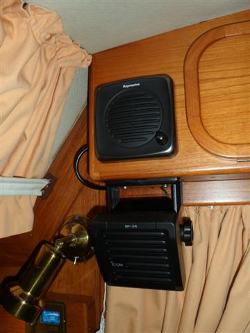
VHF speaker above the SSB speaker

All the wires neatly tucked away
The speakers for the SSB and the VHF are now together and the wires are encased in some conduit because they wouldn’t go behind the ceiling panels.
Sunday was clean up day trying to put everything back where it belonged. I scrubbed the outside decks because as there’s a building site next door the boats are all covered in dust. No photographic evidence I’m afraid!
Bill putting his tools away
Bill spent time putting his tools away including oiling his big vice.
Bill oiling his Grandpa’s big vice

All back to normal
The bikes back in place and the workshop all back to normal.
The forepeak all clear
The cupboards back in place over our bed
The new instruments all configured
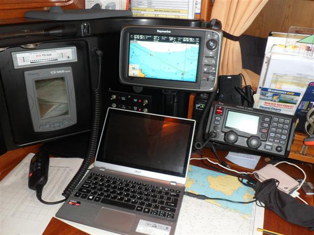
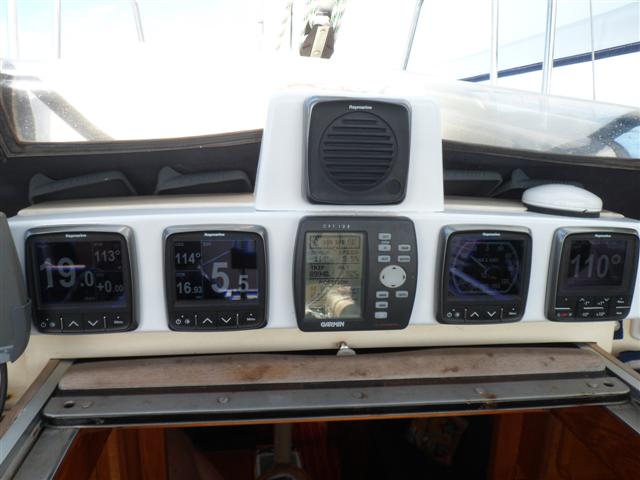
The completed navigation station
And this is the chart table, looking like nothing happened, with Bill’s new computer and the new instruments. It’s worth noting that in the middle of the instrument on the bridge head is our faithful, stand alone Garmin that survived the strike and still works. It displays our trip figure and has a very useful snails trail, which we often use, so it was refitted among the new posh instruments. It looks very old fashioned but it works.
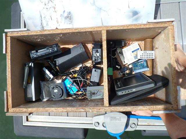
Some of the old instruments
The final use for the carrier box is storage for all the old bits which I managed to make Bill part with on the basis they don’t work!
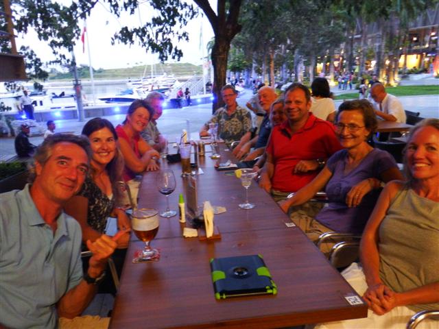
A last drink with our friends
At the end of the day we met the crews of Soltice, Hokele’a, Totem, Utopia II and Kite for a farewell drink. Soltice, Hokele’a and Kite are heading across the Indian ocean this year so we won’t see them until we get to the US some time in the future.
Jackie and I
It will be sad to say goodbye to Jackie after our gym sessions together. Utopia II and Totem went back to their boats but the rest of us had a final meal together. Tomorrow we head out of here.
Bill (Soltice), Jackie, Sue, Jack, Jake, Jamie, Bill, Behan and Zdenka
