Category Archives: sailing adventure
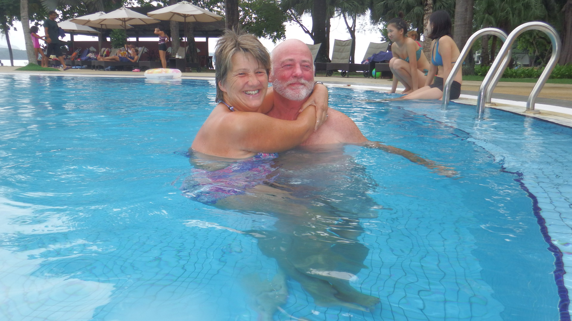
Our first week back in the Seychelles
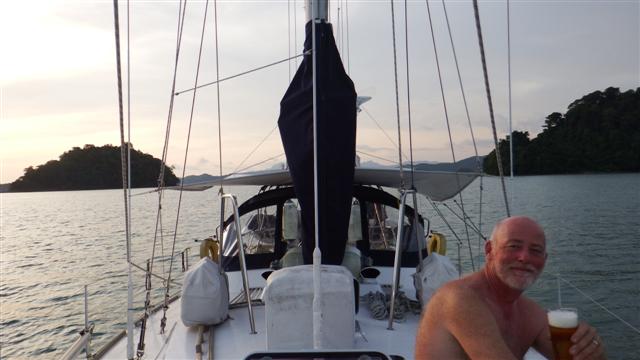
We arrived back on Camomile Saturday 9th July after a wonderful 3 weeks in the UK. As usual we hit the ground running and I spent the first day unpacking, putting away my nicely washed and ironed clothes, disentangling Bill’s bits from all 4 bags and repacking winter clothes back in the bags so they could go back under the bed.
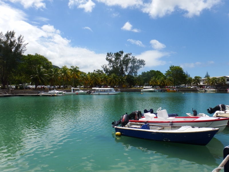
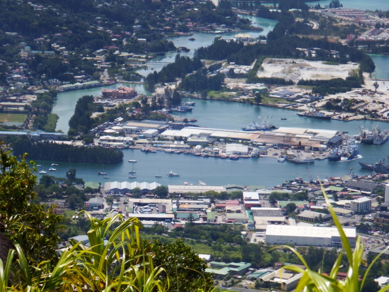
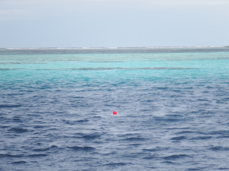
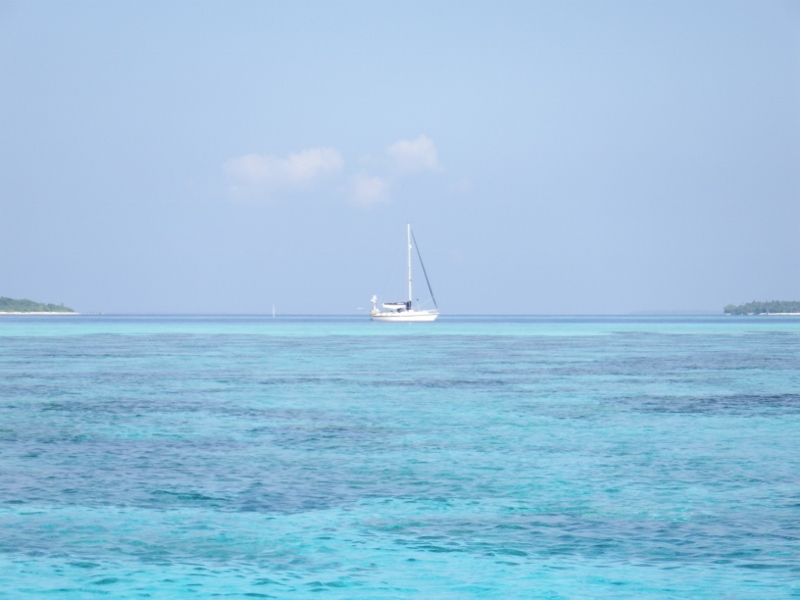
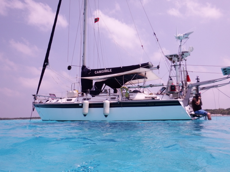
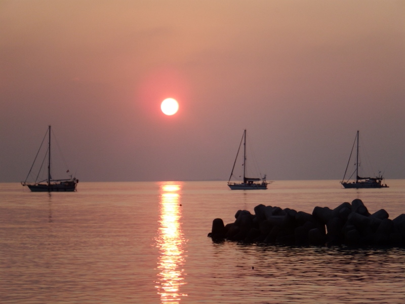
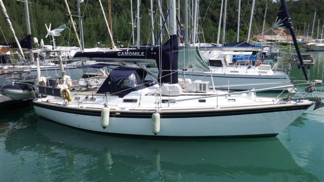
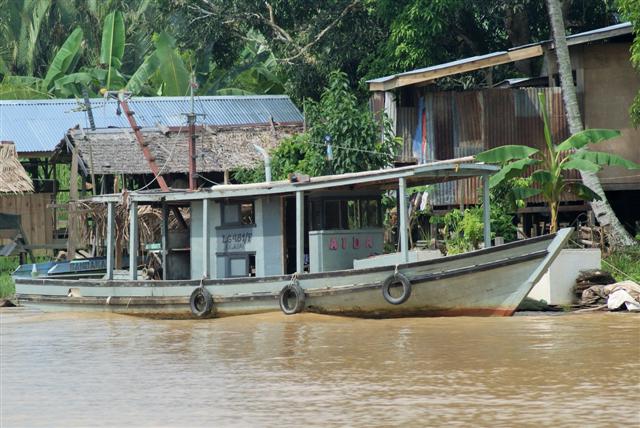
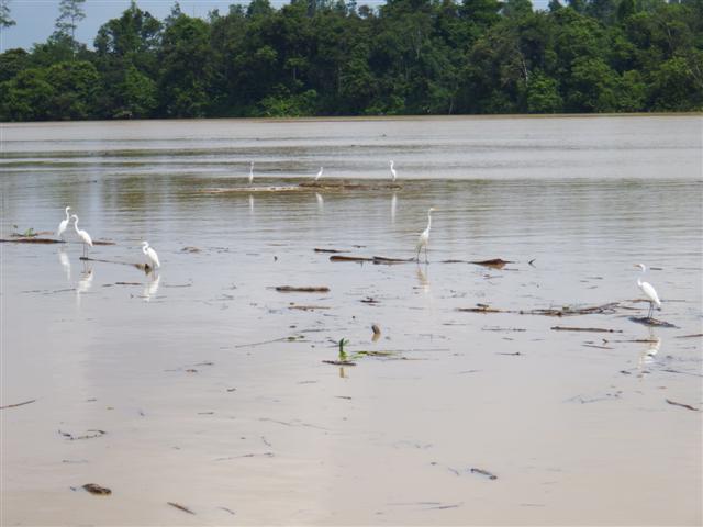
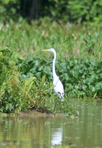
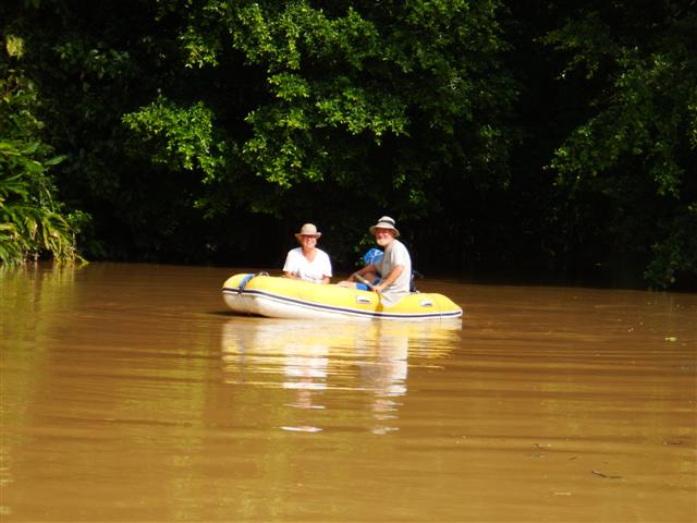
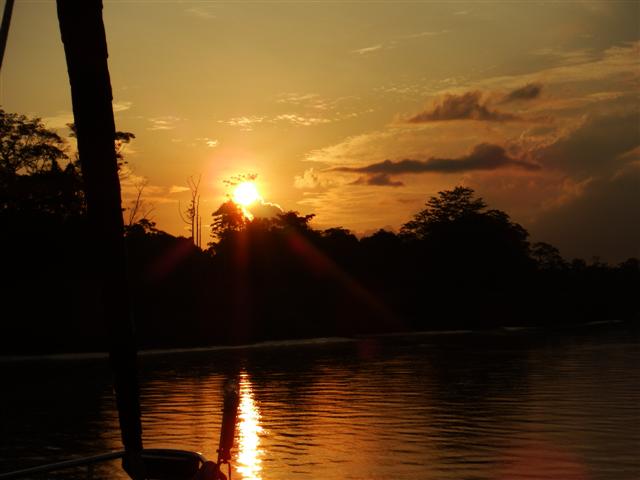
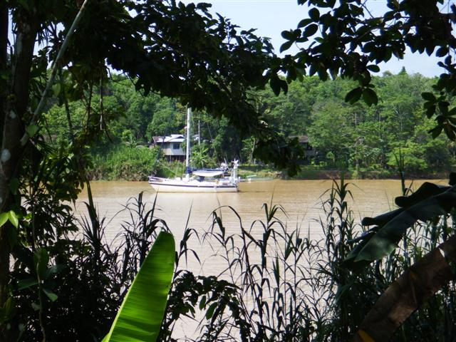
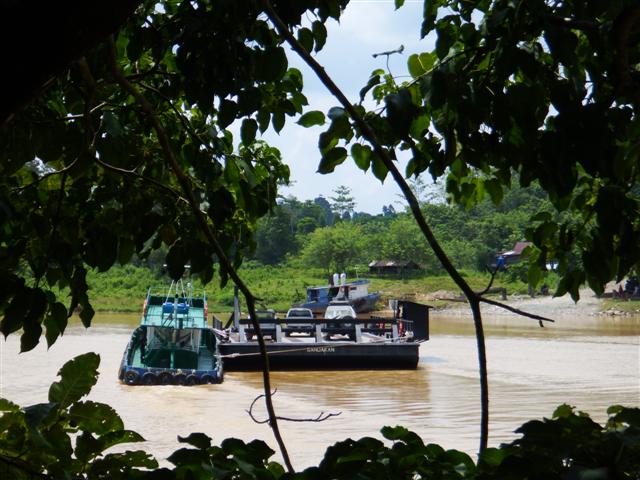
Camomile out in the bay
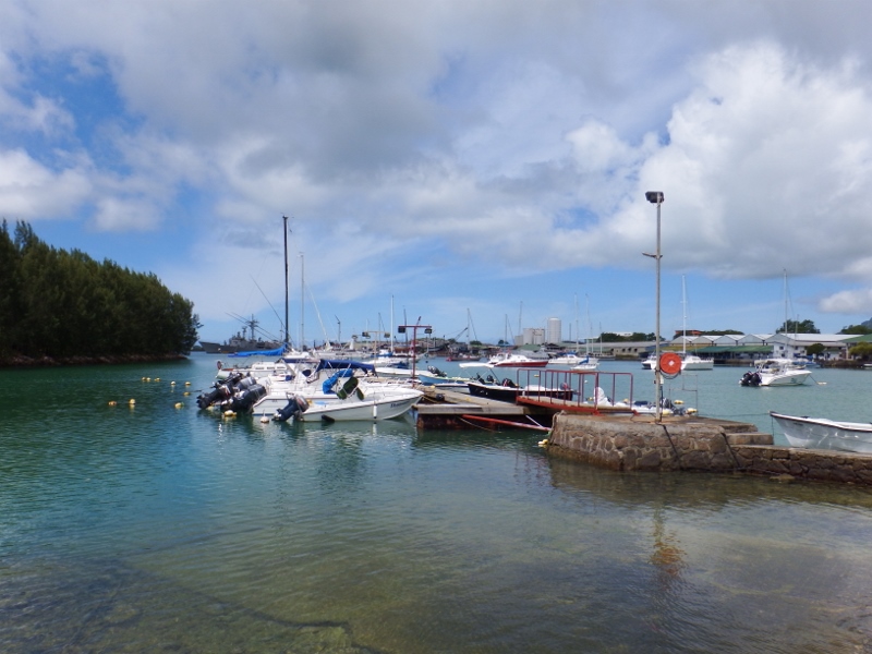
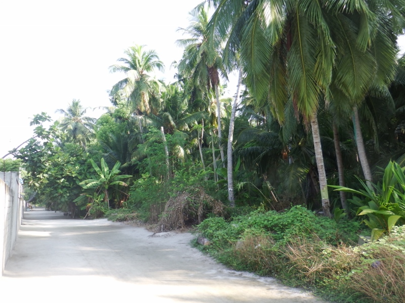
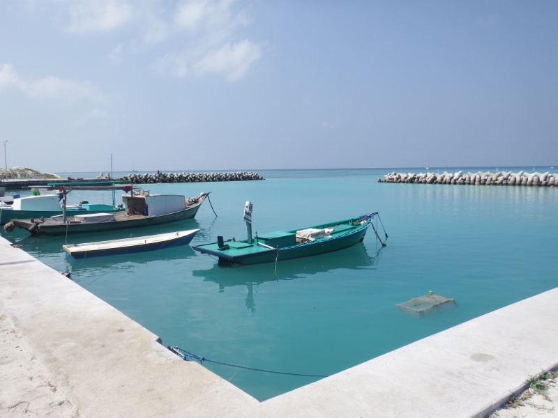
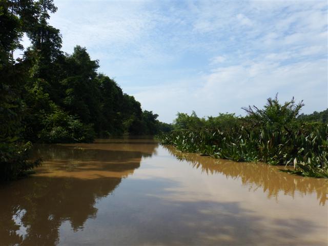
Sunday we started cleaning because the marina is under the flight path and the deck was covered in fuel particles from the plane’s engines. Unusually I also had mildew growing in some areas of the boat which, in all our time in the tropics, we haven’t had before. We then moved Camomile out of the expensive marina to Victoria bay which is right by the town. There are a number of buoys there and we picked one up at
04˚37.51S
055˚27.48E
They don’t cost anything but you need to ask the locals if it belongs to anyone or you could find yourself being asked to move. Anchoring isn’t very good here although we managed to get our anchor to stick on the first night.
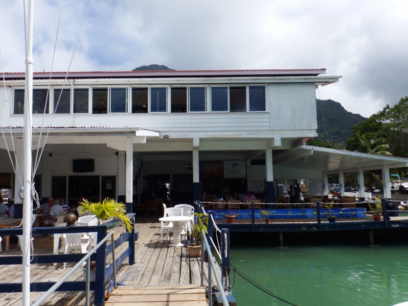
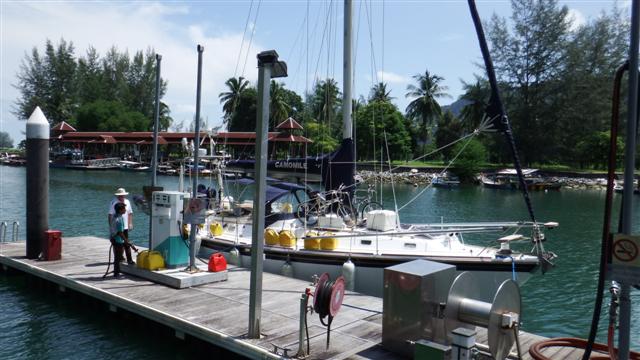
The Seychelles yacht club
Monday morning we went ashore to join the yacht club. For 125rupees (about £7) for the week you can use the (hot!) shower, dump your rubbish, use their water to fill water jugs or do washing and leave your dinghy safely on their pontoon, good value really. The next job was shopping because there wasn’t anything on the boat to eat after our time in Chagos and the UK and its very expensive eating out here, although the YC does some reasonably priced meals. The big supermarket is a 10 minute walk out of town so with a trolley each we went to stock up.
Overlooking the park
Tuesday I decided to restart my joggy trots. I haven’t been able to run for months because I’ve had a ‘planters’ heal which was very painful although it’s finally stopped hurting but mainly because it’s been too hot. There’s a little park overlooking the boats so I did a couple of circuits of that. We spent the rest of the day on board because we’ve both developed colds, probably from the plane, and Bill’s is developing into man flu with an infected eye and ear. That evening Jacqui and Kevin of Tintin moored next to us invited us on board for drinks to welcome us back. It was nice to relax and chat for a few hours.
Wednesday we played tourist for the day and did the walking tour around Victoria. It was founded on this spot by the French in 1778 and called L’Etablissement because of its excellent natural harbour with shelter provided by St Anne and neighbouring islands. After the British captured the Seychelles in 1812 the little capital was given its English name in 1841 in honour of Queen Victoria. Many of the population today is trilingual with French being the main language but English and Creole is widely spoken too.
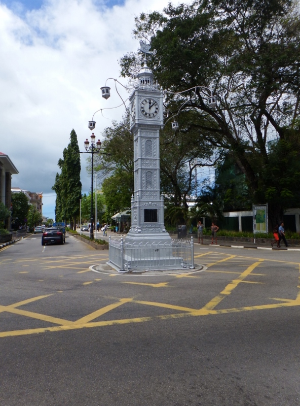
The clock tower
The clock tower in the centre is the very symbol of Victoria. It was erected as a memorial to Queen Victoria who died in 1901 but it took until 1903 to reach the Seychelles. The clock arrived in kit form and, in a mishap during unloading, the pendulum was dropped over the side of the ship. Despite a makeshift substitute being made locally the chime was disabled.

Kenwyn house
Most of Victoria east of the clock tower has been built on reclaimed land. We walked down Francis Rachel street which was once the waterfront and many of the old buildings still survive here. One such building is Kenwyn house. It is one of the best preserved 19th century buildings in Victoria. Apart from the architecture of the building itself it contains some beautiful art work from local artists. There were several pieces Bill and I liked but the price tags were way beyond our budget. This lovely little fountain was in the garden.

Pretty fountain
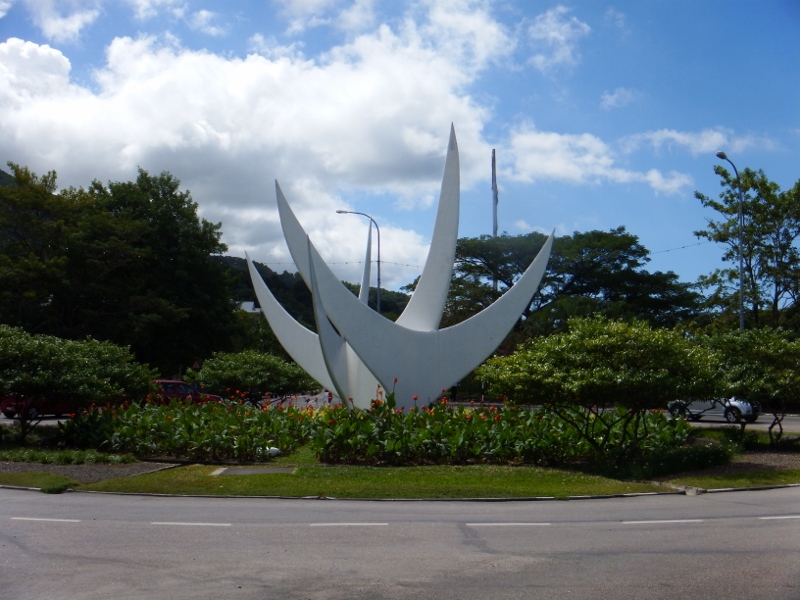
The Trwa Zwazo monument
The Seychelles gained independence from the British in 1976 and the road built on reclaimed land leading from the clock tower is named Independence avenue. At the end of the road is a roundabout with the Bicentennial Monument known as Trwa Zwazo (three birds) erected in 1978 to celebrate 200 years of human settlement in Seychelles. Each ‘bird’ represents one of the continents in the blood of the Seychellois: Europe, Africa and Asia. Do they look like birds?
Back to the clock tower again and a walk north on Albert street, also part of the original sea front, to find this very colourful building on the corner of Market street.
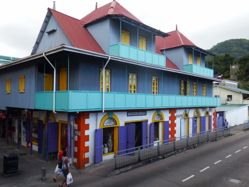
Colourful buildings
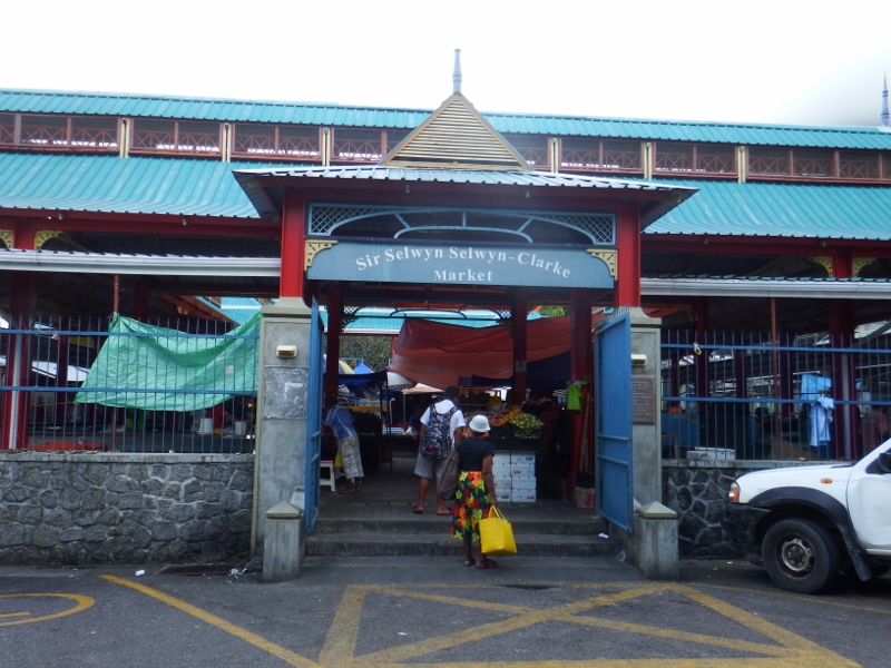
Sir Selwyn Selwyn-Clarke market
Market street, part of the old town and pedestrianised, leads to the Sir Selwyn Selwyn-Clarke market named in honour of a former governor. We had a quick look around but weren’t shopping today.
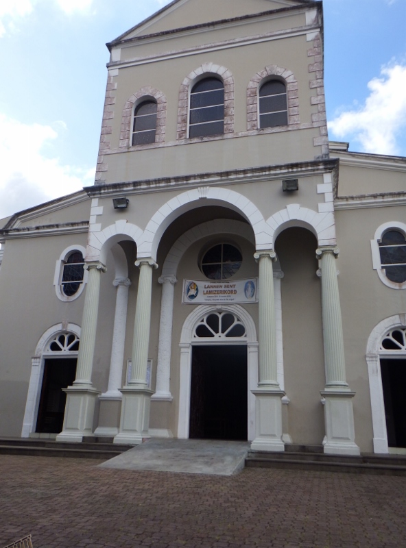
Cathedral of the Immaculate Conception
Church street leads from Market street to the roman catholic cathedral named Cathedral of the Immaculate Conception. Little remains of the original building dating from 1874, having been rebuilt in granite is 1933.
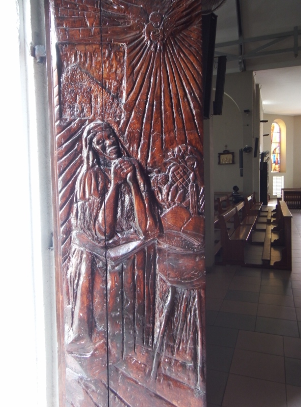
One of the original doors
One of the original doors has been fitted to a side entrance.
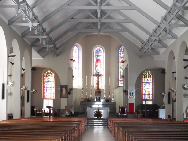
The inside was striking
I love old churches and this one was beautifully kept. The stain glassed windows were striking. It was wonderfully cool inside.
Part of the original clock tower was set on the hill behind the cathedral.
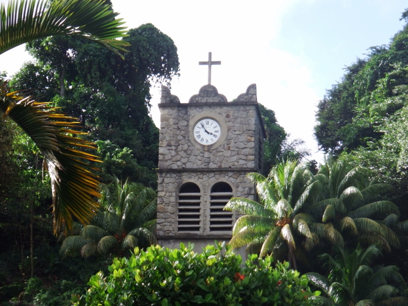
The old bell tower
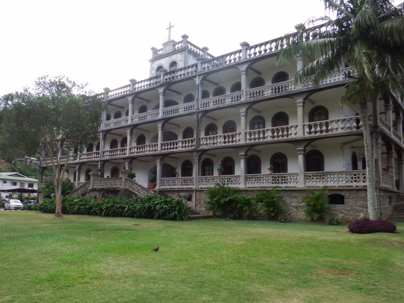
Capuchin house
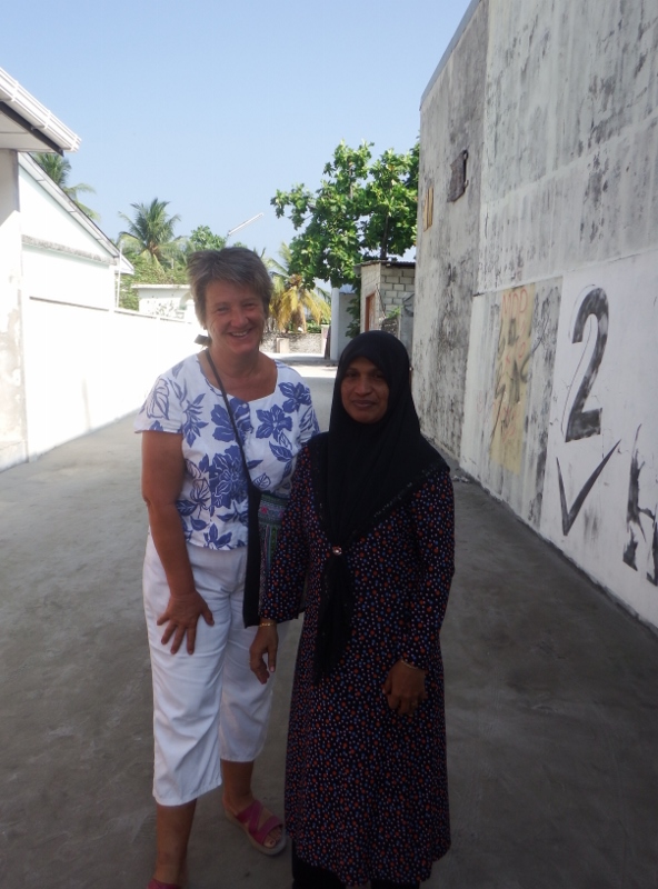
One of Victoria’s most impressive buildings, the Catholic priests’ Residence, Capuchin House stands beside the cathedral. That was the end of the walk but on the other side of the cathedral is an orphanage and these dear little ones were sitting outside the cathedral with their house mother. Their ages range from 18 months to 3 years, I just wanted to take them all home they were adorable.

The church orphans
The view from the Mission
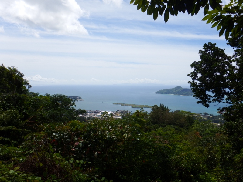
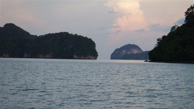
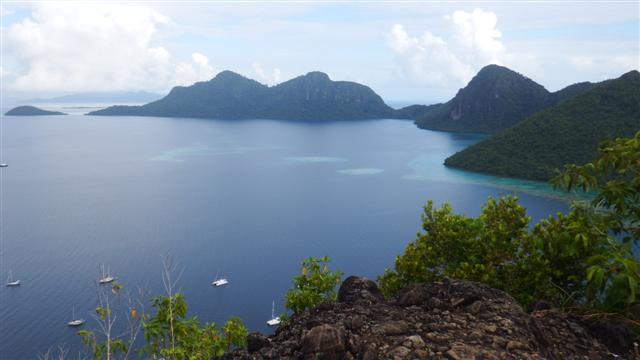
On Thursday we had another tourist day with Tintin and got on a bus. Public transport is very reasonable here. It costs 5 rupees (about 30p) a ride whether you go one stop or all around the island. We headed out of town on the Bel Air road passing the oldest cemetery in the Seychelles. Here lie some of the pioneers of the settlement of Seychelles. Leading onto the Sans Souci road it twists and turns upward. We got off by the Mission historical ruins to visit the viewpoint erected for the state visit of Queen Elizabeth II in 1972 on her tour of the Commonwealth Nations. Often there are misty clouds shrouding the mountain tops but today we were lucky and had a good view out across the islands, although the trees have grown a bit in 44 years.
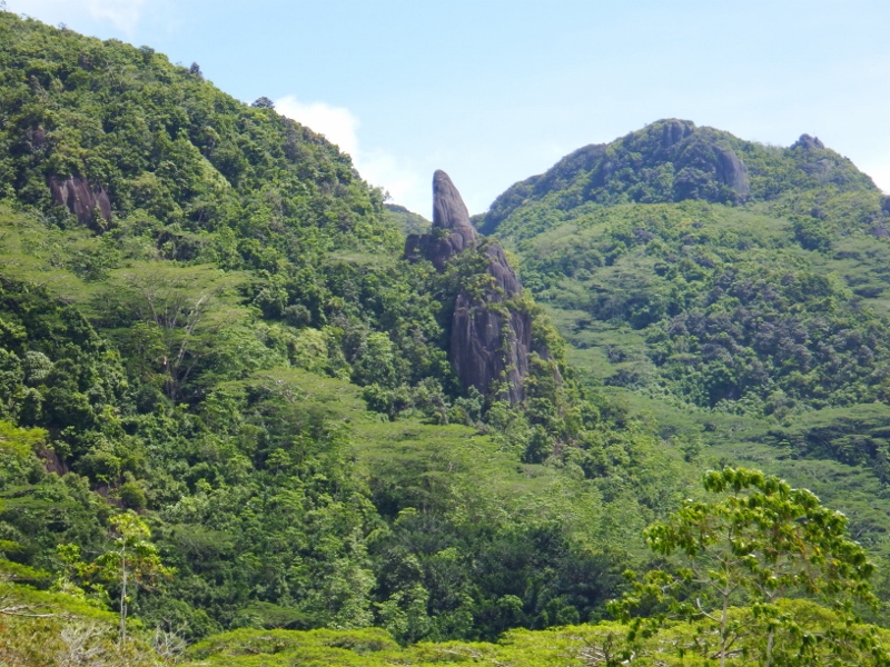
Stunning scenery
We all walked back down the road to the Copolia walk which took us about half an hour. The scenery was stunning as we walked passed endemic palms, trees and screwpines. The traffic was very infrequent so it was a pleasant walk.
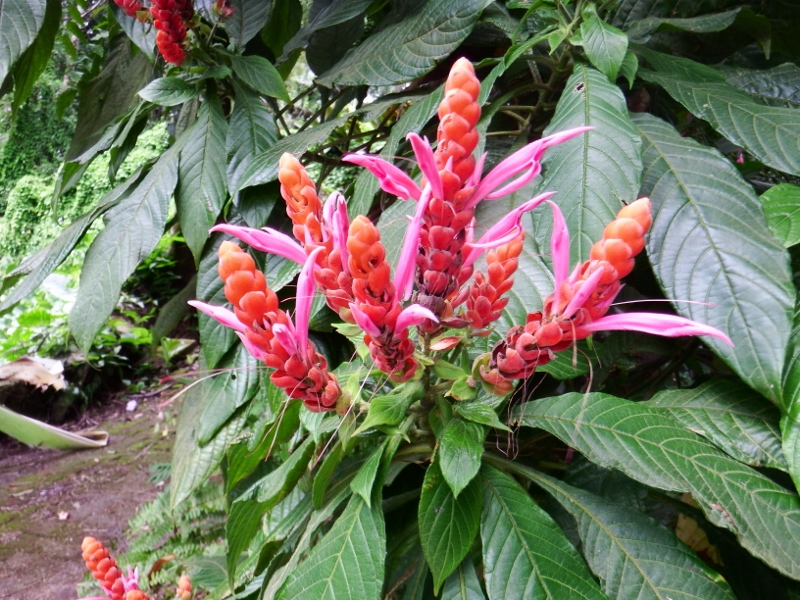
Beautiful flowers
The Copolia is only about a mile in length but is uphill using tree roots as steps along with steps cut out of the granite. There were many wild flowers growing along the way, not unlike Scotland although about 20C warmer!
We were told it was a 45 minute walk but it took us a good hour and a half but we finally made it to the top and what a stunning view.
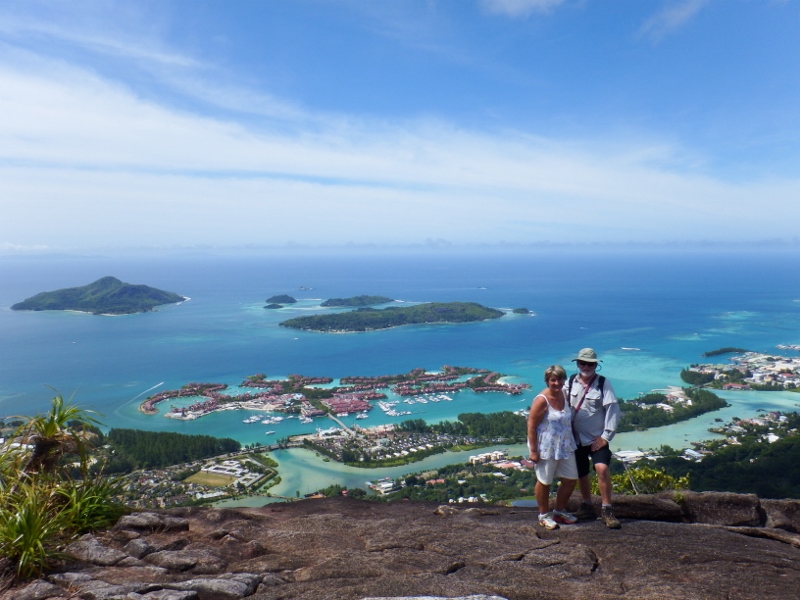
View from the top

Nepenthes
One of the reasons to come to the top, apart from the view, was to see the Nepenthes genus of pitcher plants. Of 70 species in total all but two are in south east Asia. The exceptions are in Seychelles and Madagascar. They were quite small and grew in clumps on top of the mountain.
As we looked down to the north we could see Camomile and Tintin in the harbour.
Looking down on Camomile
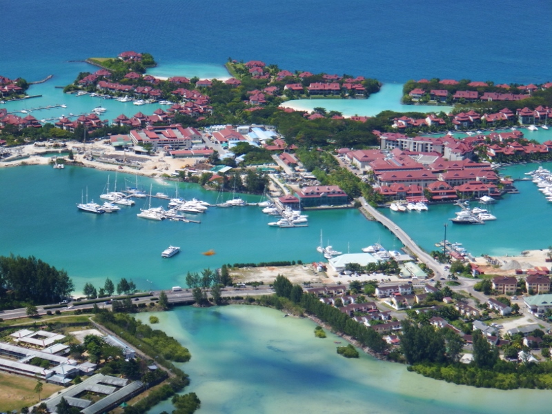
Eden marina
In front of us to the east was Eden island with Norsa sitting in the marina.
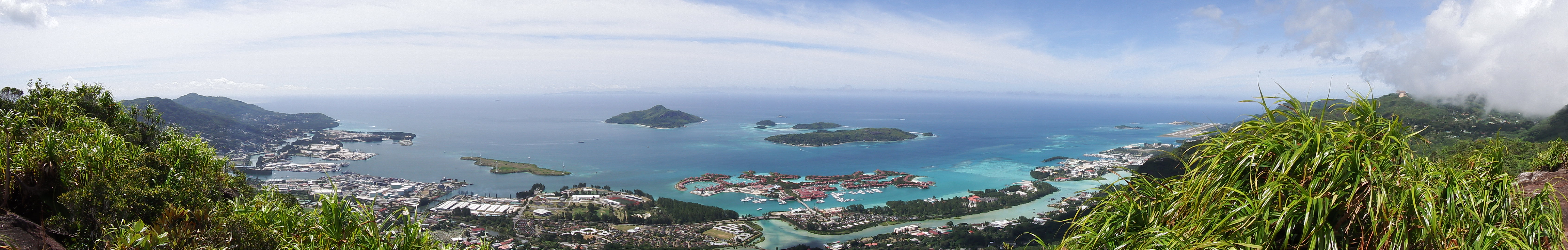
In this panoramic shot the airport is off to the south (right of the photo) and the islands of the St Anne national marine park beyond the marina.
The east coast of Mahe island
The hilltop we were standing on
That was where we headed the following week and took this photo. The peak we were standing on is in the middle of the photo.
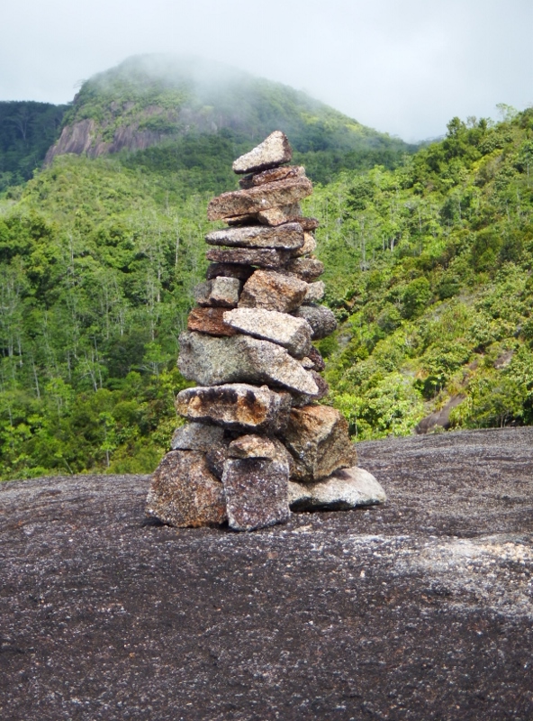
A poignant cairn
My final photo taken on the mountain is of one of the many cairns that have been built in memory of loved ones. The walk back down wasn’t as difficult but still took us nearly an hour.
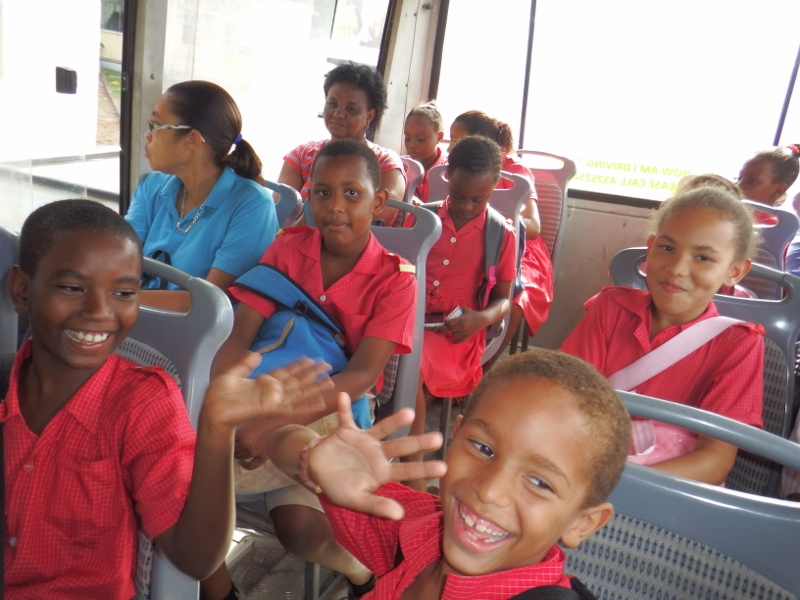
School children on the bus
Unfortunately the bus stop was another 20 minutes down the road so we had to walk to that before our poor feet and knees had a rest. These dear little school children joined us on the journey back down the hill.
We spent the rest of the week trying to shake off our colds.
Camomile loses one of her 9 lives

The sun canopy came apart at the seam
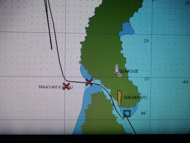
Our nightmare started as a bad dream. We arrived at the entrance to Maavah Kandu at midday after a 4 hour sail from Veymandhoo to find squalls on our path. One of the things essential for entering passes is good light to see the reefs either side. So we hovered for an hour to allow them to pass. This was the time the sun canopy chose to come apart at the seam literally. We shouldn’t have had it up but it was rolled away as quickly as we could. Unfortunately some more squalls were advancing from behind us so we just had to go in. The entrance to the pass is at 01 54.85N 073 14.62E. It’s an easy entrance with a big beacon marking it and the reef could be seen clearly on both sides, even in the bad light.
The outer reef
We made our way inside. The first thing we saw were 6 big local fishing boats, always a good sign if the local boats are sheltering in an anchorage. We motored south passed the village to the reef on the western side of the atoll. The wind was blowing strongly from the west but it was calm inside. We had a waypoint from a yacht that came through here last year. We went to it but it was in 30 metres. We motored towards the reef and dropped the anchor on a sandy reef shelf in 10 metres and fell back. The anchor pulled out. We made a second attempt this time going closer and dropped the anchor in 5 metres and fell back into 15 meters. This is NOT the way we like to anchor but we had no choice, we couldn’t go back outside and the light wasn’t good enough to travel through the atoll to see what we could find. This time it held well but Bill put out all of our 60 metre chain to allow for the sloped drop off.

Bill checking out the reef
We could see coral heads dotted around the sandy reef top and Bill took the dinghy over to have a closer look. The nearest was in our swinging area and only had about a metre clearance, we draw 2 metres. We worked out that even if the wind shifted due north in a squall we would still have a comfortable margin of safety. The alternative seemed to be motoring in circles all night. Mistake no 1, we should have moved but the anchor was holding this time so we stayed.
Our anchorage was
01 52.609N
073 15.139E
All was well the wind was dropping. Bill had the clever idea of marking the reef so we could keep an eye on it in the dark and took an orange buoy with some reflective tape tied to a bit of fishing line with a bit of chain on the bottom, over to it. We had the depth alarm set at 3 metres and the drag alarm set at 0.02nm.
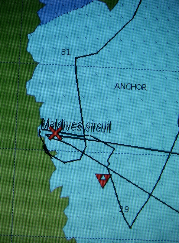
Our anchorage. Our position by the cross. The triangle is boat waypoint from last year
We settled in for the night and ate our dinner. Things started going wrong at about 9 ish. The wind started swinging around to the NW and it started raining. When shining a torch on the buoy we could see we had got closer to it. Within half an hour the depth alarm started going off because the wind had picked up and was now coming from the north. We decided to put a stern anchor out on our starboard side to pull us away from the reef. It took a while but we managed it in the dark. Bill took the dinghy round to the port side to push us off while I winched the anchor warp in. We were back in 5 metres, not good but not bad. Then the bad started. The wind veered round to the NE and picked up to 20 to 25 kts. The bad dream was turning into a nightmare. With the position the boat was now in that meant it was blowing onto our starboard beam and we were pinned onto the sand shelf with the reef a few meters away with 2 or less metres under our keel. The depth alarm kept going off so I turned it off because it was very distracting, I also turned the drag alarm off because we weren’t dragging. We waited about 20 minutes to see if it was going to drop but it didn’t. The wind was now blowing 27kts solidly from the NE and the sea was swiftly getting into a serious chop which bashed the starboard side of the boat making it jiggle which stressed both the anchors to the point that if it continued they were likely to let go. Bill was looking worried – not a good sign on our boat. We tried to decide what to do. Bill said ‘I’m prepared to lose the stern anchor but I’m not prepared to lose the boat’. We had to act quickly. A buoy was tied to the stern anchor. Bill started the engine although, as we were pinned to the sand shelf by the ever increasing wind, it was of little use unless we could move sideways and we don’t have bow thrusters. An additional problem was because all the chain was out of the locker I was needed in the forward cabin to poke it down otherwise it would jam and that was the last thing we needed. The plan was I would drop the stern anchor and quickly run inside while Bill started taking up the anchor chain (he has a remote control in the cockpit). During all this the anchor hadn’t budged, we weren’t dragged, Bill intended to motor forward toward the anchor as the chain was being raised, allowing Camomile to drift further onto the sand shelf in front of the coral head. With the chain two thirds in we would then stop raising it before it took us too far over the reef and power hard forward right using our starboard propwash to perform a tight turn and drag the rest of the chain and the anchor off the shelf and into deeper water away from the reef where we could continue raising it. It was dark, it was raining and it was risky because we didn’t know how shallow the sand shelf was or if there were any more bommies further forward, but we had no choice. With the wind increasing we needed to act quickly or Camomile would be lost. So with adrenalin pumping that’s what we did. The stern anchor fell away quickly and Bill started immediately to lift the anchor, I ran through the boat to start the job of poking down the chain, AARRGG the chain jammed half way up because it was straining so badly. If the fuse blew at this point it would be game over! Bill was pushing the up button, then the down, then the up, I was yanking it from below and managed to free it. Camomile swung into less than half a metre under her keel but thankfully there weren’t any bommies there and she motored forward dragging the anchor off the shelf with her and the rest of the chain was brought up. Phew. We did it! High fives all round. I was shaking like a leaf.
We were in deep water but the problem wasn’t over, what do we do now? We both thought of going back out the way we came in but the wind was now a steady 27 kts coming right into the entrance. We could hear the waves crashing onto the reef on the other side. To go out would be madness, we weren’t ready for a deep sea trip. The next atoll was an overnighter. We also still had the dinghy down which was thrashing around dangerously on the stern. We motored out into 50 metres fairly sure there weren’t any reefs in the area so we could lift the dinghy onto the davits. It was too rough for Bill to do it his usual way of getting in the dinghy, attaching the davit wires while I winch them up. He managed to get the stern wire on while I held the bow in with the painter, and start lifting it. Then while kneeling on the bathing platform he managed to get the forward wire on and lifted that up too. Then we both winched one end each once it was out of the water. During this whole operation it was still raining we were both soaked and, for the first time for months, feeling cold.

Our night track
All of this had taken about 2 hours and it was now 11pm. Bill decided to motor slowly up wind in an area we knew to be free from reefs having checked Navionics, google earth and Bing, which took about an hour. Then the engine was turned off and we hove to under bare poles gently drifting back through the deep water at just over 1 knot. The boat was stable in the local chop and still being inside the reef there was no swell. We drifted 4 miles in a line we knew to be safe then turned round and did it again. It was our only option there was no where else to anchor that was not a reef or 40 meters deep. We took it in turns to cat nap but neither of us could sleep properly. Ironically the wind had started dropping and gone back round to the west but we made the right call. If we’d stayed there we would have lost the boat.
The little red buoy with the fateful reef behind it

Bringing the anchor warp back on board
At daybreak we motored back to our anchoring spot to see if we could recover the stern anchor. Amazingly it was still attached to the red buoy and we managed to lift it back on board on the windlass.
Hurray here comes the anchor

The last missing part
The final event was as we were motoring out of the area we noticed an orange buoy in the water with reflective tape wrapped round it, there was the float that Bill had marked the reef with that had floated away! I picked it up with the boat hook.
So everything present and correct. Another one of Camomiles nine lives used up.
Thiladhunmathee Atoll

One of the batches of overwater bungalows
Wednesday 9th March we weighed anchor and left our beautiful island passing the Waldorf Astoria resort on our way out of the Ihavandhippolhu atoll and heading in a southerly direction from now on. They had certainly made good use of the mother island. There were over water bungalows coming out of the north and south sides of the island and jetties coming out of the east and west, it probably depends on the weather on how they land their clients or there’s always the bright red sea plane that was sitting there waiting for passengers. How the other half live!
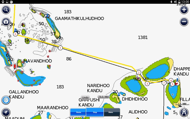
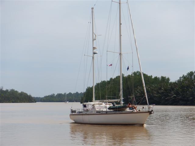
Our passage across to Thiladhunmathee atoll
We sailed, or motored, back into the deep water and on towards the Thiladhumathee Atoll. The numbers on the chart are depth of water in metres. Once we go over the edge our depth gauge won’t pick up depths much more than 150 metres and just flashes in a ‘computer says no’ sort of way. Coming back into the next atoll is a bit unnerving but the reefs are quite clearly visible as we approach. The straight black lines are our planned route and again the yellow line is the track we took.
The edge of the reef
The islands are just basically sand bars and don’t have any height so you don’t see them until you’re quite close. It would be dangerous to do a night sail around this area.
Our track in
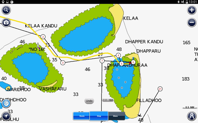
The island just above where we stayed is called Kelaa and was the northern British base during WWII.
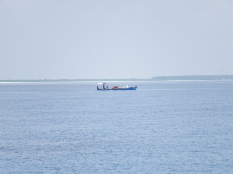
Local fishing boat
This local fishing boat had come from there. Unfortunately there’s no way in for a keel boat drawing 2 metres so we continued on to the lagoon in front of Dhapparu. Where we found Inspiration Lady and Tintin. Our position was
06 54.93N
073 13.6E in 10.8 metres sand.

Tintin and Inspiration Lady
Not sure I would recommend this anchorage because the snorkeling wasn’t very good and the beach is full of mosquitoes but Inspiration lady and Tintin had a nice visit at the village on the island of Filladhoo to the south east of the anchorage.
Our passage trough the reef
Thursday 10th we left Dhappura and headed southwest to the Rasfari reef. There was a gentle breeze from the north east so we put the twin headsails out and sailed there. So far we haven’t come across any uncharted reefs and the charted reefs are easy to see with the change in the colour of the water. Some of the islands have been a bit off set according to the radar.

Our track shows us going over the reef
This photo shows our track over the edge of the Rasfari reef, the green area is reef which means we shouldn’t cross it but you can clearly see our track takes us straight across it. I had checked it out on google earth which showed a clear passage through the reef plus we had some waypoints from other cruiser that had already visited. When we arrived I stood on the bow looking out for the deep water. The passage was narrow but there was plenty of room for us. It is a deep anchorage but we managed to find one of the few 18 metre spots there.
Looking across the reef to the nearest island.
We anchored in position
06 43.082N
072 55.422E
It was a stunning spot. We were over two miles from the nearest island but the reefs were giving us protection.
There was a reef to our port and starboard sides and a few hundred metres in front of us. So the dinghy was lowered and off we went.
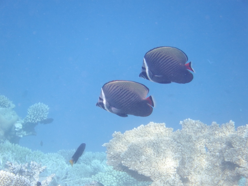
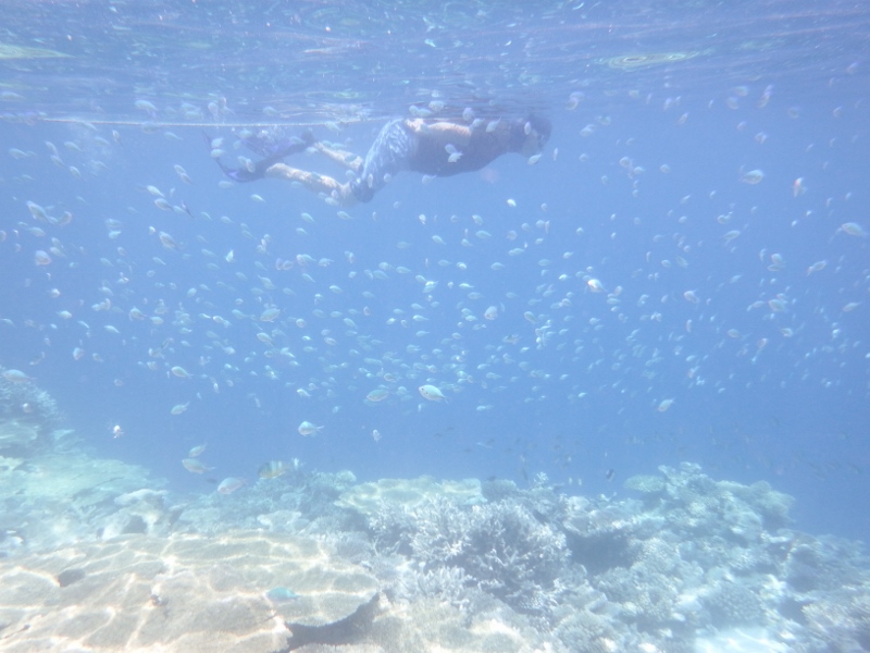
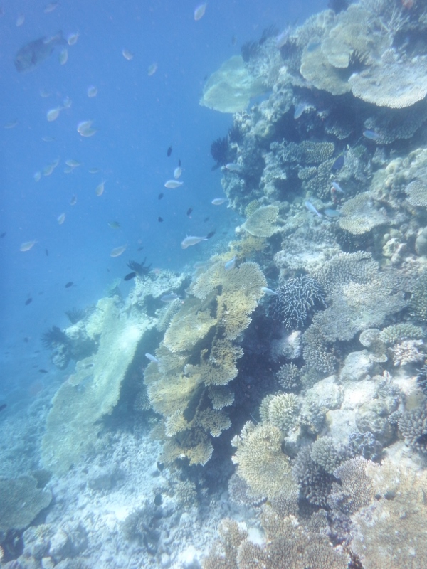
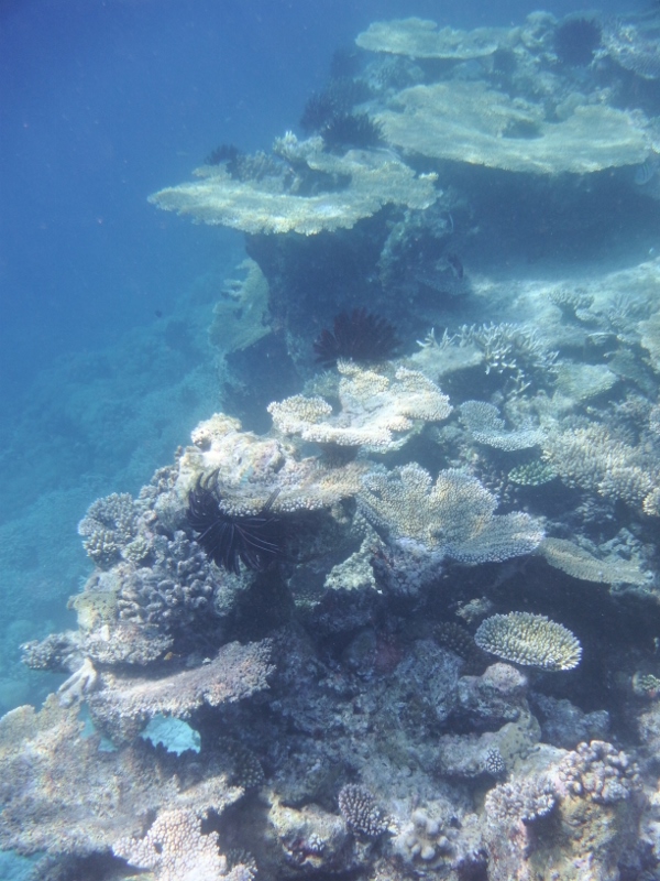
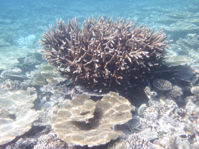
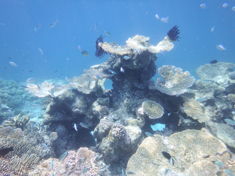
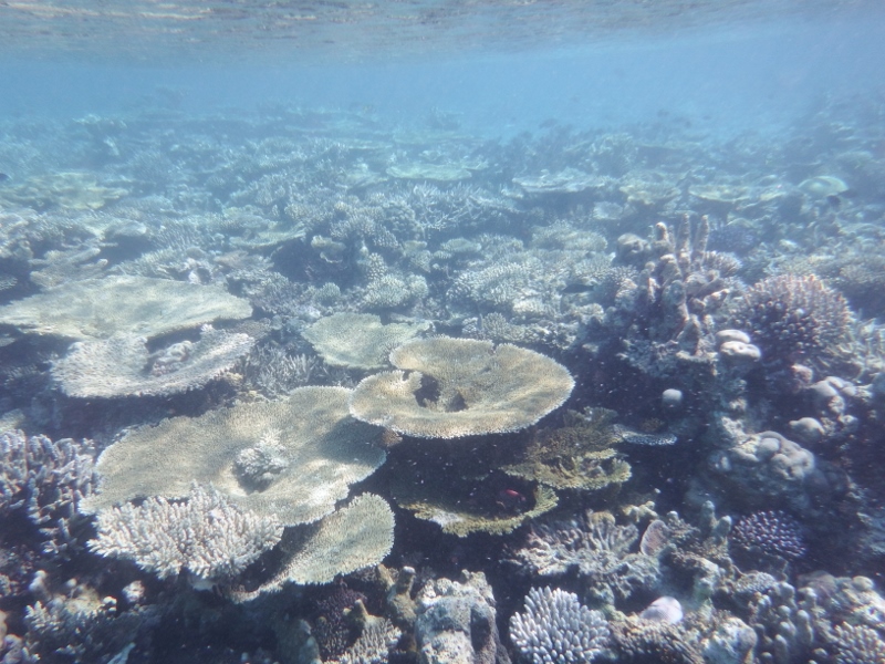
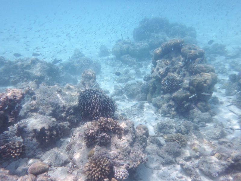
WOW the snorkeling was amazing. I have so many photos and found it difficult to choose which ones to post on here so I’m just going to post lots of them.

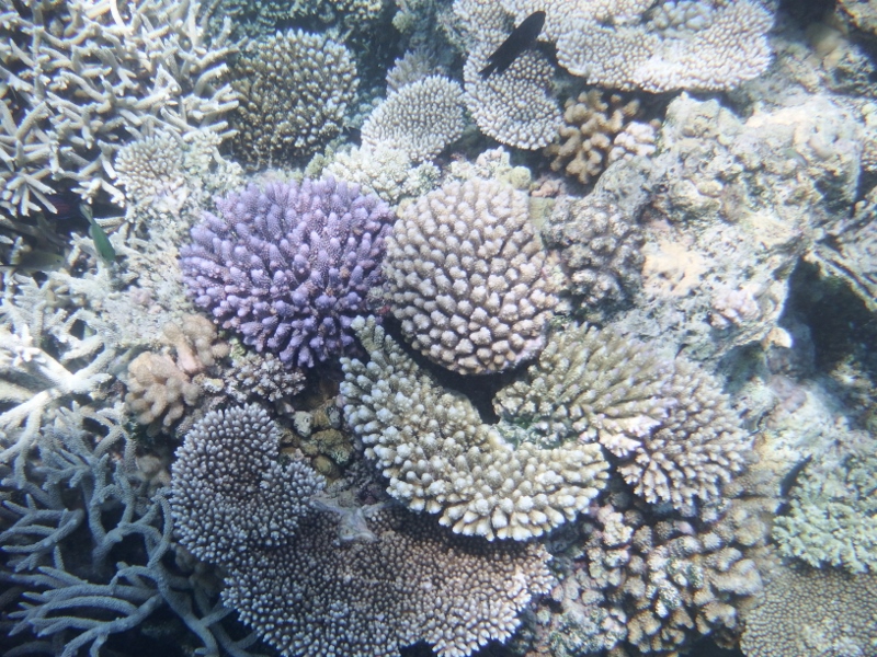
The plate coral was the best we’ve seen since Fiji
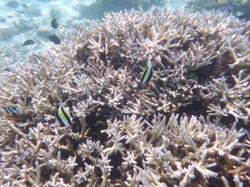
Lots of stag coral too. Can you spot the Angel fish.
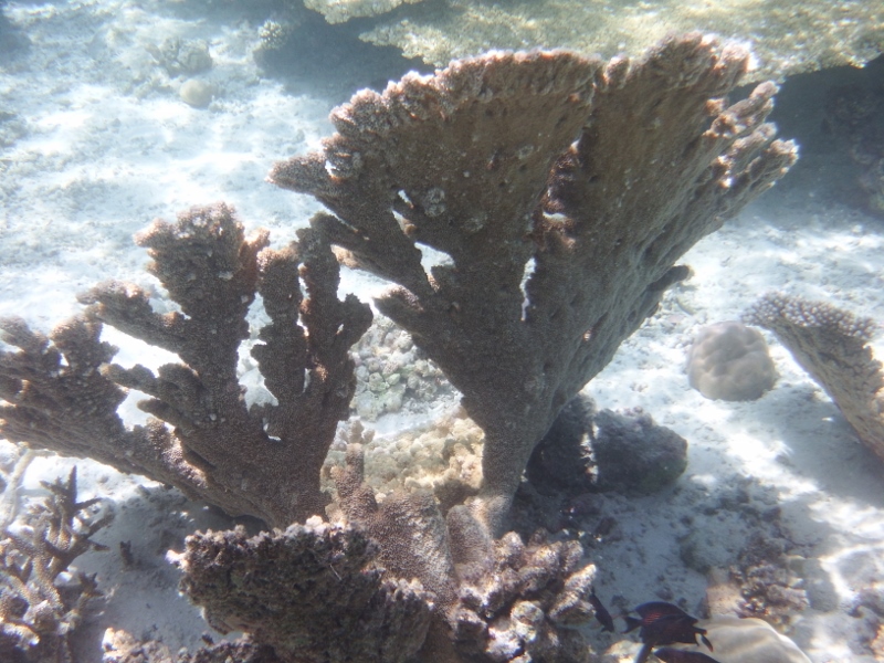
More hard coral
Beautiful coral
All of these photos were taken at the reef to the east of us.
The next day we went forward to the reef to the south and west of us and the fish life was astounding. Snorkeling along the edge of the dropoff was the best. The fish hang around waiting for the nutrients to float off the reef. So many fish.

Unicorn fish
Bat fish I think
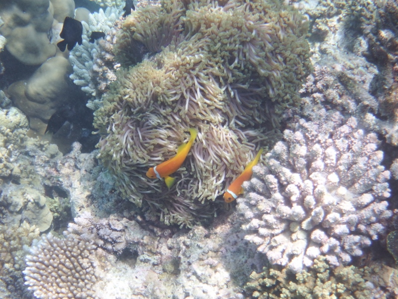
Clown fish or Nemo
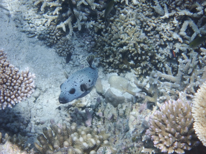
A puffer fish
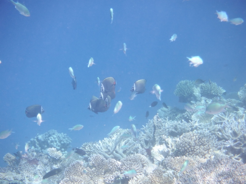
So many fish
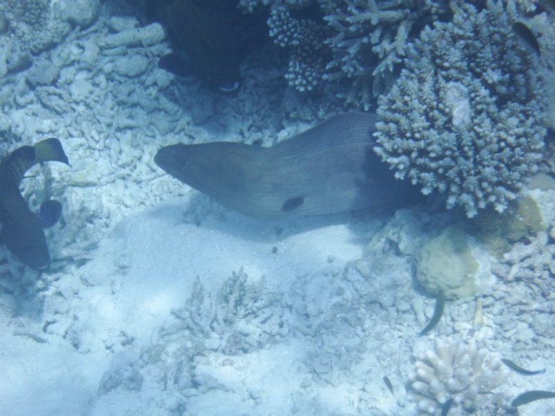
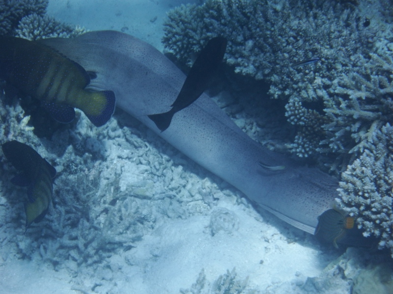
Moray eel
Then we spotted this big boy lurking under the rocks – a moray eel.
Quite lucky it see it because it blends in with rocks and it was quite a way down, about 4 or 5 metres. He came out of his hiding place and slithered under the next rock. It was a good metre and a bit long.
Moving on
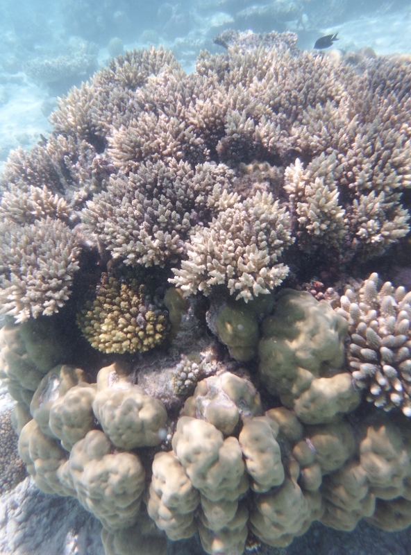
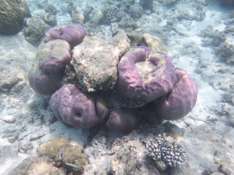
More coral
Some of the little coral heads are so pretty and colourful. This one was mauve, pink and white.
Then we spotted a big 3 metre nose to tip of tail sting ray. This wasn’t one of those tame ones you can feed in the resorts but a real wild one. A bit scary really.

A large stingray with a long tail.
Bill swimming with 100s of fish following him.
Looking at the reef from the dinghy
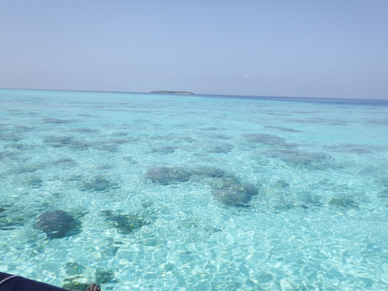
Back in the dinghy and motoring to the reef to our south. The colour of the water here is astounding The bommies were further apart in the middle of the reef. While motoring over the lagoon we could see a spot where we could have anchored in 3metres in sand but getting over the reef is the tricky bit. I think we’ll leave Camomile where she is. She’s quite happy watching us have fun.
Camomile across the reef.
Looking over the edge
For the boats coming behind us. From the anchor spot look to the south west you’ll see a red dinghy buoy which the fisherman often use with a white buoy near it (hope it hasn’t gone) when you’ve travelling in your dinghy on the west side of the reef keep those two buoys in line and head directly south. You’ll come across another buoy just before you get to the reef (it’s difficult to see) that reef in front of you is the best. An amazing drop off.
Amazing coral
When you’re swimming along the reef looking over the edge it feels like flying as you look down 10 to 20 metres into the deep blue. It’s a divers paradise.
Beautiful stag coral rising up from the plate coral
Last coral picture. Looks like a sea monster with horns.

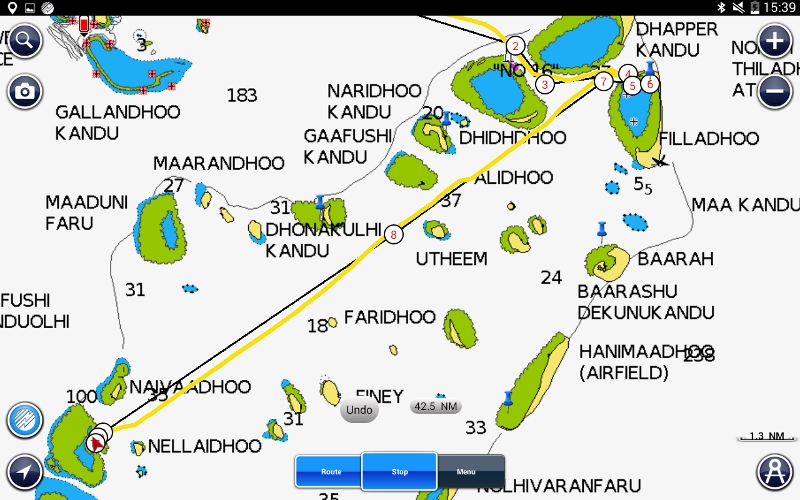
Our route to Kulhudhuffushi
Saturday 12th we left the Rasfushi reef on our way to Kulhudhuffushi where we were meeting up with Inspiration Lady and Tintin again. After an early morning start we got to the harbour at roughly the same time as Inspiration Lady. It’s possible to tie to the wharf but Bill wasn’t happy doing that so we went in and dropped our anchor. Unfortunately we were drifting too close to the shallow area by the wall. Bill tried to bring the anchor up quick but it jammed and wouldn’t go up or down. Gary was planning to go up against the wall and suggested we tie alongside them which we did so Bill was able to sort out the anchor chain. Tintin came in about an hour later and also tied to the wall.
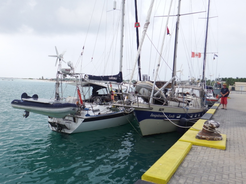
Camomile alongside Inspiration Lady
Our position
06 36.9N
073 03.9E
More coral houses here
It was only US$12 to go into the harbour which was very reasonable and saved us anchoring in the deep water outside. The town wasn’t very big but had an ATM so we were able to get some local currency. It also had some groceries stores and a couple of places to eat. It was Jackie’s birthday and we all went out to celebrate (camera left behind).
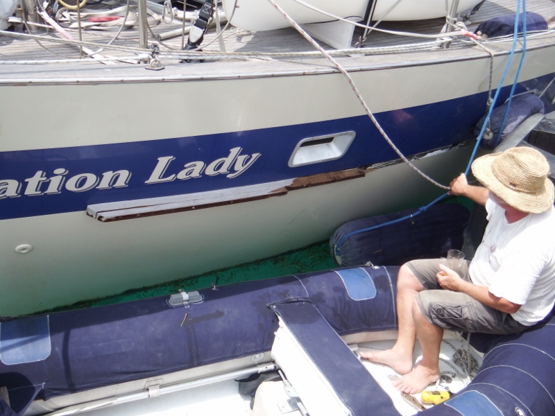
The damage to Inspiration Lady
The tide dropped overnight and unfortunately Inspiration Lady’s rub rail managed to get under the big rubber fender that is permanently attached to the wall of the wharf and as the tide was coming back up it ripped part of it off. The fenders had bounced out of the way. Poor Gary. Bill helped him remove the old wood but he has a serious repair to do.
We stayed there two nights then headed out on 14th March to continue south and into Miladhunmadulu atoll.
One last coral picture.
First impressions of Uligamu
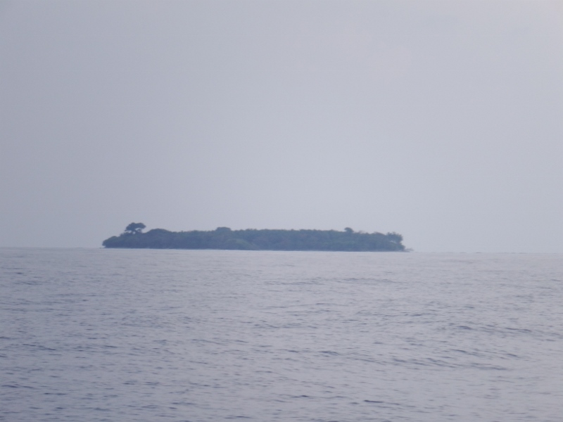
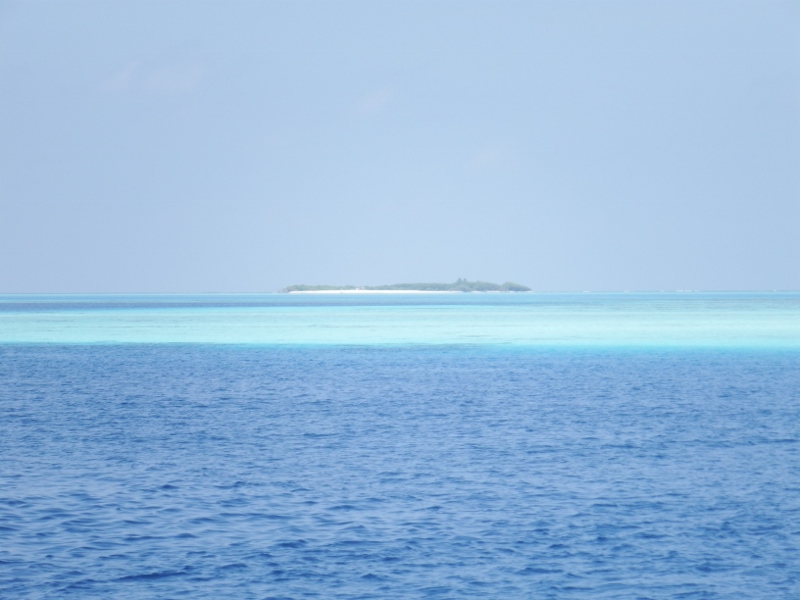
One of the first islands
Our last 24 hours at sea was motoring the wind died completely and we took the sails down. It wasn’t so bad because the water maker was on so we could have showers and clean the boat when we arrived. It was exciting seeing the first islands during the day although they are made of sand with jungle covering them and aren’t very high. Some of them have villages on them but a lot of them are uninhabited.
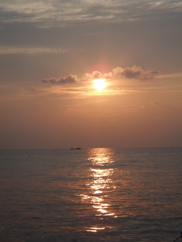
Amazing sunset
The last part of the journey saw an amazing sunset. Not so good because we wanted to be anchored before it got dark. We came into the anchorage as the sun went down. There’s a ‘shelf’ inside the reef to anchor on but as we were approaching I could see coral over the bow. It was far too late to play that game so we anchored in 18 metres further out. Bit exposed but we could move in tomorrow when it was safe with the sun overhead.

Bill raising the Maldives courtesy flag
We were anchored at
07˚ 04.71 north
072˚ 55.13 east
Our journey of 715 nautical miles had taken 5 days 8 hours giving us an average speed of 5.58 knots not bad considering we were travelling at 2 or 3 kts the first few days with the current against us. Our agent Assad brought the customs, immigration, etc out to us to check us in along with a tub of ice cream! How good is that? Check in took about half an hour then it was showers and bed. We were tired. The next day Bill raised our Maldives courtesy flag.
As the next day was Friday we stayed on the boats. The Maldives are 100% Sunni Muslim so Friday is their Sunday. The fact that they are muslims also means there’s no alcohol sold here, only very expensively in resorts!!! Now you can see why we stocked up. Assad came out to the boat to get our sims sorted for the phones and to set it up as a modem. The internet seems quite fast here so that’s a change.
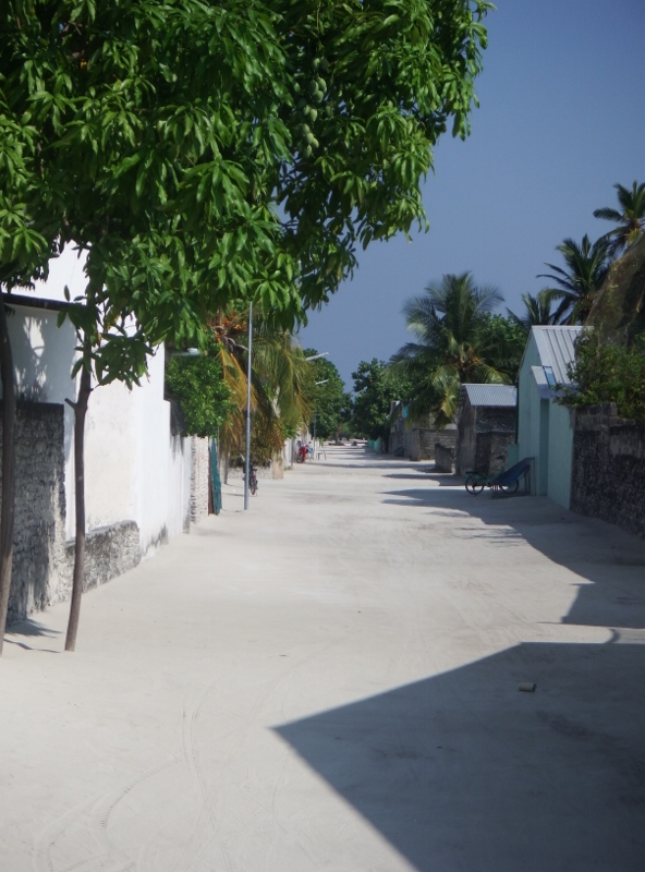
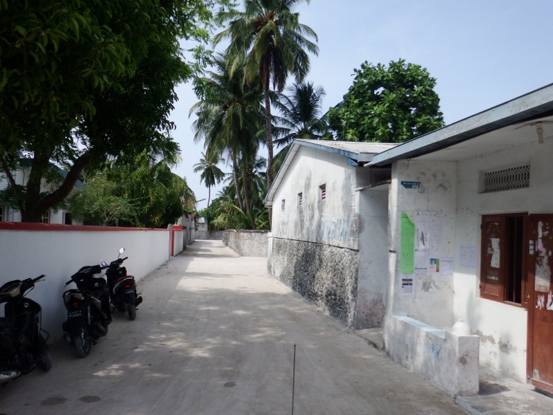
The main road
On Saturday Inspiration Lady, Tintin and Camomile crews went ashore for a tour of the little village. There are only 500 people on the island and they basically belong to one of two families. There aren’t any cars. This is the main road through the village.
This is one of the ladies of the village
Some of the villagers have lived on the island all their life.
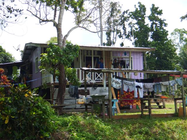
A local house
This was her house.

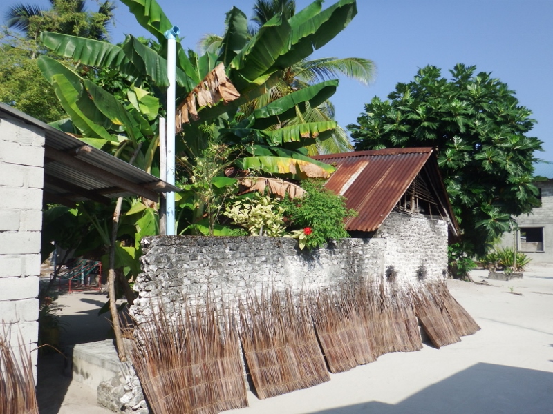
Beautiful banana tree.
The land is mostly sand so not very much grows here but they do have some wonderful trees. This banana tree was laden with fruit. Take a look at the wall, it’s made of dressed coral which means they cut it and shape it before using it to build houses and walls. It’s not allowed any more but there are still some beautiful pieces around.
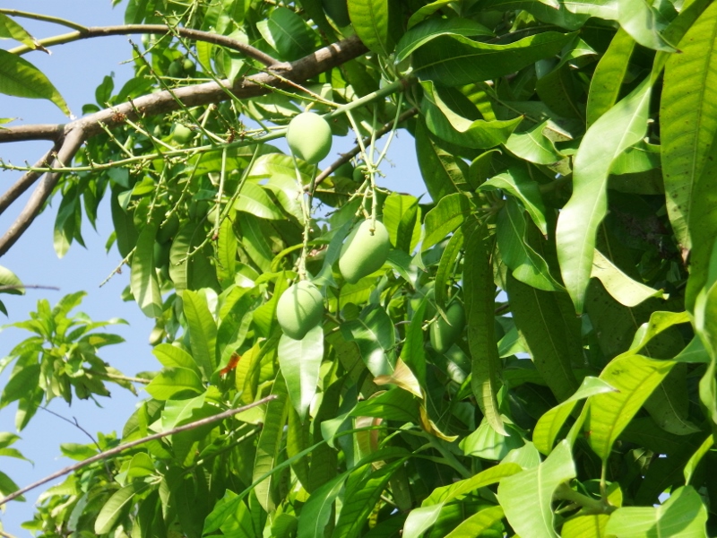
Mangos beginning to ripen.
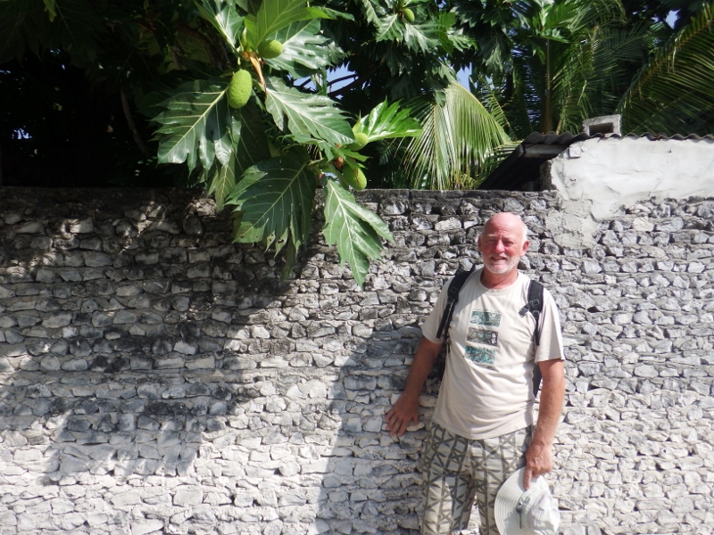
Breadfruit tree
A beautiful bread fruit tree with another lovely coral wall.

Another beautiful coral house
The end of the road
This was the end of the village. Just jungle beyond here.
Right next to the end of the road is the generator housing.
Generator housing
Pumping away 24 hours providing power for homes of the people.
Local shop
There are 2 shops on the island, this is the bigger one of the two. It seemed to have a fair sized selection of goods but very little in the way of fresh stuff. I’ve ordered some bread which is coming on the supply ship on Monday. I still have quite a lot of supplies from my Sri Lanka stock up but I could do with some lettuce and apples. Will be interesting to see what else turns up.
So sweet
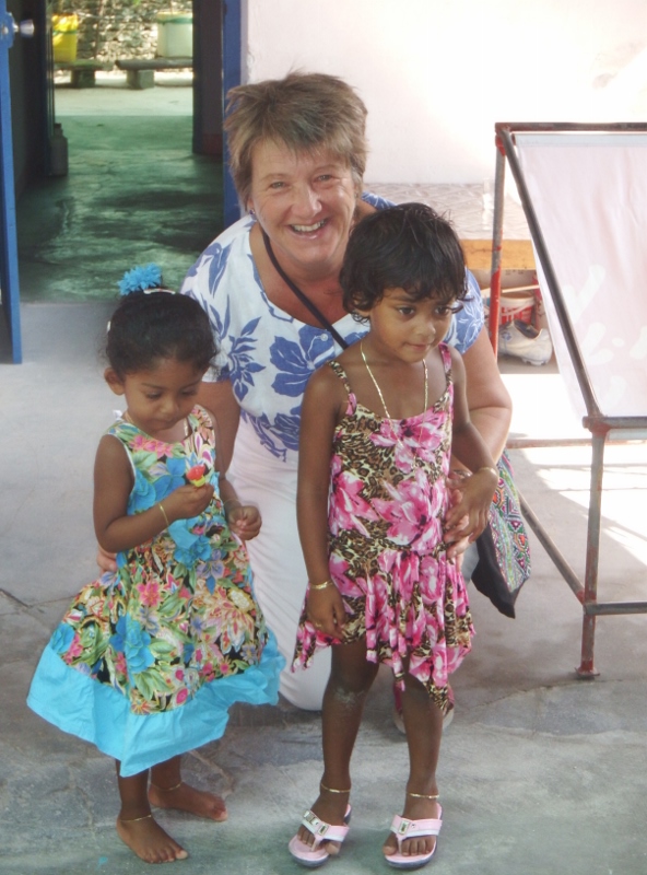
I found these adorable little girls at Assad’s house the one on the left is his daughter. They were like a pair of dolls. So sweet.

Beautiful school
Assad took us to see the village school although being Saturday no one was there. It was in very good condition but being run like the schools were 50 years ago. Ages 6,7 and 8 in one class room, 9, 10 and 11 year olds in a second classroom and a couple more classrooms for the older children. At 16 they take a Cambridge exam like a GCSE if they pass the government will pay for them to go to Mahe and at 18 they take further exams, A levels, for a place in University. There are also Btec courses for the ones who don’t pass the exam.

School playground
There isn’t much for them to do on the island and I think most of them would probably stay on in Mahe once they had finished their education. That means the island will slowly die out if the young people don’t return but we’ve seen that so much in our travels.
The village harbour
We walked back to the jetty and the dinghies. Assad invited the 6 of us to a meal at his house that evening to try some local food.
Meanwhile Bill and I still hadn’t been in the water and we’ve been here for 2 days so we headed back to Camomile. Two of the other boats had left leaving two spaces on the ‘shelf’ so Camomile and Inspiration Lady took them.
Camomile in the beautiful water
Under the water
We are now anchored in the most stunning aquamarine colour. It’s like being anchored in a swimming pool.
Our position is
07˚ 05.02N
072˚ 55.18 E
take a look on google earth.
More coral
Meanwhile in the water …..
Lots of fish
The coral near Camomile
I tried to get a photo of Camomile with the coral underneath but it didn’t quite work but close.

The keel
This is our keel under the water.
The anchor on the bottom
and the anchor in about 5 metres of water. So clear.
Bill snorkeling

Delicious meal prepared by the ladies of the village
That evening we went back ashore for our wonderful meal.
Inspiration Lady, Camomile and Tintin in the evening sunset
Phuket to Sri Lanka day 3
Position at 10.00 Saturday 30th January
0744.841N
09132.362E
24 hour run from 10.00 29th to 10.00 30th 144 miles
617 miles to go
Who asked for more wind? It certainly wasn’t me!
We continued to sail gently and slowly through the Sombrero channel yesterday in between the Nicobar islands, the squalls have cleared for now. Once through the islands we changed course for Trincomalee harbour, Sri Lanka. The GPS read 725 miles to the next waypoint. Grooooan, deep joy.
We were doing a good speed because there was a strong current pushing us along the channel but once through our speed dropped again because the islands were taking our wind. The engine went back on for an hour at 16.30 to get us clear of the islands. The day continued as we gradually got back into the routine of passage making. I ran my usual net, I do love to chatter to people. Nicone are a little bit behind us now, not sure how that happened, I must have taken a wrong reading yesterday. Tintin are about 50 miles north of us on almost on the same longitude and have also passed through the Nicobars today. Inspiration Lady are about 130 miles behind us still motor sailing as they didn’t get the nice sail at the beginning to give them the ‘push’ we had. Rise and Shine also checked in and will be leaving Phuket tomorrow.
Bill had a shock in the dark last night, a flying fish flew through the opening in the cockpit cover and landed on his foot shedding it’s scales everywhere, poor thing. It made him jump out of his skin, which I found very amusing. I handed him a plate and he lifted it up and threw it back in the sea then had to get in the shower and wash the smelly scales off his feet.
After Bill had gone to bed I noticed we had more wind. Without the moon (which doesn’t come out until about 11pm at the moment)it’s difficult to see any thing so I put the radar back on. To my horror there was a huge squall rapidly approaching us and the wind was building fast. I got Bill back out of bed because we had full sails up but it was too late to reef down as the wind got stronger. I watched the wind increase to 18 then 20 then 28kts with a full main and both the gennys flying this wasn’t good. Bill changed course to run with it as we started getting lashed with rain. The waves were surging and pushing us along at 7.5 to 8kts; too fast for Camomile. Bill managed to winch the gennys in but there wasn’t anything we could do with the main. Fortunately after about half an hour it started to subside and we gradually came back on course and then the rain stopped and the wind dropped again, phew. Once the moon came out it was possible to see the dark clouds but fortunately they stayed away from us.
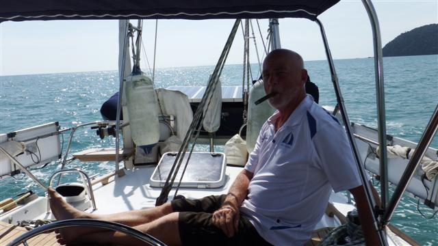
I came back on watch at 4.00 Bill had the boat sailing along nicely with the gennies still reefed in. During the night the north east monsoon had started to blow and we were getting a steady 15kts of wind on the starboard beam, where it should be, but we still had a full main up. By 7.00 when Bill got up the wind had increased to 18kts and a full main was too much for the Hydrovane to trim. Camomile is easy to reef with her single line reefing (in the right conditions) and within 15 minutes we had 2 reefs in the main with both the gennies flying on the port side. As we came back on course Camomile picked up her skirts and flew, she loves it, so does Bill; I’m not so sure.
Heeling into the wind
We are so out of practise, we haven’t sailed like this since 2013 across the Gulf of Carpentaria in Australia and this is supposed to be the easy passage of the Indian ocean. Bill says I’m fussing 18 to 20kts on the beam is a lovely sail. As I write this I have to keep clinging to the chart table because we are also getting bounced around by the waves hitting our starboard beam. Every 20th one or so is bigger than the rest so all the hatches are now closed to prevent any water getting in. We’ll pass the half way point this evening. All is well on board.
First day at Sea

Motoring passed Tintin as we leave.
Position at 10.00 Thursday 28th January
0744.802N
09602.833E
24 hour run from 10.00 27th to 10.00 28th 116 miles
880 miles to go
We got off to a flying start yesterday morning just before 7am. The Finnish boat Nicone left just before us and Tintin left about an hour later. Sadly Inspiration Lady didn’t leave with us because Gary had a little medical problem and they decided it would be better dealt with at anchor and not at sea.
The twin headsails flying
Bill put the twizzle up and we were flying along at 6 or 7kts. We lost sight of Thailand quite quickly. With the twizzle flying we managed to overtake Nicone but they stayed within our sight all day. All the work Bill had put in on the Hydrovane has paid off, new bearings, new shaft (the old one had been bent 3 times in storms) and a new sail.
‘Lizzy’ and ‘Harry’ working well
Harry looks very smart and was steering the boat well, he also matches our smart new ensign that Bill had for Christmas, thank you Thomas. (picture later)
We’ve come across a completely random phenomenon. Looking ahead we can see what looks like standing waves which, when you are in the midst of, throws the boat around like you’re in a washing machine. Then within 5 or 10 minutes it’s gone again. Been through about a dozen of these patches now. Haven’t seen anything like it before.
I managed to cook pork chops, mashed potatoes, carrots, broccoli (that’s the last of that)and gravy. Bit adventurous but the chops needed eating and, so they didn’t disappear over the side of the plate, I put them in a bowl.
I did the net after dinner and Nicone and Tintin checked in to report they were both sailing well. Inspiration Lady checked in from anchor and thankfully Gary feels much better and they plan to leave in the morning. We also had Rise and Shine and Always Saturday check in although they haven’t left yet either. Everyone welcome. 4036 at 13.00 utc or 20.00 Thailand time.
During the night the wind started dropping, as was forecast, and our speed dropped to 3 to 5 kts. The moon came up about 22.00 which lit our path. Bill did the night watch using his nice new head torch, thank you James.
I was back on watch at 6.00 this morning and saw an amazing sunrise, one of the privileges of sailing our oceans. Sailing slowly today with the twizzle rig at about 4 to 5kts All’s well on board.

Beautiful sunrise.
Ready for the off

Camomile after her final lift a few weeks ago ready for the Indian ocean
We’ve been preparing Camomile for this trip for almost a year now starting on 1st February last year when Camomile was lifted at Rebak for her major refit. Now after the rudder bearings were completely overhauled, her steering completely overhauled, a complete new paint job, new teak woodwork, new propshaft, new main sail and genoa, new sprayhood and bimini, as well as engine serviced, and numerous other jobs she’s finally ready to leave. Are we ready? I think so, every single nook and cranny has been filled with food and alcohol and I did a huge load of washing today. We’ve checked out of Thailand and are sitting in Nai Harn bay ready to head out sometime in the next week bound for Sri Lanka and the Indian ocean. The passage to Sri Lanka is a little over 1000 miles and will probably take about 7 or 8 days. No facebook but don’t worry about us. Will try to send messages this way which will pass through to facebook but we won’t receive any replies until we get to Sri Lanka.
During this year we hope to spend February in Sri Lanka, we have a 30 day visa.
March we’ll sail to the Maldives which is about 700 miles so that will probably take about 5 to 6 days. We will apply for a 60 day cruising permit there which will take us to the second week in May.
Next stop will be BIOT Chagos about 300 miles from the bottom of the Maldives so just a couple of days to get there. Chagos is a British Indian Ocean territory leased to the Americans. The permits are quite hard to obtain (we haven’t got ours yet) but it’s supposed to be beautiful so hopefully all the paperwork will be worth it. The permit will be for 28 days but we’ll be watching for a weather window and may leave before the permit expires.
The next destination will be Mahe in the Seychelles, another 1000 miles, 7 or 8 days again. Depending on the weather we should be arriving there sometime towards the end of June spending the rest of June and July there. In August we’ll have a mosey around the island groups to the west of Mahe and hopefully spend a week or so in the Comores.
September we’ll cross to Madagascar and some time in October to South Africa but it all gets a bit hazy that far away.
That’s the plan – written in the sand at low tide but hopefully it will come to fruition.
So we now we wait for a weather window.
Langkawi to Puteri – Getting away from Langkawi
Camomile ready to go
Monday 1st June we were ready to leave – just. We folded up the cockpit cover. Bill put the last of his tools away and put his little work bench on the giveway table, it had served its purpose.
Goodbye Hard dock Cafe
We went over to the office to pay our final bill and say our goodbyes to the office staff and have one last look at the Hard dock café. Quite a lot of the boats are unoccupied now as a lot of cruisers have headed home to avoid the southwest monsoon or headed south already. We needed to catch them up.
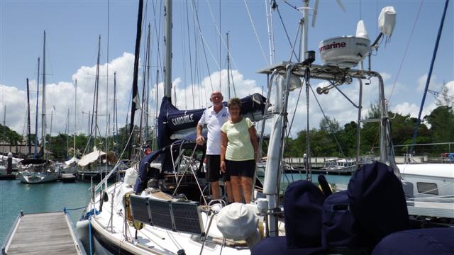
Photo call on the aft deck before we left
There were a few goodbyes left to say before our photo was taken on the aft deck and we left at 1pm.

Byebye Rebak marina.
Bill relaxing
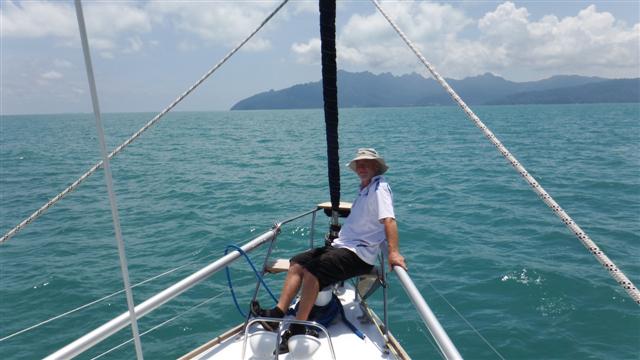
Bill enjoying the view from the new dolphin seat he made. It felt good to be out in the beautiful blue sea again. The first part of our journey only took an hour as we headed to Tulaga on mainland Langkawi for fuel.
Camomile on the fuel pontoon
Our jerry cans were all empty and the main tank took 100 litres as well. It was quite nerve-racking coming alongside for the first time because of our beautifully painted topsides.
Bill’s well earned cigar
Within an hour we were off again on the 3½ hour journey to the main town of Kuah. Bill wanted to raise our beautiful new sail to check it out. Good job we did because as it has deeper reefs than the old one the reefing lines weren’t long enough. Big problem, new reefing lines were needed, more expense! Eventually the sail went up without the reefing lines attached and Bill could sit back on his superb seat under our lovely new bimini cover and enjoy his Christmas cigar that he had been saving for the occasion.

Stunning sunset
We arrived at Kuah at 18.30 in time for the most stunning sunset. This is what we’ve missed. We sat on the deck with our sundowners.
The next morning Phil from Lyttleton Sails came on board to look at our sail and confirmed that we needed new reefing lines. Fortunately he was able to give us some tips on where to get them from. After managing to land the bikes ashore Bill and I cycled up to Chin Ho trading to look at rope and do some supermarket shopping. The gears on my bike weren’t working properly and Bills tyres kept going down so we took them to the bike man again but this time he was unable to fix them. They’ll have to go back in their bags until someone comes out from the UK who can carry some bike parts for us. Any volunteers?
Storm clouds building
That evening wasn’t as good as the first one and in fact as we got back to the boat storm clouds were brewing. We started to lift the dinghy onto the davits before the clouds burst but one of the wires broke – another problem; would we ever get away from here?
Wednesday 3rd I gave Chris and Keith ex of Poco Andante a call in their apartment in Kuah and luckily they came to our rescue driving us around for the day so Bill could buy his rope. We all had lunch together before they took us to a duty free shop they knew to top up our alcohol stores. That evening we joined them again along with many other cruisers including Lorraine and Graham of Lorrigray for the cruisers mid week get together. All enjoyed a wonderful evening. (Forgot my camera.)
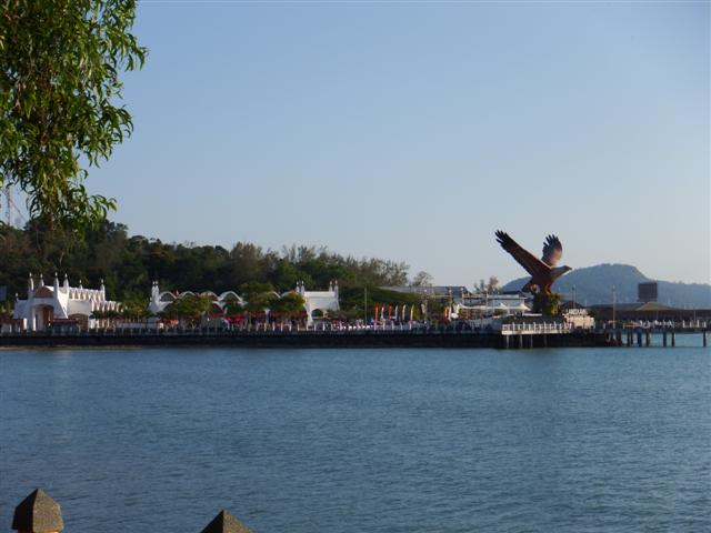
View of the ferry port from the park.
Thursday 4th I walked through the park to the ferry port to check us out of Langkawi and get our port clearance for Puteri 400 miles south. There just happens to be a Starbucks there so I finally got my cappuccino I had been looking forward to. The giant eagle is a symbol of Langkawi, there are many eagles in the area. After lunch and a final wine shop we headed back to Camomile.
Cheers!
Bill spent all of the morning of the 5th June trying to replace the davit wire. It proved to be quite difficult but he managed it in the end. The anchor came up just after 1pm and finally it was goodbye to Kuah until the end of the year. We didn’t go far and anchored at Pulau Besar just 2 hours away. Sundowners on the deck again.

Beautiful Pulau Besar
Bill wanted to get the new reefing lines in before we headed south so Saturday 6th he spent quite a bit of the day rerunning them in and out of the boom while I sat writing. Once he’d finished we raised the sail to check all was ok and thankfully, with a few minor adjustments, everything was fine.
Stunning limestone islands
Sunday 7th we finally left Langkawi. I was beginning to think we wouldn’t ever get away. Camomile motored through this gap and headed south for 60 miles. After all the playing with the main before we left there wasn’t any wind and we only managed to sail one hour of the 12 hour passage.

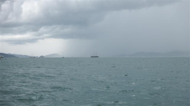
A storm on the horizon
As we are now in the south west monsoon season there are a lot of storms around. We watched this one approach with trepidation. It’s also possible to see them on the radar and we were able to skirt round some of it but it still hit us with torrential rain and strong winds.
Fishing traps
There were also a lot of these guys dotted along our path. No they aren’t pirates just fishermen but they set these fish traps. Not sure how they work but we always steer well clear of them. They are everywhere.

More fishing traps

Just sticking out of the water
Most of them have a fishing boat next to them but some don’t and as they aren’t lit travelling in these waters at night is very dangerous.
Finally we reached Panang just as the sun was going down. We planned to stay there a few days.
Christmas Newsletter 2014
I tried to send this potted version of our year out on email but some of them failed so I’ve published here with a few more photos on it.
James’s 30th birthday
Firstly apologies that I didn’t do a newsletter last year. We had made our way up the Eastern Australian coast and reached Darwin by July. While there, as many of you know, I flew back to the UK because Mum was taken very ill. Even though she seemed to be recovering, allowing me to return to Australia, she died in August. Unfortunately as we had just entered Indonesia on single entry visas, it would have been very difficult to leave the country so Bill and I had our own little service on a beautiful island at the same time as the funeral in the UK; one of the downsides of cruising. After continuing up through Indonesia and into Malaysia, where we put Camomile up on the hard for 3 months, we returned to the UK for the internment of Mum’s ashes and to sort out her bungalow with my sisters. We had a nice time back in the UK. We also celebrated James’s 30th birthday (can’t believe my oldest baby is 30!) and spent Christmas with James in Scotland with Thomas and Sonal joining us there. The boys cooked a delicious Christmas lunch between them.
Returning back to Camomile on 2nd January Bill spent a week doing the usual out of the water jobs before having her re-launched on 7th January just in time for James to arrive. Having left the RAF at the end of 2013 James took a year off to go travelling starting with visiting us while he got over his jetlag and deciding where he wanted to go.
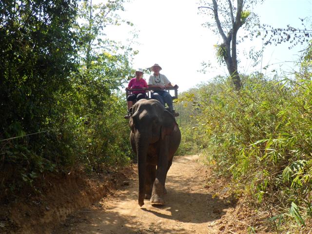
Elephant ride
We all left Camomile on 19th January, James went to Vietnam, Bill and I to Laos and Cambodia. We had a fantastic time visiting Vientiane, capital of Laos, then onto Vang Viang and the old capital of Louang Phabang where we enjoyed visiting the beautiful temples. While there we took part in a long arduous trek to an elephant camp where I was richly rewarded with a ride on an elephant, something I’ve always wanted to do.
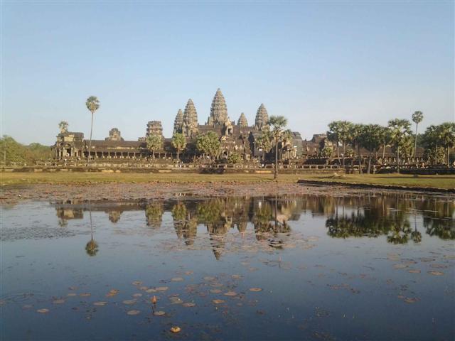
Superb Angkor Wat
Phnom Penh in Cambodia didn’t quite reach our expectations but our final destination was the Cambodian ancient temples of Angkor with Angkor Wat, where we met up with James again, turning out to be the highlight of our trip.

Zoe and Bill
After returning to the boat 9th February to complete a few more boat jobs we set sail a week later and headed north. Most of March was spent in Thailand where we had 2 visitors. Firstly James arrived again for 3 weeks. The first 2 weeks spent on the western coast of Phuket and out to the Similian and Surin islands which were wonderful. That was followed by a week visiting the ‘hongs’, hollowed out rocks in Phang Nga bay, where Bill’s stepsister Zoë also joined us for 4 days as part of her 6 week stay in Thailand. It was great getting to know her.
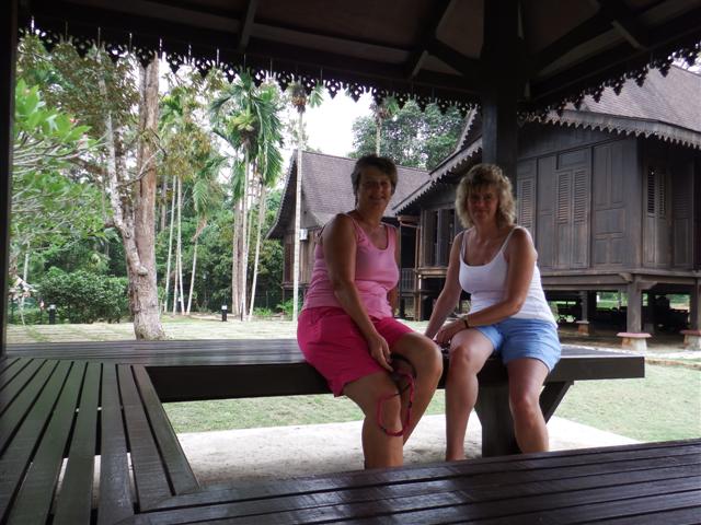
Susan and Angela
April was spent cruising south back down the western coast of Malaysia on the Sail Malaysia East rally to Johor Bahru in time for my sister Angela to arrive on 27th April for a 2 week holiday. Unfortunately shortly before she arrived we were struck by lightening. Luckily it wasn’t a direct hit but it was close enough to take out most of the navigation equipment, both VHF and SSB radios, battery management system, the fridge, the alternator, TV, music radio, the list kept building over the first few days. My poor sister arrived to a very sick boat but hopefully she still had a nice time. We all went to Singapore for a few days to celebrate my birthday as well as limping out to see a couple of islands to give her a taste of the cruising life. Once she had gone Bill set about restoring Camomile with the help of a Singapore supplier and our insurance company, miraculously we were up and running in 7 weeks and finally able to leave JB on 16th June to catch up with the rally and continue on our travels. Top Sail on behalf of RSA settled our claim in full.
Pulau Gaya
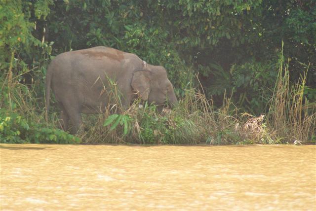
July and August were spent on the Sabah coastline of Malaysian Borneo. Our week in the most excellent Kinabatangan River being the highlight. We saw lots of Proboscis monkeys, macaque monkeys and dozens of varieties of birds but our sighting of a Pygmy elephant on his own and later a small herd was the pinnacle of the trip. Pygmy elephants are only about 4 inches shorter than normal elephants but with the removal of a lot of their natural rainforest habitat, sightings of them have become rare so we considered ourselves fortunate.
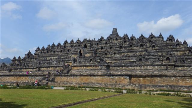
Fantastic Borobodur
At the end of August we headed south into Indonesia crossing the equator back into the southern hemisphere again. It took us 5 days to sail to Lombok arriving in time for our 36th wedding anniversary on 2nd September. While Camomile was safely tucked up in Medana bay marina we took the opportunity to fly to Yogyakarta for a 4 day to visit Prambanana, the biggest Hindu temple in Indonesia, and Borobudur, the biggest Buddhist stupa in the world, along with a selection of other sights. It was all pretty spectacular.

Thomas and Sonal with Sue and Bill in Gili Air
We returned to Camomile to welcome our youngest son Thomas and lovely girlfriend Sonal onto Camomile, their first visit since we left the UK. We had a wonderful time with them visiting the waterfalls of the Rinjani volcano and the Gili islands among other things. They were with us for 8 wonderful days before heading to Bali and onto Singapore before flying home. It was the highlight of the year for us.

The beautiful beach at Tanjung Kelayang
1st October we arrived at the Karimanjava islands which are north of the island of Java in Indonesia, while there we found some of the best snorkelling of our trip, almost as good as Fiji. Continuing to the island of Belitung to the beaches of Tanjung Kelayang, which we both decided was the best beach of the year. It was also the last beach for this year because on 13th October we checked out of Indonesia and headed back across the equator again and onto Johor Bahru at the bottom of the Malaysia peninsular arriving back at Puteri marina on 17th October to check back into Malaysia for the rest of the year. We were sad to leave Indonesia having spent 2 summers there and discovered such nice friendly people.
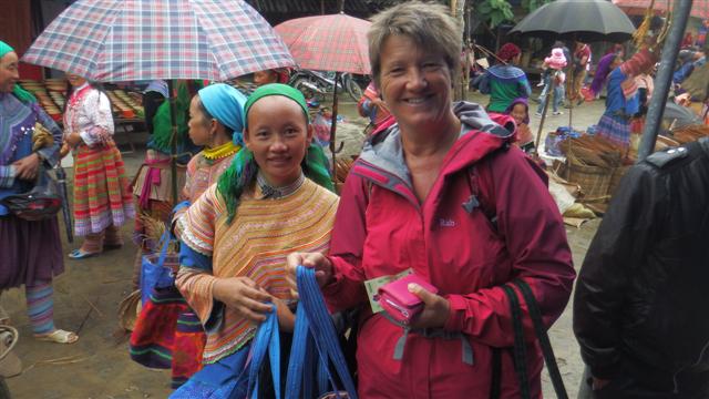
Buying goods in the Bac Ha market near Sapa
After spending a couple of weeks doing boat jobs (the list never seems to go down, as fast as jobs come off one end, more jobs get added on the other end!) we headed on ‘holiday’ to Vietnam for a couple of weeks. Vietnam was wonderful and worth the trip. We visited the capital of Hanoi, madness, took the train to Lao Cai to visit the hill tribes of the Hamong people and do some trekking, back to Hanoi on the train.
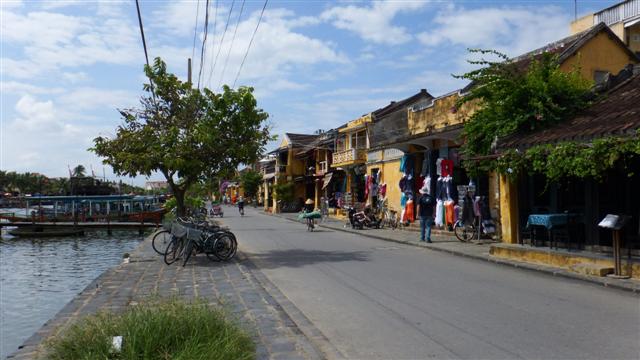
The waterfront at Hoi An
Flew to Nadang to visit beautiful Hoi An, which was our favourite, and the enigmatic Cham ruins of My Son, practically destroyed by the American airforce during the war. Then finally flew to Hoi Chin Minh city even madder but with a certain amount of charm where, among other things, we visited the evocative and haunting War Remnants museum. It was very sobering and told a totally different side of the war story. Although some of it was propaganda the photos were not fakes and left us emotionally drained for the rest of the day. We finished our tour with a visit to the Cu Chi tunnels, which was also very thought provoking. We loved Vietnam and the Vietnamese people; they are spirited survivors.

Norman, Sara, Sue and Bill at pre Christmas cocktail party at Rebak marina
On the 12th November we returned to Camomile to start our journey up the west Malaysian coast. At Pangkor marina, where we had left them last year, our good sailing friends Norman and Sara were waiting for us on Norsa to sail north with us for the next 3 or 4 months. We are all spending Christmas together at Rebak marina off the island of Langkawi, which is on the Malaysian/Thailand border. A real yachtie paradise because we can use the 5 star resort facilities, including their beautiful pool.
The plan next year is to spend January in Thailand before heading back to Rebak beginning of February for a month up on the hard where Camomile is going to have a new prop shaft, rudder bearings and cutlass bearing and the GRP on her hull is going to be thoroughly cut back and polished and new cove and boot line and the transom painted. The old treadmaster deck is going to be removed (a lot of it has disappeared already) and the coach roof will also be cut and polished. We will then go back in the water and move down to Pangkor where Joe is going to paint the decks with 2 pack paint and Bill will replace all the woodwork. We’ve also got a new Mainsail and sail bag on order so she will look thoroughly beautiful after all that.
Meanwhile I’m going back to the UK for 3 or 4 weeks in March to visit my niece’s new baby due in February and for my sister’s wedding.
Hopefully Camomile will be out of cosmetic surgery by end of April in time for us to cruise the Sarawak and Sabah coast of Malaysian Borneo again as we missed a lot of it last year. The Philippines is planned for June before heading back down to Sabah. Depending on the weather we would like to get over to the eastern Thailand coast in August and our ‘holiday’ next year is hopefully going to be Hong Kong and China for the first 2 weeks in September. We’ll probably eventually end up back in Western Thailand at the end of the year ready to head across the Indian Ocean in 2016 but plans on a yacht are always set in jelly so any of this could change.
I started this newsletter on a sad note so I want to end it on a happy one and wish everyone a Happy Christmas and a wonderful and healthy New Year wherever you may be.
Lots of love from Bill and Sue xx
Happy Christmas from Malaysia
The Kinabatangan River

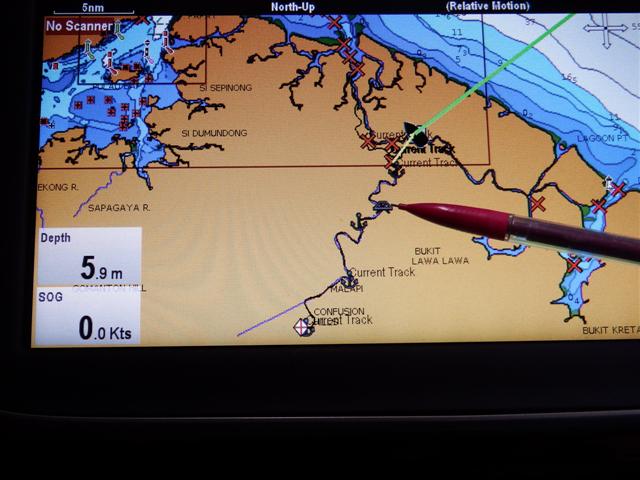
Chart showing entrance waypoints
We spent a week at Sandakan before moving on to the Kinabatangan river. The night before we left a huge storm swept across the anchorage causing some of the boats to drag again. There was so much rubbish on the sea bed the anchors couldn’t dig in properly. The pink area on this chart is rain, when it rains here it rains!! This chart also shows the waypoints and our route plotted across the sandbanks to the entrance to the Kinabatangan river. The entrance has a sandbar and lots of sandbanks, it looks like our route went over the shallows but we didn’t have less than a metre under our keel the whole journey on the high tide.
Jackster with Samsara II in the distance
Our friends on Jackster followed us in and Samsara II were a little way behind them. Fortunately the convoy had broken up a bit, some of the catamarans had gone in a day or two earlier and some of the mono hulls were still in Sandakan waiting another day or two for a higher high tide.
Wildlife spotting on the bow
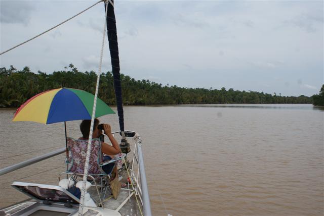
I took up my position on the bow with my deckchair, sunshade and binoculars looking out for wildlife.
Chocolate brown river
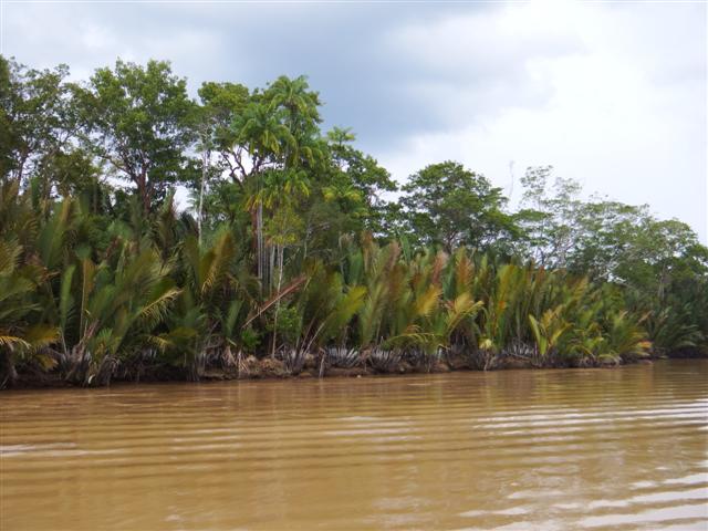
Ninah palms on the river bank
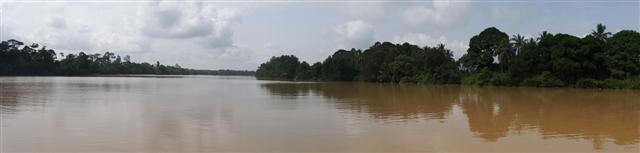
The Kinabatangan river is Sabah’s longest at 560km of chocolate brown water, it coils into the Borneo interior. There’s a narrow strip of rain forest trees that have lots of wildlife in it that flee ever-encroaching palm-oil plantations. The scenery was beautiful not in a ‘chocolate box cottage’ kind of way but in a ‘Borneo rainforest’ kind of way.
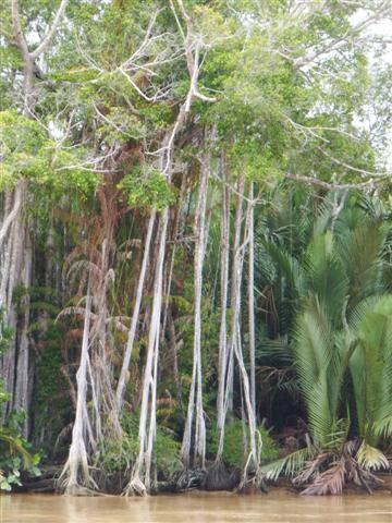
Riverside scenery
Our plan was to slowly glide along and just stop whenever we saw something interesting. All along the river are different types of trees holding 100s of monkeys. We were able to get in quite close to the rivers edge; it was fairly deep.

Nudging the bow in close
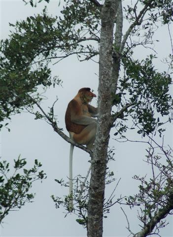
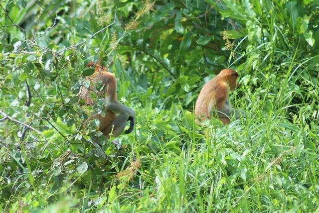
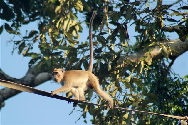
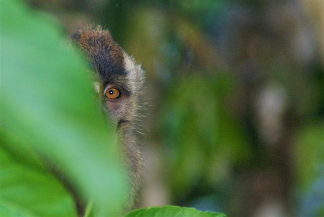
Proboscis monkey
There were Proboscis monkeys everywhere; the males have large pendulus noses. They leap from tree to tree, bush to bush. We have lots of photos of them but here are just a few.

 The three boats anchored together that evening and we all enjoyed a fantastic display of fireflies once it got dark. Our waypoint was
05º42.08N
118º21.63E
Waking up in the morning in the middle of a rain forest was magical. The silence was very noisy.
Fishing village
We got under way and continued our slow journey stopping whenever we caught sight of something in the trees.

Homestead
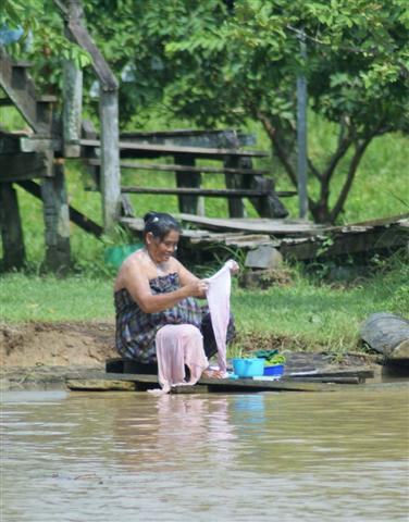
Local woman doing the washing
We went past some homesteads. The little shed on the waters edge is a ‘long drop’ toilet. Then a bit further along the riverbank the ladies were washing their hair and their clothes, as they’ve probably done for centuries, and the children were swimming in the water. The river flowed fairly fast so I suppose everything gets washed out to sea.
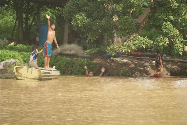
Local boys swimming

Local boys fishing
These young boys were fishing, not sure I would like to eat anything caught in that water.

Slooping house
Yes this house is sloping towards the water; I wasn’t holding the camera crooked.
Anchored next to resort
Egrets balancing on floating logs
We turned right into the main river and anchored off of a resort for the rest of the day. There were lots of lumps of wood floating down the river. The egrets like to stand on them and float down with the tide and watch for fish but they were a real nuisance getting caught around the anchor chain.

Debris caught around the anchor chain
There was more heavy rain in the afternoon, well we are in a rainforest. We only travelled about 6 miles that day, if it hadn’t rained we might have gone on but we had plenty of time. Our waypoint was
05º41.10N
118º22.98E
Entrance to Oxbow lake
The next morning we made our way to the entrance of an oxbow lake, which was only 3 miles away. An oxbow lake is a U-shaped body of water that forms when a wide meander from the main stem of a river is cut off, creating a freestanding body of water. The first part was long and narrow then it opened up into the lake and wow!

The oxbow lake

Egret in the lake
The photos don’t do it justice but I’ve taken some panoramic shots to try and recreate our view.

Egret in flight

Kingfisher with orange breast
The bird life was fantastic. Lots of hornbills, egrets and this beautiful kingfisher with an orange breast and red beak.
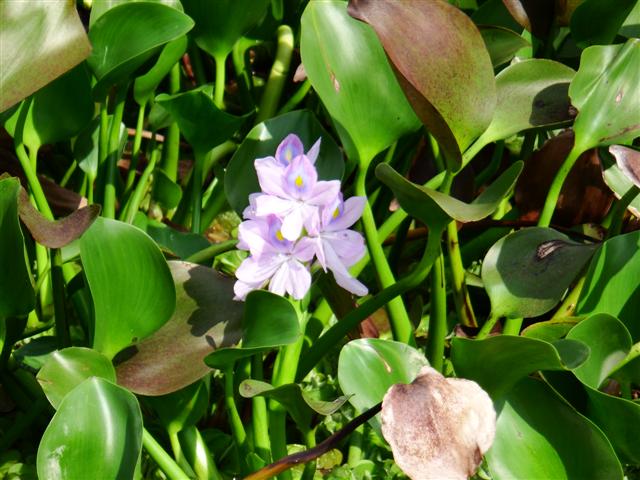
Blue water Hyacinth
The blue water hyacinths that covered more than half the lake were exquisite.

Dave and Jacqui on Jackster
Jackster and Samsara were there too.
Steve and Julie on Samsara II
Pygmy elephant
After an hour or so we motored back to the boats, I took up my position on the bow again and we continued up the river. We were so lucky being the lead boat that day because just around the next bend I saw a pygmy elephant drinking from the river.

“Cruisers coming, I’m off”
It was on it’s own and we glided slowly towards it but it saw us coming and turned back into jungle. The others arrived and we could hear it stamping around behind the bush but it didn’t come back out again.
Pencil marks the spot
The pencil marks the spot where we saw the elephant. The red and white flag at the bottom of the chart is as far as we could go because it’s marking power lines that we couldn’t get under.
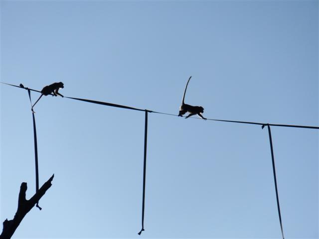
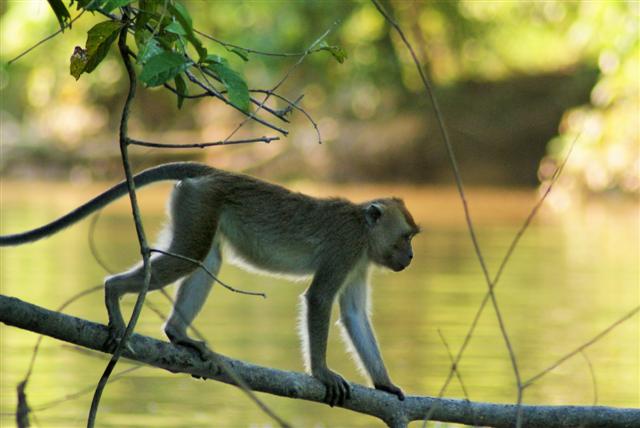
Macques on the webbing line
Our third night at anchor was spent only about an hour before the power lines next to a tributary. We took a closer look in the dinghy. There was webbing stretched high up across the tributary. Just as we were wondering what it was for a couple of monkeys walked along it. When they stopped they wound their tails expertly around the webbing hanging down for balance. We got some great photos of them.
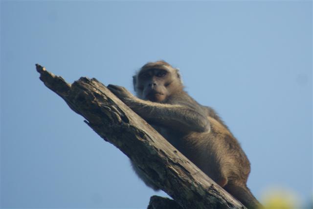
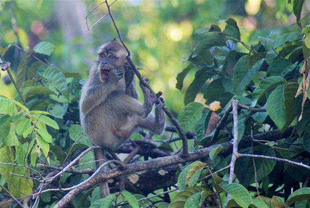
Macaque monkey
Further in there were lots of macaque monkeys playing in the undergrowth.
Stunning sunset
A stunning sunset awaited us back at the boat.
Our waypoint was
05º33.35N
118º20.17E
The next day we motored the last hour into Sukau the village next to the power lines.
The waypoint was
05º30.48N
118º17.54E our chartplotter showed this on land but the chart had been roughly correct up to the last little bit.
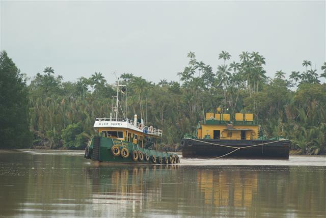
Tug and tow
Our old friend the ‘tug and tow’ was there to greet us. We were only 20 miles inland as the crow flies but we’d travelled 41 miles from the river entrance. I don’t think Camomile has been that far away from the sea since crossing the Panama canal.
Camomile pretending to be the African Queen

Local mosque
I went ashore to explore Sukau. There was the usual mosque and several rows of prettily painted houses with the usual washing hanging out.
Pretty houses
Barge acting as ferry
The roads were only dirt tracks but to cross the river a barge was used pushed along by a large tug.
I walked for a couple of miles on a circuit from the village to a couple of resorts and back. Sadly I found as soon as I was away from the river the trees changed to palm oil plantations, miles and miles of them. It’s so wrong because the wildlife can’t live in them and in particular the wild Orang-utans need proper trees to live in.

Another pygmy elephant
We spent 2 nights in Sukau before making our way back down the river. On the second evening we took the dinghy under the power lines to see what we could find. We found a whole herd of pygmy elephants and we managed to get really close. So lucky
I took 100s of photos and it was difficult choosing which ones to post on my blog, I hope you like my choice. A photo can show you what we saw but you can’t feel the temperature or the humidity, you can’t smell the jungle and you can’t hear the sounds of which there was a cacophony.
I’m looking at you, looking at me, looking at you
